 FAO Map Catalog
structure
Type of resources
Available actions
Topics
Keywords
Contact for the resource
Provided by
Years
Formats
Representation types
Update frequencies
status
Scale
Resolution
-
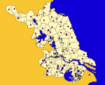
Major cities of Jiangsu Province, China at County level
-
Infrastructures including vector layers that represent the network of roads, gravel roads, thacks, railroad lines and build-up areas in the CORB-contributing area of Angola. Source: Data provided by SINFIC, based on the Topographic Map of Angola (IGCA). This dataset is part of the GIS Database for the Environment Protection and Sustainable Management of the Okavango River Basin project (EPSMO). Detailed information on the database can be found in the “GIS Database for the EPSMO Project†document produced by Luis Veríssimo (FAO consultant) in July 2009, and here available for download.
-
The Global Roads Inventory Project (GRIP) dataset was developed to provide a more recent and consistent global roads dataset for use in global environmental and biodiversity assessment models like GLOBIO. The GRIP dataset consists of global and regional vector datasets in ESRI filegeodatabase and shapefile format. It is also available as global raster datasets of road density at a 5 arcminutes resolution (~8x8km). GRIP version 4 (GRIP4) is based on many different sources, including OpenStreetMap. The UNSDI-Transportation datamodel was applied for harmonization of the individual source datasets. GRIP4 is provided under an Open Data Commons Open Database License (ODbL) and is free to use.
-
The Tertiary Roads Density raster layer is part of the Global Roads Inventory Project (GRIP) dataset, developed to provide a more recent and consistent global roads dataset for use in global environmental and biodiversity assessment models like GLOBIO.
-
The Highways Density raster layer is part of the Global Roads Inventory Project (GRIP) dataset, developed to provide a more recent and consistent global roads dataset for use in global environmental and biodiversity assessment models like GLOBIO.
-
The Secondary Roads Density raster layer is part of the Global Roads Inventory Project (GRIP) dataset, developed to provide a more recent and consistent global roads dataset for use in global environmental and biodiversity assessment models like GLOBIO.
-
The Primary Roads Density raster layer is part of the Global Roads Inventory Project (GRIP) dataset, developed to provide a more recent and consistent global roads dataset for use in global environmental and biodiversity assessment models like GLOBIO.
-
Land area in km2 per 5 arcminute cell. This layer is part of the Global Roads Inventory Project (GRIP) dataset, developed to provide a more recent and consistent global roads dataset for use in global environmental and biodiversity assessment models like GLOBIO.
-
The Local Roads Density raster layer is part of the Global Roads Inventory Project (GRIP) dataset, developed to provide a more recent and consistent global roads dataset for use in global environmental and biodiversity assessment models like GLOBIO.
-
The Total Roads Density raster layer is part of the Global Roads Inventory Project (GRIP) dataset, developed to provide a more recent and consistent global roads dataset for use in global environmental and biodiversity assessment models like GLOBIO.