 FAO Map Catalog
Spatial Data Services and Mapping
Type of resources
Available actions
Topics
Keywords
Contact for the resource
Provided by
Years
Representation types
Update frequencies
status
Scale
-
Seamless nominal 90 metre DEM (Digital Elevation Model) of Volta Megabasin. The VOLTA_HSHD image data layer is comprised of 13201x14401 derivative raster hillshade features derived based on 0.000833_ data originally from SRTM 3as v.2.
-
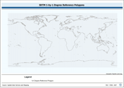
SRTM 1x1 degree tile reference layer with various encoding attributes. The 1X1_PY shapefile data layer is comprised of 64800 derivative vector surface water bodies features derived based on 1:100 000 data originally from SRTM-SWBD. The layer provides nominal analytical/mapping at 1:125 000. Data processing 60% complete globally, with African and Arabian subsets 100% complete. Acronyms and Abbreviations: SWBD - Surface water Body SRTM - Shuttle Radar Topography Mission;
-
Grayscale hillshaded image of SRTM 3 as terrestrial DEM and ETopo2 bathymetric data, resampled for compatibility with HydroShed data for Africa. SRTM is Shuttle Radar Topography Mission; DEM is Digital Elevation Model; ETopo2 is a 2 minute Elevation Topographic DEM including bathymetry. The 7-5AS_GSCL_SRTM-BATH image data layer is comprised of 37221x45583 derivative image hillshade features derived based on 0.0020833333_ data originally from SRTM 3as v.2.
-
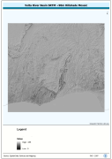
Seamless DEM (Digital Elevation Model) covering Lake Tanganyika Basin-Watershed. The LKTAN_HSHD image data layer is comprised of 14401x16801 derivative raster hillshade features derived based on 0.000833_ data originally from SRTM.
-
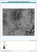
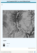
Lake Tanganyika SRTM 3 as DEM Mosaic. The DEM_MOS grid data layer is comprised of 14401x16801 derivative raster digital elevation model features derived based on 0.000833_ data originally from SRTM. The layer provides nominal analytical/mapping at 1:250 000. Acronyms and Abbreviations: SRTM - Shuttle Radar Topography Mission DEM - Digital Elevation Model
-
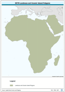
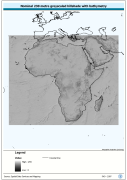
Seamless polygonal continental landmass and oceanic island mask data layer derived from SRTM-SWBD tiled database. The MASK_PY shapefile data layer is comprised of 4333 derivative vector surface water bodies features derived based on 1:100 000 data originally from SRTM-SWBD. The layer provides nominal analytical/mapping at 1:125 000. Data processing 60% complete globally, with African and Arabian subsets 100% complete. Acronyms and Abbreviations: SRTM - Shuttle Radar Topography Mission; SWBD - Surface water Body.
-
Volta Basin SRTM 3 as Based DEM Mosaic. SRTM is Shuttle Radar Topography Mission; DEM is Digital Elevation Model. The DEM_MOS grid data layer is comprised of 13201x14401 derivative raster digital elevation model features derived based on 0.000833_ data originally from SRTM 3as v.2.
-
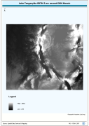
Lake Tanganyika SRTM 3 as Hillshade Mosaic. The HSHD_MOS grid data layer is comprised of 14401x16801 derivative raster hillshade features derived based on 0.000833_ data originally from SRTM. The layer provides nominal analytical/mapping at 1:250 000. Acronyms and Abbreviations: DEM - Digital Elevation Model
-
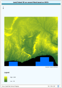
Enhanced natural color and 2.5d hillshade orthorectified image derivative. The LKTAN_IMGCAT_IMGSHD image data layer is comprised of 120 derivative calculated seamless image catalog features derived based on 15 metre data originally from FAO.
-
Catalog of RGB image derivaitive of SRTM 3-arc second Version 2 hillshaded DEM for Africa, seamless tiled compilation of color classified DEM and hillshade. SRTM is Shuttle Radar Topography Mission; DEM is Digital Elevation Model. The SRTM-3AS_IMGCAT_JP2 Image data layer is comprised of 3204 derivative calculated seamless image catalog features derived based on 0.000833_ data originally from FAO.