 FAO Map Catalog
Ministry of Environment and Natural Resources
Type of resources
Available actions
Topics
Keywords
Contact for the resource
Provided by
Formats
Representation types
Update frequencies
status
Scale
-
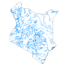
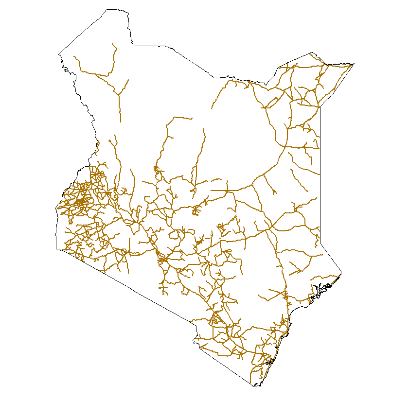
The full resolution dataset of rivers was produced from visual interpretation of digitally enhanced LANDSAT TM images (Bands 4,3,2) acquired mainly in the year 1995.
-
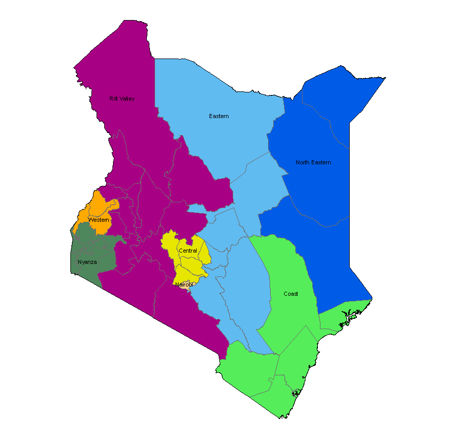
The national and administrative boundaries have been provided by the NFPI. Coastlines have been adapted to match the landcover dataset.
-
This dataset is a thematic reaggregated version of the original national Africover landcover multipurpose database. It contains all natural vegetation with a herbaceous component. The original full resolution land cover has been produced from visual interpretation of digitally enhanced LANDSAT TM images (Bands 4,3,2) acquired mainly in the year 1999 (see the "Multipurpose Landcover Database" metadata for more details). This dataset is intended for free public access. Thematic aggregation is the way that the end user customizes the Africover database to fulfil his/her specific requirements. The Africover database gives equal level of detail to Agriculture as well as Natural vegetation or Bare Areas etc. Generally a single user does not need this level of detail for each class type; therefore he/she will enhance the information of one land cover type and will generalize or erase the information related to other land cover aspects. The most powerful way to conduct an aggregation exercise is to use the classifiers as basic elements of the exercise. This gives the user the maximum flexibility on the use of data. The shape main attributes correspond to the following fields: -ID -HECTARES -GRASS_ID -GRASS_DESC You can download a zip archive containing: -the ke-grass-agg (.shp) -the Kenya Classifiers Used (.pdf) -the Kenya legend (.pdf and .xls) -the Kenya Legend - LCCS Import file (.xls) -the LCCS glossary_kenya(.pdf) -the thematic-aggregation-procedure (.pdf) -the thematic-aggregation-annex1 (.pdf) -the thematic-aggregation-annex2 (.pdf) -the Userlabel Definitions (.pdf)
-

This dataset is a thematic reaggregated version of the original national Africover landcover multipurpose database. It contains all cultivated land. The original full resolution land cover has been produced from visual interpretation of digitally enhanced LANDSAT TM images (Bands 4,3,2) acquired mainly in the year 1999 (see the "Multipurpose Landcover Database" metadata for more details). This dataset is intended for free public access. Thematic aggregation is the way that the end user customizes the Africover database to fulfil his/her specific requirements. The Africover database gives equal level of detail to Agriculture as well as Natural vegetation or Bare Areas etc. Generally a single user does not need this level of detail for each class type; therefore he/she will enhance the information of one land cover type and will generalize or erase the information related to other land cover aspects. The most powerful way to conduct an aggregation exercise is to use the classifiers as basic elements of the exercise. This gives the user the maximum flexibility on the use of data. The shape main attributes correspond to the following fields: -ID -HECTARES -CULT_ID -CULT_DESC You can download a zip archive containing: -the ke-cultiv-agg (.shp) -the Kenya Classifiers Used (.pdf) -the Kenya legend (.pdf and .xls) -the Kenya Legend - LCCS Import file (.xls) -the LCCSglossary_kenya(.pdf) -the thematic-aggregation-procedure (.pdf) -the thematic-aggregation-annex1 (.pdf) -the thematic-aggregation-annex2 (.pdf) -the Userlabel Definitions (.pdf)
-
This is a thematic aggregation of the original full resolution Geomorphology/Landform and Lithology database which has been produced from visual interpretation of digitally enhanced LANDSAT TM images acquired mainly in the year 1997. The landform classes have been developed using the ITC (International Institute for Geo-Information Science and Earth Observation) and SOTER (Soil and Terrain Database) methods. This thematic aggregation groups the landform codes into broader landform units. The structure of the derived legend follows a specific criteria that allows and easy correlation between these classes and the standardised one listed in LCCS (SOTER classification first and second level). SOTER is a pure Parametric or Morphometric classification. The main origin or process of terrain units is an important descriptive element because it relates to the dominant exogenous or endogenous processes. This aspect in a general classification gives a meaningful grouping and has analytical value. The proposed legend is structured in such a way that it can be read, not only from the Morphometric point of view as in SOTER, but also taking into account the main origin and the age of landforms (mainly derived from the lithology legend). Lithology is linked with the mapping units, but is listed separately. See the full landform/lithology legend in the resource section.
-

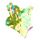
The full resolution land cover has been produced from visual interpretation of digitally enhanced high-resolution LANDSAT TM images (Bands 4,3,2) acquired mainly in the year 1995. The land cover classes have been developed using the FAO/UNEP international standard LCCS classification system. This database can be analyzed in the GLCN software Advanced Database Gateway (ADG), which provides a user-friendly interface and advanced functionalities to breakdown the LCCS classes in their classifiers for further aggregations and analysis. The ADG software is available for download on the GLCN web site at http://www.glcn.org/sof_7_en.jsp. The shape main attributes correspond to the following fields: -ID -USERLABER -LCCCODE (unique LCCS code) You can download a zip archive containing: -the dataset ke-landcover-ge (.shp) -the Kenya Classifiers Used (.pdf) -the Kenya legend (.pdf and .xls) -the Kenya Legend - LCCS Import file (.xls) -the Userlabel Definitions (.pdf) Note: the document Kenya Classifiers Used.pdf, is a list of all the LCCS classifiers used in the study area. They are grouped under the 8 major land cover types. In addition to the standard classifiers contained in LCCS the user may find “user defined†classifiers used by the map producer to add additional information to a specific class, not available in LCCS. The user-defined attributes are always coded with the letter “Zâ€.
-
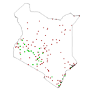
The full resolution dataset of towns was developed from data from the National Imagery and Mapping Agency (NIMA).
-

This dataset is a thematic reaggregated version of the original national Africover landcover multipurpose database. It contains all natural vegetation with a woody component. The original full resolution land cover has been produced from visual interpretation of digitally enhanced LANDSAT TM images (Bands 4,3,2) acquired mainly in the year 1999 (see the "Multipurpose Landcover Database" metadata for more details). This dataset is intended for free public access. Thematic aggregation is the way that the end user customizes the Africover database to fulfil his/her specific requirements. The Africover database gives equal level of detail to Agriculture as well as Natural vegetation or Bare Areas etc. Generally a single user does not need this level of detail for each class type; therefore he/she will enhance the information of one land cover type and will generalize or erase the information related to other land cover aspects. The most powerful way to conduct an aggregation exercise is to use the classifiers as basic elements of the exercise. This gives the user the maximum flexibility on the use of data. The shape main attributes correspond to the following fields: -ID -HECTARES -WOODY_ID -WOODY_DESC You can download a zip archive containing: -the ke-woody-agg (.shp) -the Kenya Classifiers Used (.pdf) -the Kenya legend (.pdf and .xls) -the Kenya Legend - LCCS Import file (.xls) -the LCCS glossary_kenya(.pdf) -the thematic-aggregation-procedure (.pdf) -the thematic-aggregation-annex1 (.pdf) -the thematic-aggregation-annex2 (.pdf) -the Userlabel Definitions (.pdf)
-

This dataset is a spatially reaggregated version of the original national Africover multipurpose database. The original full resolution land cover has been produced from visual interpretation of digitally enhanced LANDSAT TM images (Bands 4,3,2) acquired mainly in the year 1999. The data was aggregated by eliminating polygons below a certain area threshold to give priority to the classes belonging to Agriculture. This threshold corresponds to approx. a 30 % reduction in the polygon count. The dataset was then re-aggregated based on area threshold values. For more information on the area thresholds used to spatially aggregate the land cover data, please see the 'spatial-agg-procedure' document included in the zip file available here for download. The land cover classes have been developed using the FAO/UNEP international standard LCCS classification system. The data set is intended for free public access. The shape main attributes correspond to the following fields: -ID -HECTARES -USERLABEL -LCCCODE (unique LCCS code) -CODE1 -CODE2 -CODE3 -LC You can download a zip archive containing: -the dataset ke-spatial-agg (.shp) -the Kenya Classifiers Used (.pdf) -the Kenya legend (.pdf and .xls) -the Kenya Legend - LCCS Import file (.xls) -the spatial-agg-procedure (.pdf) -the Userlabel Definitions (.pdf) Note: the document Kenya Classifiers Used.pdf, is a list of all the LCCS classifiers used in the study area. They are grouped under the 8 major land cover types. In addition to the standard classifiers contained in LCCS the user may find “user defined†classifiers used by the map producer to add additional information to a specific class, not available in LCCS. The user-defined attributes are always coded with the letter “Zâ€.
-
The full resolution dataset of towns was produced from visual interpretation of digitally enhanced LANDSAT TM images (Bands 4,3,2) acquired mainly in the year 1995.