 FAO Map Catalog
railroads
Type of resources
Available actions
Topics
Keywords
Contact for the resource
Provided by
Formats
Representation types
Update frequencies
status
Scale
-
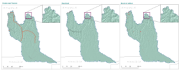
Infrastructures including vector layers that represent the network of roads, gravel roads, thacks, railroad lines and build-up areas in the CORB-contributing area of Angola. Source: Data provided by SINFIC, based on the Topographic Map of Angola (IGCA). This dataset is part of the GIS Database for the Environment Protection and Sustainable Management of the Okavango River Basin project (EPSMO). Detailed information on the database can be found in the “GIS Database for the EPSMO Project†document produced by Luis Veríssimo (FAO consultant) in July 2009, and here available for download.
-

On 8 November 2013, Typhoon Haiyan made landfall in the Philippines causing widespread devastation, tremendous loss of life and catastrophic impact on infrastructure and natural resources. As a result of the devastating damage to agriculture and fisheries sectors and the severe impact on lives and livelihoods FAO has declared Level 3 Emergency Response. In response to the call for needs assessment and coordinating humanitarian assistance in agriculture and fisheries sectors the FAO, Land and Water Division Geospatial Unit collected a number of datasets from various sources including FAO, WFP, UNITAR-UNOSAT, EC-JRC, USDA, USGS as well as updated reports from national agencies as well as the National Disaster Risk Reduction and Management council. A set of data were also used as ancillary data to support the impact assessment analysis. They are organized as follows: BASE LAYERS - Coastline (OCHA); National and sub-national boundaries (FAO GAUL2012); Contour lines (OCHA); Rivers and Lakes (The Philippines' National Mapping and Resource Information Authority- NMRIA); Hydrobasins (FAO) - Cities (NGA/VPAM-0); Points of interest (NMRIA). INFRASTRUCTURES - Roads, Railroads and Airports (NMRIA). LAND COVER AND LAND USE - Land cover (ESA Globcover); Mangroves (FAO GLC-Share); Forest (FAO FRA2010); Land use systems (FAO). FARMING - Cattle density (FAO); Pig density (FAO); Poultry density (FAO).