 FAO Map Catalog
irrigation
Type of resources
Available actions
Topics
Keywords
Contact for the resource
Provided by
Years
Formats
Representation types
Update frequencies
status
Scale
-
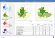
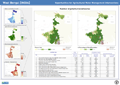
The potential for investment in agricultural water management (AWM) in support to rural livelihoods is assessed as a function of the demand from rural population and the availability (supply) of the resource. This map shows the distribution of rural population who could benefit from water-related interventions. The level of demand is based on the analysis of the livelihood zones, combined with poverty level. The supply is a function of availability of water, calculated on the basis of water (Internal renewable water resources) per person, with water development being constrained below the threshold 1700 m3/p.
-
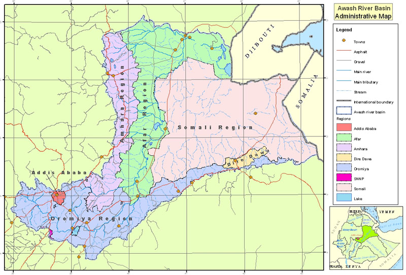
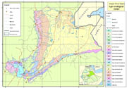
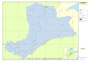
Administrative areas, roads and settlements in Awash River Basin, used for the project GCP/GLO/207/ITA
-

Remote Sensing based Water Accounting (WA+) of the Helmand River Basin (Afghanistan, Iran, Pakistan). Spatially explicit results include: land and water use classification, actual evapotranspiration, biomass, yields, irrigated crop water productivity. More information on WA+ is available through www.wateraccounting.org
-
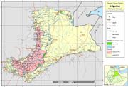
Wereda (administrative units) covered by pilot survey of irrigation schemes for the project GCP/GLO/207/ITA
-
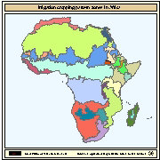
Irrigation cropping pattern zones in Africa which are considered to be homogeneous with respect to crop calendar and cropping intensity. The delineation of the irrigation cropping pattern zones was done by compiling information of various types: distribution of irrigated crops, average rainfall trends and patterns, topographic gradients, presence of large river valleys (Nile, Niger, Senegal), presence of extensive wetlands (the Sudd in Sudan), population pressure, technological differences and crop calendar above and below the equator. The dataset consists of the following information: - GIS generated codes (FID, ID); - a code with an unique number to identify the cropping pattern zone (PATRN_CODE); - a code with the name of the cropping pattern zone (PATRN_NAME); - the cropping pattern, crop calendar and monthly and yearly cropping intensities for the different zones are described in the on-line link below (Table 1). The map with irrigation cropping pattern zones is based on the FAO publication on Irrigation potential in Africa - FAO, 1997. Irrigation potential in Africa - A basin approach. FAO Land and Water Bulletin. Rome 177 p.
-
Awash River Basin climatic data used for the project GCP/GLO/207/ITA. The dataset includes: agroecological zones, meteorological stations, rainfall isohyets. Data downloadable upon permission given by owner (Ethiopian Ministry of Water and Energy). Please contact the data distributor or any other points of contact associated to this metadata.
-
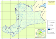
Awash River Basin hydrographic data used for the project GCP/GLO/207/ITA, including rivers, lakes and hydrographic stations within the basin.
-
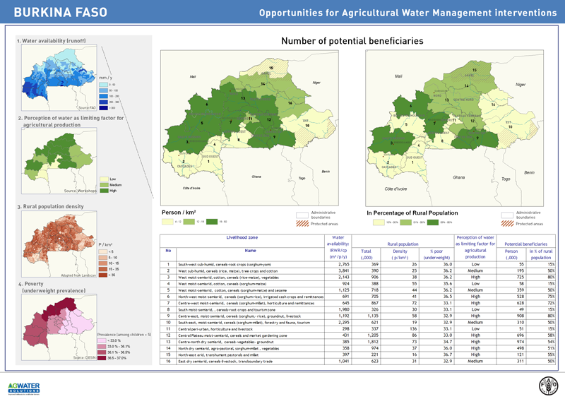
This map shows where AWM can be the entry point for improving livelihoods and where to prioritize investments in AWM to have the maximum impact on rural livelihoods. High potential areas are those showing the highest potential for AWM investment. These areas are identified on the basis of three guiding principles: 1) where water is available 2) where the target beneficiaries are mostly located; and 3) where agricultural water management is key for livelihoods.
-
The potential for investment in agricultural water management (AWM) in support to rural livelihoods is assessed as a function of the demand from rural population and the availability (supply) of the resource. This map shows the distribution of rural population who could benefit from water-related interventions. The level of demand is based on the analysis of the livelihood zones, combined with poverty level. The supply is a function of availability of water, calculated on the basis of water (Internal renewable water resources) per person, with water development being constrained below the threshold 1700 m3/p.
-
Awash River Basin boundary used for the project GCP/GLO/207/ITA