 FAO Map Catalog
Keyword
build-up areaa
Type of resources
Available actions
Topics
Keywords
Contact for the resource
Provided by
Representation types
Update frequencies
status
Scale
From
1
-
1
/
1
-
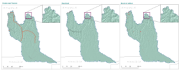
Infrastructures including vector layers that represent the network of roads, gravel roads, thacks, railroad lines and build-up areas in the CORB-contributing area of Angola. Source: Data provided by SINFIC, based on the Topographic Map of Angola (IGCA). This dataset is part of the GIS Database for the Environment Protection and Sustainable Management of the Okavango River Basin project (EPSMO). Detailed information on the database can be found in the “GIS Database for the EPSMO Project†document produced by Luis Veríssimo (FAO consultant) in July 2009, and here available for download.