 FAO Map Catalog
Tag_land
Type of resources
Available actions
Topics
Keywords
Contact for the resource
Provided by
Years
Formats
Representation types
Update frequencies
status
Scale
-
Land use statistics
-

Map showing 35 lengths of growing period zones for the developing world. Digital version of "Major Climatic Divisions" derived from the Agro-Ecological Zones Project, made by FAO in 1978. Refer to World Soil Resources Report 48, Vol. 1 Methodology and Results for Africa; Vol. 2 Results for Southwest Asia; Vol. 3 Methodology and Results for South and Central America; Vol. 4 results for Near East.
-
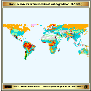
Digital version of the GLASOD database. The International Soil Reference and Information Centre (ISRIC) at Wageningen ( The Netherlands) was commissioned by the United Nations Environment Programme (UNEP) to collect the GLASOD database. From the data, ISRIC produced a 1:10 million scale wall chart which was published in 1990. One of the prime objectives of assembling the GLASOD database was its use in the Global Assessment of Desertification. Further processing was then conducted by UNEP Global Resource Information Database (GRID)
-
2015 Farming Systems for Sub-Saharan Africa region at the continental level to capture current spatial extent of systems and provide a basis for updated analysis, trends, issues and strategic priorities for each system. In 2000 as part of the Joint FAO-World Bank Farming Systems and Poverty Study (Dixon et al 2001) separate broad-scale farming systems were identified for the six World Bank Development Regions of the world. The current dataset is an update of the 2000 study and identifies Farming Systems for Africa at the continental level to capture current spatial extent of systems and provide a basis for updated analysis, trends, issues and strategic priorities for each system. Within this context delineating major farming systems provides a framework to guide development and targeting of strategic agricultural policies and interventions to reduce poverty and promote the adoption of more sustainable land management practices. In the 2015 study Systems were identified using an iterative process and a series of classifiers/informants including: available natural resources ( water, land, soils, elevation, length of growing period); Population (agriculture, rural, urban and total); Copping and pasture extent; the dominant pattern of farming activities and household livelihoods; access to markets and trends; nutrition, and estimated farm size Perhaps John which were augmented with expert input. A multidisciplinary team of experts were associated with each farming system assisting in the identification and characterisation process along with the documentation of issues such are emergent properties, drivers of change and trends, and priorities for each system. The current work updates and expands on the analysis of Sub-Saharan Africa Farming Systems in Dixon 2001 study. Many farming systems exhibit a strong geographical pattern reflecting a mix of factors such as climate, soil and markets. At the continental level broadly similar farming systems share recognizable livelihood patterns and similar development pathways, infrastructure and policy needs.
-
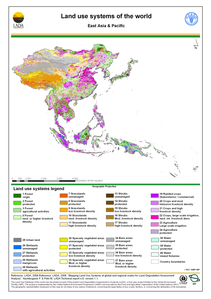
Version 1.1 of a thematic grid of Land Use Systems (LUS) and its attributes for East Asia and Pacific with a spatial resolution of 5 arc minutes or 0.083333 decimal degrees. This dataset is developed in the framework of the LADA project (Land degradation Assessment in Drylands) by the Land Tenure and Management Unit of the Food and Agriculture Organization of the United Nations and is copyright of FAO/UNEP GEF. The LUS map implementation is based on a innovative methodology combining more than 10 global datasets. Due to the map generation method, the quality of the map can never be uniform. The overall quality of the map depends heavily on the individual quality of the data for the different countries.
-
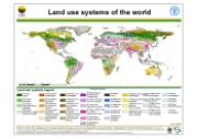
Version 1.1 of a thematic grid of Land Use Systems (LUS) and its attributes with a spatial resolution of 5 arc minutes or 0.083333 decimal degrees. This dataset is developed in the framework of the LADA project (Land degradation Assessment in Drylands) by the Land Tenure and Management Unit of the Food and Agriculture Organization of the United Nations and is copyright of FAO/UNEP GEF. The LUS map implementation is based on a innovative methodology combining more than 10 global datasets. Due to the map generation method, the quality of the map can never be uniform. The overall quality of the map depends heavily on the individual quality of the data for the different countries.
-
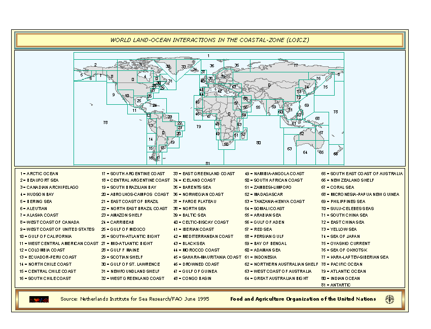
World Land-Ocean Interactions in the Coastal-Zone based on a Coastal zone (LOICZ)database received in 1995 from the Netherlands Institute for Sea Research (NIOZ).
-
World cluster map of the world based on a Coastal zone (LOICZ) database received in 1995 from the Netherlands Institute for Sea Research (NIOZ).
-

Recommended input level (for maize) for sub-saharean Africa based on the FAO-UNESCO Soil Map of the World.
-
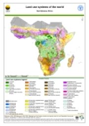
Version 1.1 of a thematic grid of Land Use Systems (LUS) and its attributes for Sub-Saharan Africa with a spatial resolution of 5 arc minutes or 0.083333 decimal degrees. This dataset is developed in the framework of the LADA project (Land degradation Assessment in Drylands) by the Land Tenure and Management Unit of the Food and Agriculture Organization of the United Nations and is copyright of FAO/UNEP GEF. The LUS map implementation is based on a innovative methodology combining more than 10 global datasets. Due to the map generation method, the quality of the map can never be uniform. The overall quality of the map depends heavily on the individual quality of the data for the different countries.