 FAO Map Catalog
Lebanon
Type of resources
Available actions
Topics
Keywords
Contact for the resource
Provided by
Formats
Representation types
Update frequencies
status
Scale
-

Include: Carte des opérations dressée par le projet d''étude des eaux souterraines au Liban en mars 1968, Carte pluviométrique (1 000 000), Carte des ressources potentielles (1 000 000),
-

Lebanon land cover map (12 sheets)
-
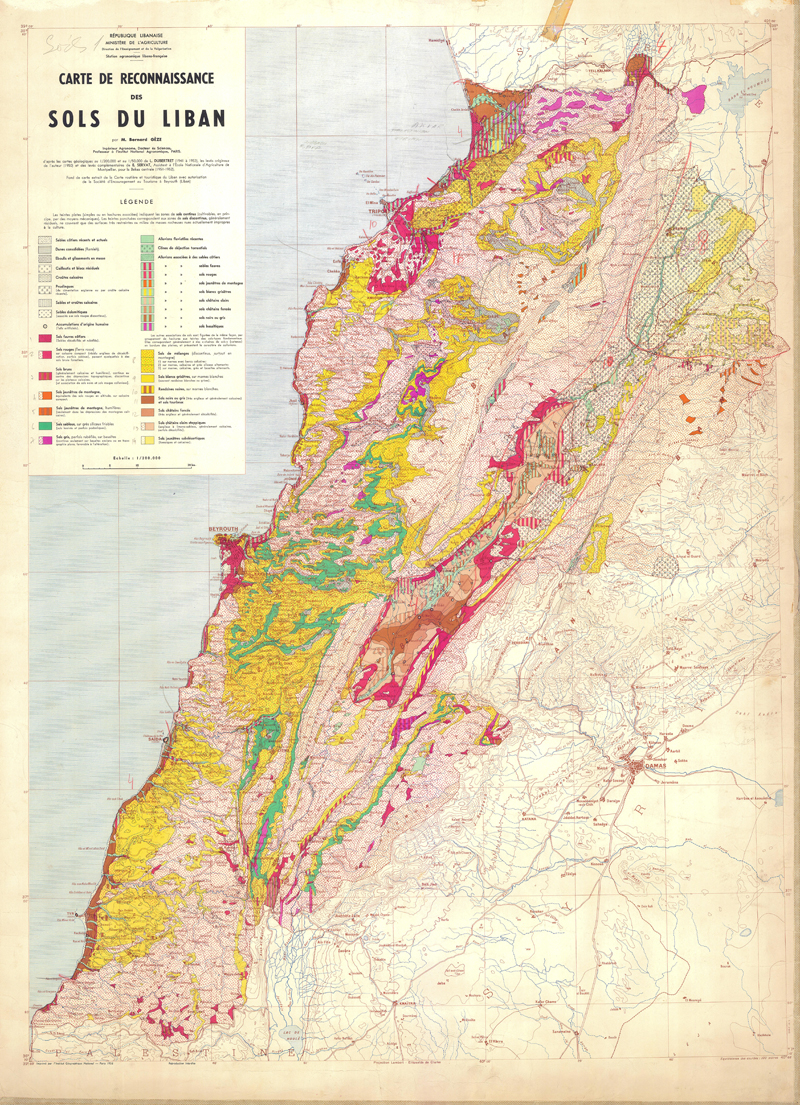
Carte de reconnaissance des sols du Liban
-
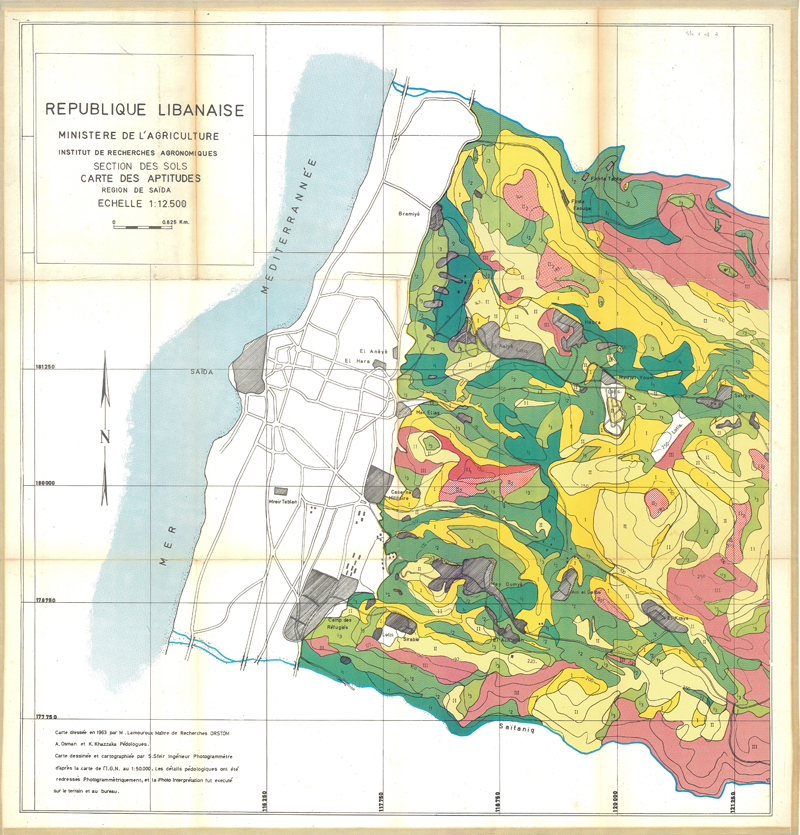
Lebanon Land suitability map : Saida> Description of the mapping units
-
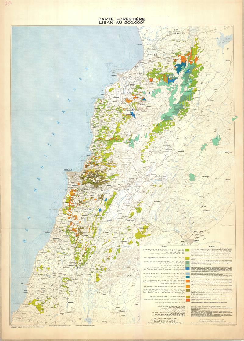
Carte forestière, Liban, au 200 000e
-

Carte géologique du Liban
-
This land use dataset, covering the Litani River Basin area, is based on the land cover classification map of 2013 produced by the National Center for Remote Sensing, (CNRS), Lebanon. The distinction of irrigated cropland and some crop type details were updated using WaPOR land cover classification version 1. Protected areas are derived using the database developed by WDPA, https://www.protectedplanet.net/. The classification scheme is the WA+ standard classification scheme. Please read the Land Cover Classification (Africa and Near East - Annual - 100m) metadata for more information on data source.
-
Saturated soil water content calculated over the Litani River Basin area in Lebanon. The dataset is derived from the High Resolution Soil Map of Hydraulic Properties (HiHydroSoils v1.0).
-
Boundary of the Litani River Basin obtained from HydroBASINS (Lerner and Grill, 2013).
-
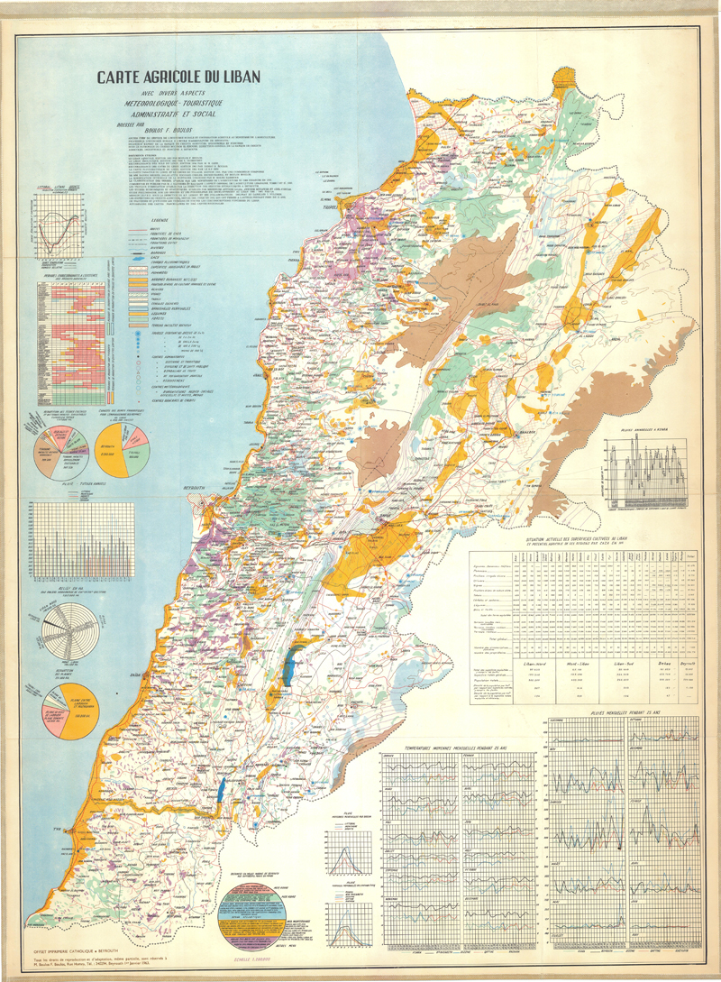
Carte agricole du Liban avec divers aspects météorologique-touristique-administratif et social (3ème édition)