 FAO Map Catalog
.All Subjects
Type of resources
Available actions
Topics
Keywords
Contact for the resource
Provided by
status
Scale
-
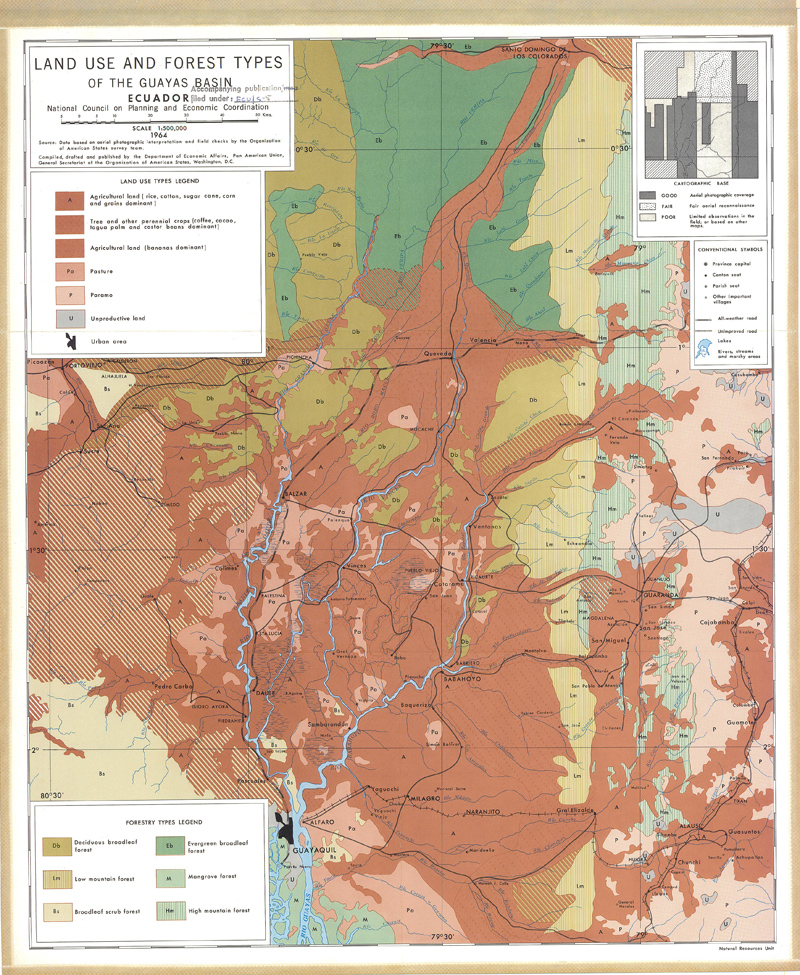
Include: Land use and forest types
-

Include: The composite evaluation of natural resources
-

Include: Vegetation types, Mpanda
-

Include: Suitability for cotton and Suitability for irrigation, Mpanda
-
Include: Semidetailed soils of the Awash basin, middle valley (100 000), Semidetailed soils map of the Awash basin, lower plains (100 000), Reconnaissance soils map of the Awash basin, lower plains (250 000), Reconnaissance soils map of the Awash basin,Middle valley (250 000), Land use map (1 000 000), Tentative definition of area boundaries in terms of erosion (1 000 000), Geomorphology map (1 000 000), Irrigability map, lower plains and Middle Valley (100000), Irrigability map, lower plains (250 000), Irrigability map, Middle valley (100 000)
-
Include: Land potential, Mpanda
-
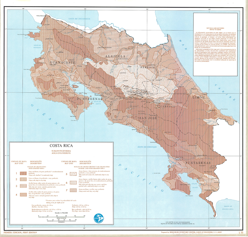
Include: Soils-Engineering (L-13),(T-13); Description of the mapping units
-
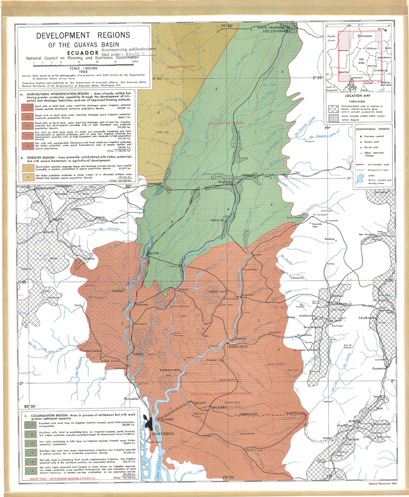
Include: Development regions of the Guayas basin,
-

Include: Rock Types (L-10), (T-10); Rock Types Map; Description of the mapping units
-
Include: Vegetation (L-6), (T-6); Soils (L-5), (T-5); (L-13), (T-13); State of the ground (L-8), (T-8); Rock Types (L-10), (T-10); Geology (L-9), (T-9); Drainage (L-3), (L-3); Land use (L-17), (T-17); Land potential (L-18), (T-18); Vegetation (L-6), (T-6); Surface configuration (L-2), (T-2);