 FAO Map Catalog
1000000
Type of resources
Available actions
Topics
Keywords
Contact for the resource
Provided by
Years
Formats
Representation types
Update frequencies
status
Scale
-
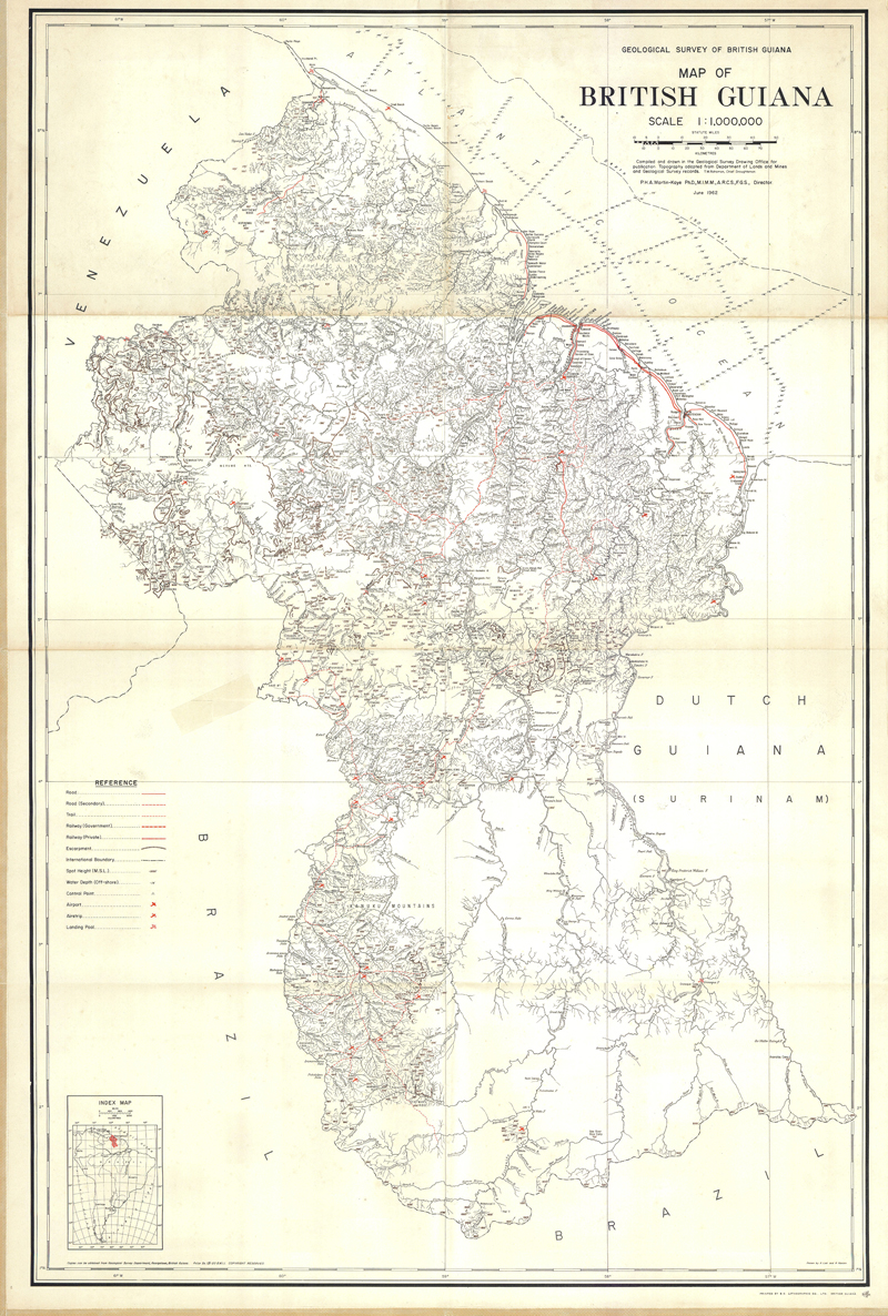
Geological map of British Guiana
-
Delineation of aquifer systems in Angola, that share geographical overlapping with the Okavango Basin. Source: Generated for the EPSMO project based on hydrogeological map of Angola provided by Direccao de Geologia e Minas at 1/1000000. This dataset is part of the GIS Database for the Environment Protection and Sustainable Management of the Okavango River Basin project (EPSMO). Detailed information on the database can be found in the “GIS Database for the EPSMO Project†document produced by Luis Veríssimo (FAO consultant) in July 2009, and here available for download.
-
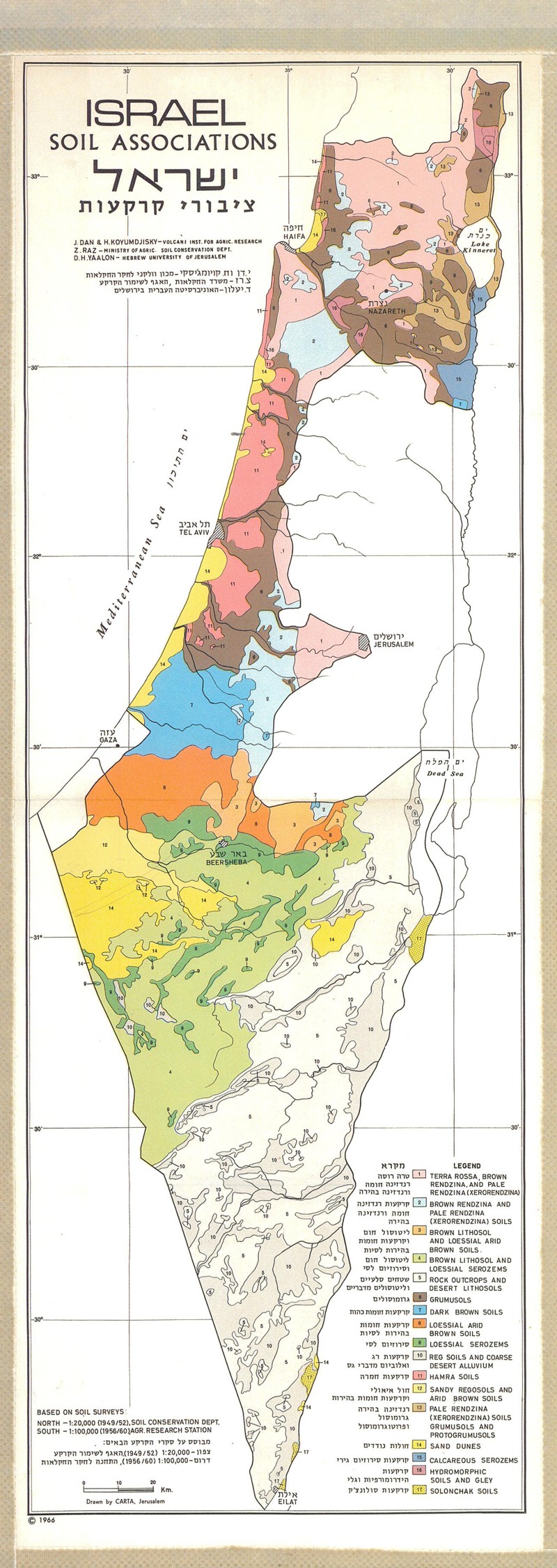
Soil associations
-
This layer represents the spatial distribution of rain measuring stations, in Namibia, that share geographical overlapping with the Okavango Basin. Source: Ministry of Agriculture, Water and Forestry of Namibia. This dataset is part of the GIS Database for the Environment Protection and Sustainable Management of the Okavango River Basin project (EPSMO). Detailed information on the database can be found in the “GIS Database for the EPSMO Project†document produced by Luis Veríssimo (FAO consultant) in July 2009, and here available for download.
-
Mapa ecologico del Peru segun la clasificacion de formaciones vegetales del mundo de L.R. Holdridge; (3 Sheets)
-
Include: Modal slope, Mpanda
-
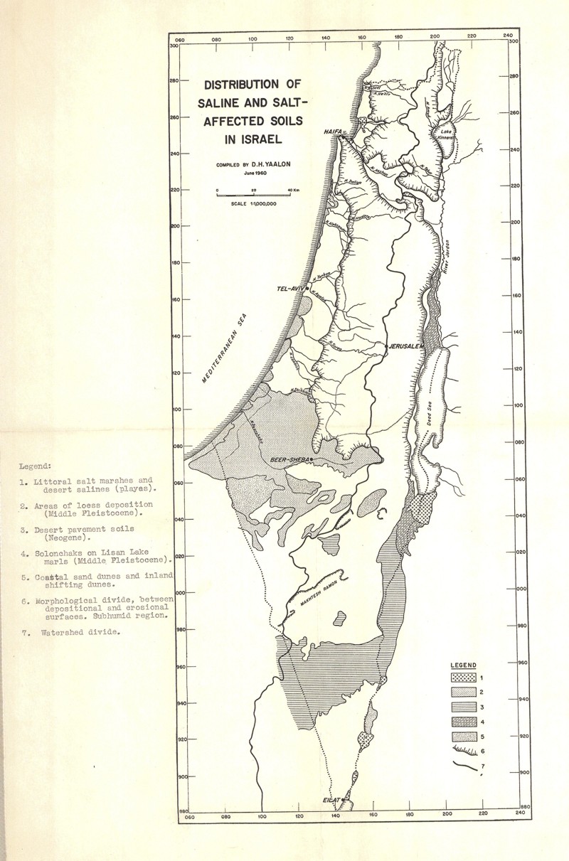
Distribution of saline and salt-affected soils in Israel
-
Include: Soil & land use distribution over a part of Northern plains
-
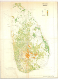
Sri Lanka land utilization (2 sheets)
-

Include: Ruggedness, Sumbawanga