 FAO Map Catalog
100000
Type of resources
Available actions
Topics
Keywords
Contact for the resource
Provided by
Years
Formats
Representation types
Update frequencies
status
Scale
-

Mapa de aptidao agricola dos solos do Distrito Federal
-
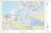
Include: Semarang (1991) (Lembar III)
-
Sumatra soils: Alai Hilir, Kuamang Kuning, Hitam Ulu, Kubang Ujo; Singkut
-
The full resolution dataset of towns was developed from data from the National Imagery and Mapping Agency (NIMA).
-
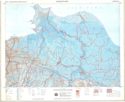
Include: Tegal (1992) (16)
-

This dataset is a thematic reaggregated version of the original national Africover landcover multipurpose database. It contains all cultivated land. The original full resolution land cover has been produced from visual interpretation of digitally enhanced LANDSAT TM images (Bands 4,3,2) acquired mainly in the period 2000-2001 (see the "Multipurpose Landcover Database" metadata for more details). This dataset is intended for free public access. Thematic aggregation is the way that the end user customizes the Africover database to fulfil his/her specific requirements. The Africover database gives equal level of detail to Agriculture as well as Natural vegetation or Bare Areas etc. Generally a single user does not need this level of detail for each class type; therefore he/she will enhance the information of one land cover type and will generalize or erase the information related to other land cover aspects. The most powerful way to conduct an aggregation exercise is to use the classifiers as basic elements of the exercise. This gives the user the maximum flexibility on the use of data. The shape main attributes correspond to the following fields: -ID -HECTARES -CULT_ID -CULT_DESC You can download a zip archive containing: -the ug-cultiv-agg (.shp) -the Uganda Classifiers Used (.pdf) -the Uganda legend (.pdf and .xls) -the Uganda Legend - LCCS Import file (.xls) -the LCCSglossary_uganda (.pdf) -the thematic-aggregation-procedure (.pdf) -the thematic-aggregation-annex1 (.pdf) -the thematic-aggregation-annex2 (.pdf) -the Userlabel Definitions (.pdf)
-

This dataset is a thematic reaggregated version of the original national Africover landcover multipurpose database. It contains all natural vegetation with a herbaceous component. The original full resolution land cover has been produced from visual interpretation of digitally enhanced LANDSAT TM images (Bands 4,3,2) acquired mainly in the year 1999 (see the "Multipurpose Landcover Database" metadata for more details). This dataset is intended for free public access. Thematic aggregation is the way that the end user customizes the Africover database to fulfil his/her specific requirements. The Africover database gives equal level of detail to Agriculture as well as Natural vegetation or Bare Areas etc. Generally a single user does not need this level of detail for each class type; therefore he/she will enhance the information of one land cover type and will generalize or erase the information related to other land cover aspects. The most powerful way to conduct an aggregation exercise is to use the classifiers as basic elements of the exercise. This gives the user the maximum flexibility on the use of data. The shape main attributes correspond to the following fields: -ID -HECTARES -GRASS_ID -GRASS_DESC You can download a zip archive containing: -the rw-grass-agg (.shp) -the Rwanda Classifiers Used (.pdf) -the Rwanda legend (.pdf and .xls) -the Rwanda Legend - LCCS Import file (.xls) -the LCCS glossary_rwanda(.pdf) -the thematic-aggregation-procedure (.pdf) -the thematic-aggregation-annex1 (.pdf) -the thematic-aggregation-annex2 (.pdf) -the Userlabel Definitions (.pdf)
-

Include: Region de Mokebo (A. Sols; C. Utilisation des sols) (Van Oosten, M.F), Region de Kiubo (A.Sols; C. Utilisation des sols) (Van Wambeke, A.)
-
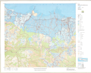
Include: Karawang (1990) (Lembar I)
-
Include: Kediri (1992) (32)