 FAO Map Catalog
8-05
Type of resources
Available actions
Topics
Keywords
Contact for the resource
Provided by
Years
Representation types
Update frequencies
status
Scale
-
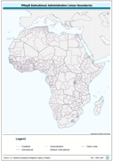
Ad2-Seamless and topologically robust derivative of all linear VMap0 - Ed5 coastal, national, subnational and sovereign boundary data layers cross-checked against related polygonal vectors. The AD2_LN shapefile data layer is comprised of 3656 derivative vector framework library features based on data from VMap0, 5th Edition. The layer provides analytical/mapping at 1:1 000 000. Data processing complete globally, this is an African subset. Acronyms and Abbreviations: VMap0 - Vector Map for Level 0.
-
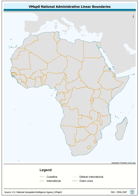
Ad1-Seamless and topologically robust derivative of all linear VMap0 - Ed5 coastline and national/sovereign boundary data layers cross-checked against related polygonal vectors. The AD1_LN shapefile data layer is comprised of 1826 derivative vector framework library features derived based on 1:1 000 000 data originally from VMap0, 5th Edition. The layer provides nominal analytical/mapping at 1:1 000 000. Data processing complete globally, this is an African subset. Acronyms and Abbreviations: VMap0 - Vector Map for Level 0
-
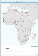
Robust derivative of VMap0 - Ed5 data layers with harmonized encoding. The AIRPT_PT shapefile data layer is comprised of 762 derivative vector framework library features derived based on 1:1 000 000 data originally from VMap0, 5th Edition. The layer provides nominal analytical/mapping at 1:1 000 000. Data processing complete globally, this is an African subset. Acronyms and Abbreviations: VMap0 - Vector Map for Level 0.
-
Consolidated table of water temperature. The WT_MNTHY tabular data layer is comprised of 1004351 derivative raster water temperature features derived based on 0.5 degrees resolution data originally from CRES/FAO. The layer provides nominal analytical/mapping at 1:220 000 000. Acronyms and Abbreviations: CRES - Centre for Resource and Environmental Studies, The Australian National University (ANU); FAO - Food and Agriculture Organization in the United Nations.
-
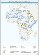
General point features, robust derivative of VMap0 - Ed5 data layers with harmonized encoding. The GNFTR_PT shapefile data layer is comprised of 17136 derivative vector framework library features derived based on 1:1 000 000 data originally from VMap0, 5th Edition. The layer provides nominal analytical/mapping at 1:1 000 000. Data processing complete globally, this is an African subset. Acronyms and Abbreviations: VMap0 - Vector Map for Level 0.
-
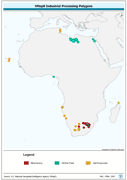
Seamless and topologically robust derivative of VMap0 - Ed5 data layers. The INDUS_PY shapefile data layer is comprised of 92 derivative vector framework library features derived based on 1:1 000 000 data originally from VMap0, 5th Edition. The layer provides nominal analytical/mapping at 1:1 000 000. Data processing complete globally, this is an African subset. Acronyms and Abbreviations: VMap0 - Vector Map for Level 0.
-
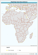
Seamless and robust derivative of VMap0 - Ed5 Library Reference data features. The LR_RD_LN shapefile data layer is comprised of 10113 derivative vector framework library features derived based on 1:1 000 000 data originally from VMap0, 5th Edition. The layer provides nominal analytical/mapping at 1:1 000 000. Data processing complete globally, this is an African subset. Acronyms and Abbreviations: VMap0 - Vector Map for Level 0.
-
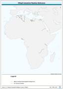
Seamless and topologically robust derivative of VMap0 - Ed5 data layers. The PIPE_LN shapefile data layer is comprised of 186 derivative vector framework library features derived based on 1:1 000 000 data originally from VMap0, 5th Edition. The layer provides nominal analytical/mapping at 1:1 000 000. Data processing complete globally, this is an African subset. Acronyms and Abbreviations: VMap0 - Vector Map for Level 0.
-
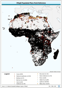
Robust derivative of VMap0 - Ed5 Populated Place data layer. The PPL_PT shapefile data layer is comprised of 39172 derivative vector framework library features derived based on 1:1 000 000 data originally from VMap0, 5th Edition. The layer provides nominal analytical/mapping at 1:1 000 000. Data processing complete globally, this is an African subset. Acronyms and Abbreviations: VMap0 - Vector Map for Level 0.
-
Seamless and topologically robust derivative of linearVMap0 - Ed5 Utility and related data layers. The UTIL_LN shapefile data layer is comprised of 2476 derivative vector framework library features derived based on 1:1 000 000 data originally from VMap0, 5th Edition. The layer provides nominal analytical/mapping at 1:1 000 000. Data processing complete globally, this is an African subset. Acronyms and Abbreviations: VMap0 - Vector Map for Level 0.