 FAO Map Catalog
2002
Type of resources
Available actions
Topics
Keywords
Contact for the resource
Provided by
Years
Formats
Representation types
Update frequencies
status
Scale
Resolution
-

The raster map was originally produced from a multivariate regression predicting animal distribution from census livestock statistics and satellite-derived information (mainly environment and land development). More information about the original layer and its calculation can be provided from Jan Slingenbergh (AGAH) Jan.Slingenbergh@fao.org.The current map is an update of this previous one, based on more recent census data. The regression has not been updated.
-

Based on bovine density (FAO, 1999), livestock systems distribution, system-specific production parameters, calculations of output per animal to obtain beef production density (output per km2) were performed using the Livestock Development Planning System Version 2 model. Part of a study "Cattle and small ruminant production systems in sub-Saharan Africa: a systematic review" (FAO, 2002).
-

Based on bovine density (FAO, 1999), livestock systems distribution, system-specific production parameters, calculations of output per animal to obtain milk production density (output per km2) were performed using the Livestock Development Planning System Version 2 model. Part of a study "Cattle and small ruminant production systems in sub-Saharan Africa: a systematic review" (FAO, 2002).
-
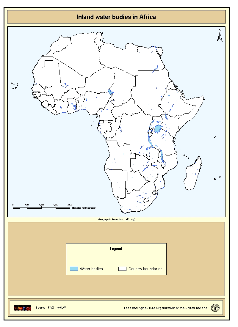
Shapefile of inland water bodies in Africa. This dataset originates from the Digital Chart of the World 1:1000000, 1998. The waterbodies for Africa have been characterized (as lake, lagoon, reservoir etc.) and named (if the names were easily available). The data layer presented contains all the waterbodies that had a name and were not characterized as river.
-

Grid with estimated maximum available soil moisture in mm/m with a spatial resolution of 5 * 5 arc minutes. Information with regard to maximum available soil moisture was calculated from the "Derived Soil Properties" of the "Digital Soil Map of the World" which contains raster information on soil moisture in different classes.
-

Predicted mean monthly air temperature (annual). Predictions based on estimates by the Center for resource and Enviornmental Studies (CRES) which can be interpreted as estimates of standard means for the period of 1920 to 1980. The AIRTMP_MN grid data layer is comprised of 1450x1380 derivative raster air temperature features derived based on 0.05 degrees resolution data originally from CRES / FAO. The layer provides nominal analytical/mapping at 1:220 000 000. Madagascar not included. Annual Total Air Temperature, Average Monthly Air Temperature (Annual) and the Monthly Air Temperature from January to December are also available for download. Acronyms and Abbreviations: CRES - Centre for Resource and Environmental Studies, The Australian National University (ANU); FAO - Food and Agriculture Organization of the United Nations.
-
Grid with average Wet Day Frequency (rain days per month) for the period 1961-1990. This dataset is constructed from observations, backed with synthetic data derived from precipitation. Source: New, M., Lister, D., Hulme, M. and Makin, I., 2002: A high-resolution data set of surface climate over global land areas. Climate Research 21:1-25
-

Estimated distribution of the main ruminant prodution systems based on rainfall, length of growing period, cropping pattern and mean temperature during the growing period, Part of a study "Cattle and small ruminant production systems in sub-Saharan Africa: a systematic review" (FAO, 2002).
-
Land use statistics
-

The dataset contains the predicted areas of suitability for four tsetse fly species (f. fuscipes, morsitans, pallidipes and tachinoides). All of the distributions have been produced using variations of the same methodology - by modelling the "known" presence and absence of the flies (usually the 1977 Ford and Katondo maps modified with more recent information collected from national and international agencies and researchers). The modelling process relies on logistic regression of fly presence against a wide range of predictor variables for a large number of regularly spaced sample points for each area. The predictor variables include remotely sensed (satellite image) surrogates of climate - vegetation, temperature, moisture - which have been subjected to Fourier processing to provide an additional set of season and timing related measures for each parameter. Demographic, topographic and agroecological predictors are also used. These models are then applied to the predictor imagery to determine the predicted areas of suitability for tsetse. Data are provided at 1 kilometre resolution over the tsetse affected area in Ethiopia. The maps were produced in May 2002 for FAO/IAEA Joint Division by Environmental Research Group Oxford (ERGO Ltd) in collaboration with the Trypanosomosis and Land Use in Africa (TALA) research group.