 FAO Map Catalog
1994
Type of resources
Available actions
Topics
Keywords
Contact for the resource
Provided by
Years
Representation types
Update frequencies
status
Scale
-

Average altitude in Djibouti, Eritrea, Ethiopia, Kenya, Somalia, Sudan and Uganda.
-
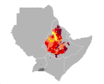
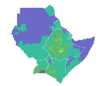
Teff yield in Djibouti, Eritrea, Ethiopia, Kenya, Somalia, Sudan and Uganda. Map presents reference yield estimated through data collection and agricultural statistics.
-
Average terrain-slope characteristics in Djibouti, Eritrea, Ethiopia, Kenya, Somalia, Sudan and Uganda.
-
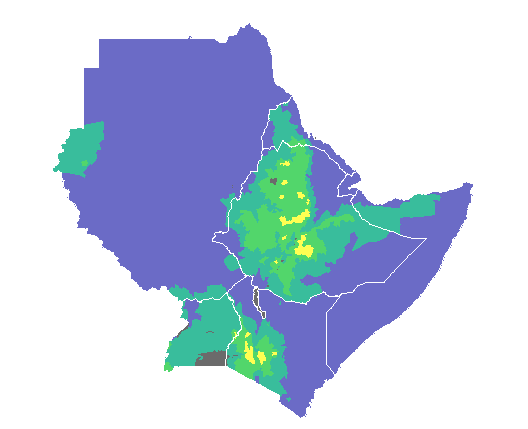
Length of growing period in Djibouti, Eritrea, Ethiopia, Kenya, Somalia, Sudan and Uganda.
-
Annual mean temperature in Djibouti, Eritrea, Ethiopia, Kenya, Somalia, Sudan and Uganda.
-
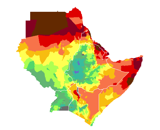
Average annual rainfall in Djibouti, Eritrea, Ethiopia, Kenya, Somalia, Sudan and Uganda.
-
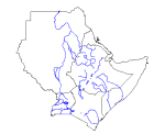
Major rivers in Djibouti, Eritrea, Ethiopia, Kenya, Somalia, Sudan and Uganda.
-
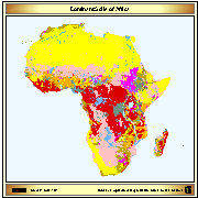
Simplified version of the FAO/UNESCO soil map of the world, containing only 8 major soil classes. The map has been used to do the back cover of the publication GIS in FAO (FAO, Feb 89)
-
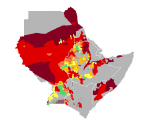
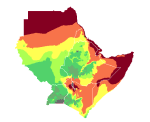
Sorghum yield in Djibouti, Eritrea, Ethiopia, Kenya, Somalia, Sudan and Uganda. Map presents reference yield estimated through data collection and agricultural statistics.
-
Average annual Potential Evapotranspiration (PET) in Djibouti, Eritrea, Ethiopia, Kenya, Somalia, Sudan and Uganda.