 FAO Map Catalog
16-0
Type of resources
Available actions
Topics
Keywords
Contact for the resource
Provided by
Years
Representation types
Update frequencies
status
Scale
-
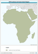
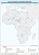
Seamless polygonal continental landmass and oceanic island mask data layer derived from SRTM-SWBD tiled database. The MASK_PY shapefile data layer is comprised of 4333 derivative vector surface water bodies features derived based on 1:100 000 data originally from SRTM-SWBD. The layer provides nominal analytical/mapping at 1:125 000. Data processing 60% complete globally, with African and Arabian subsets 100% complete. Acronyms and Abbreviations: SRTM - Shuttle Radar Topography Mission; SWBD - Surface water Body.
-
Derivative of the above "Null" SRTM 3-arc second dataset with terrestrial void areas backfilled with SRTM-GTopo30 DEM, 3204 Arc-Grid tiles. Source: FAO
-
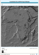
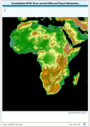
Grid based hillshade of consolidated 30 as SRTM-ETopo2 DEM. SRTM is Shuttle Radar Topography Mission; DEM is Digital Elevation Model; ETOPO2 is a 2 minute Elevation Topographic DEM including bathymetry.. The HSHDBATH grid data layer is comprised of 10800x11400 derivative raster hillshade features derived based on 0.00833_ data originally from SRTM 30as v.2.
-
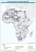
Robust centre-point derivative of SWB - Hydro polygonal features. The VMAP_PT shapefile data layer is comprised of 25128 derivative polygon framework library features derived based on 1:1 000 000 data originally from VMap0/DCW. The layer provides nominal analytical/mapping at 1:1 000 000. Seamlessly complete globally, with consolidation-harmonization @ ~70%, this Africa subset at final. Acronyms and Abbreviations: VMap0 - Vector Map for Level 0; SWB - Surface Water Body; DCW - Digital Chart of the World.
-
Enhanced SRTM-GTopo30 DEM with ocean values masked and set to null. SRTM is Shuttle Radar Topography Mission; GT30/GTopo30 is Global Topographic 30 arc second DEM database, nominal 1km postings; DEM is Digital Elevation Model. The SRTMGT30 grid data layer is comprised of 10800x11400 derivative raster digital elevation model features derived based on 0.00833_ data originally from SRTM 30as v.2.
-
Robust separately encoded depiction of the SWB - Hydro polygonal outlines. The VMAP_LN shapefile data layer is comprised of 30413 derivative polygon framework library features derived based on 1:1 000 000 data originally from VMap0/DCW. The layer provides nominal analytical/mapping at 1:1 000 000. Seamlessly complete globally, with consolidation-harmonization @ ~70%, this Africa subset at final. Acronyms and Abbreviations: VMap0 - Vector Map for Level 0; SWB - Surface Water Body; DCW - Digital Chart of the World.
-
Derivative of the "Baseline" SRTM 3 arc second dataset with ocean and terrestrial void areas set to null using a SRTM-SWBD 1 arc second mask, 3204 Arc-grid based tiles. Source: FAO
-
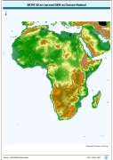
Consolidated SRTM-GTopo30 DEM with masked ocean values backfilled based on ETopo2 Bathymetry. SRTM is Shuttle Radar Topography Mission; GT30/GTopo30 is Global Topographic 30 arc second DEM database, nominal 1km postings; DEM is Digital Elevation Model. The SRTMBATH grid data layer is comprised of 10800x11400 derivative raster digital elevation model features derived based on 0.00833_ data originally from SRTM 30as v.2.
-
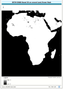
A 30 arc-second land/ocean mask derived from the SRTM -SWBD nominal 30 metre coastline data. SRTM is Shuttle Radar Topography Mission; SWBD is Surface Waterbody . The SRC_MASK grid data layer is comprised of 10800x11400 derivative raster digital elevation model features derived based on 0.00833_ data originally from SRTM 30as v.2.
-
"Seamless" set of 3304 Arc-grid based DEM tiles derived from the Version 2 of the SRTM 3 arc second data library covering Africa; nominal 90 metre. Source: NASA/SRTM