 FAO Map Catalog
irregular
Type of resources
Available actions
Topics
Keywords
Contact for the resource
Provided by
Formats
Representation types
Update frequencies
status
Scale
-
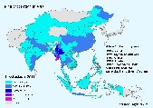
Agro-MAPS consists of selected agricultural land-use statistics (crop production, area harvested and crop yield) aggregated by sub-national administrative districts for selected years. The full Agro-MAPS database currently contains data for 134 countries - 130 countries at admin1 level; 59 countries at admin2 level. These countries represent 92% of the world land surface. Users can interactively query and display Agro-MAPS data as maps, for a given country or region (Africa, Asia, North America, Latin America & the Caribbean, Asia, Near East in Asia, Oceania).
-
This vector dataset contains FAO processed administrative boundaries from multiple sources, produced in 2022 for the Hand-in-Hand Initiative Geospatial Platform publishing. The data was sourced and processed from the United Nations second administrative level boundaries (UN-SALB) programme, complemented with Hand-in-Hand Initiative and geospatial platform data from official geospatial data producers. Country boundaries are processed against UN official recognized borders (UN-map 2018), administrative subdivision checked for geometry a topology, validated, and corrected. Attributes are standardized to the UN-SALB programme schema and coding system. Processed by UN-FAO-CSI AgroInformatics geospatial analysis team, the data is used for thematic mapping, geospatially enabled statistics location-based integration, and Hand-in-Hand geospatial analysis (GIS-MCDA, suitability/location analysis, agricultural typologies, zonal statistics extraction).