 FAO Map Catalog
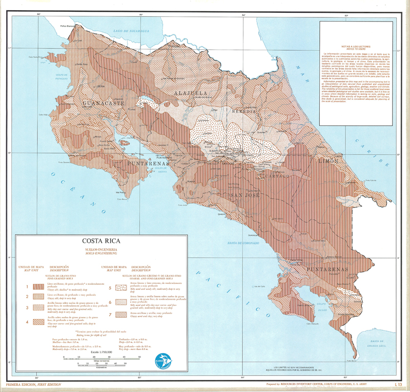
Analisis regional de recursos fisicos; Regional analysis of physical resources (1st edition) (Soils-Engineering - Costa Rica)
Include:
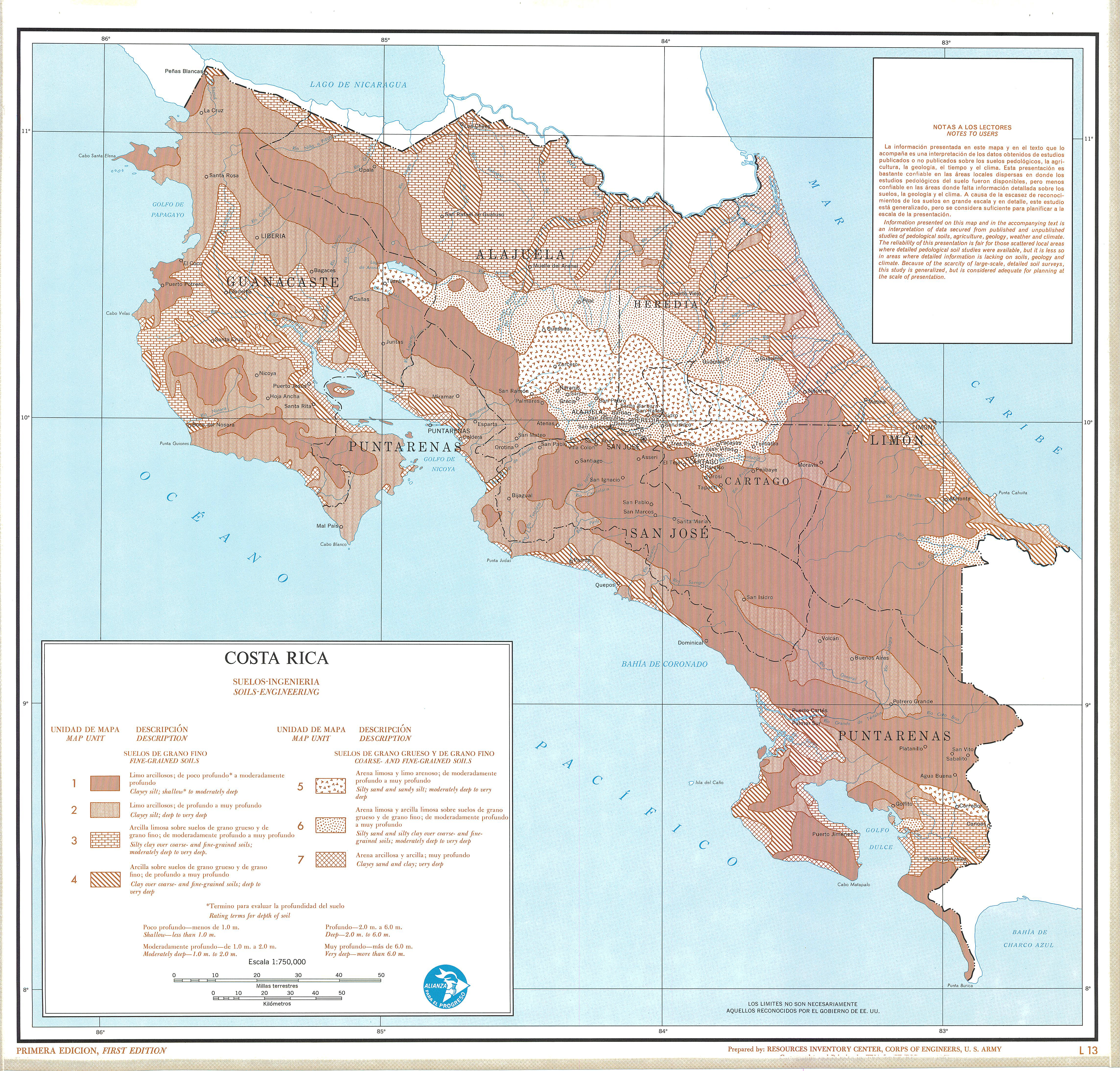
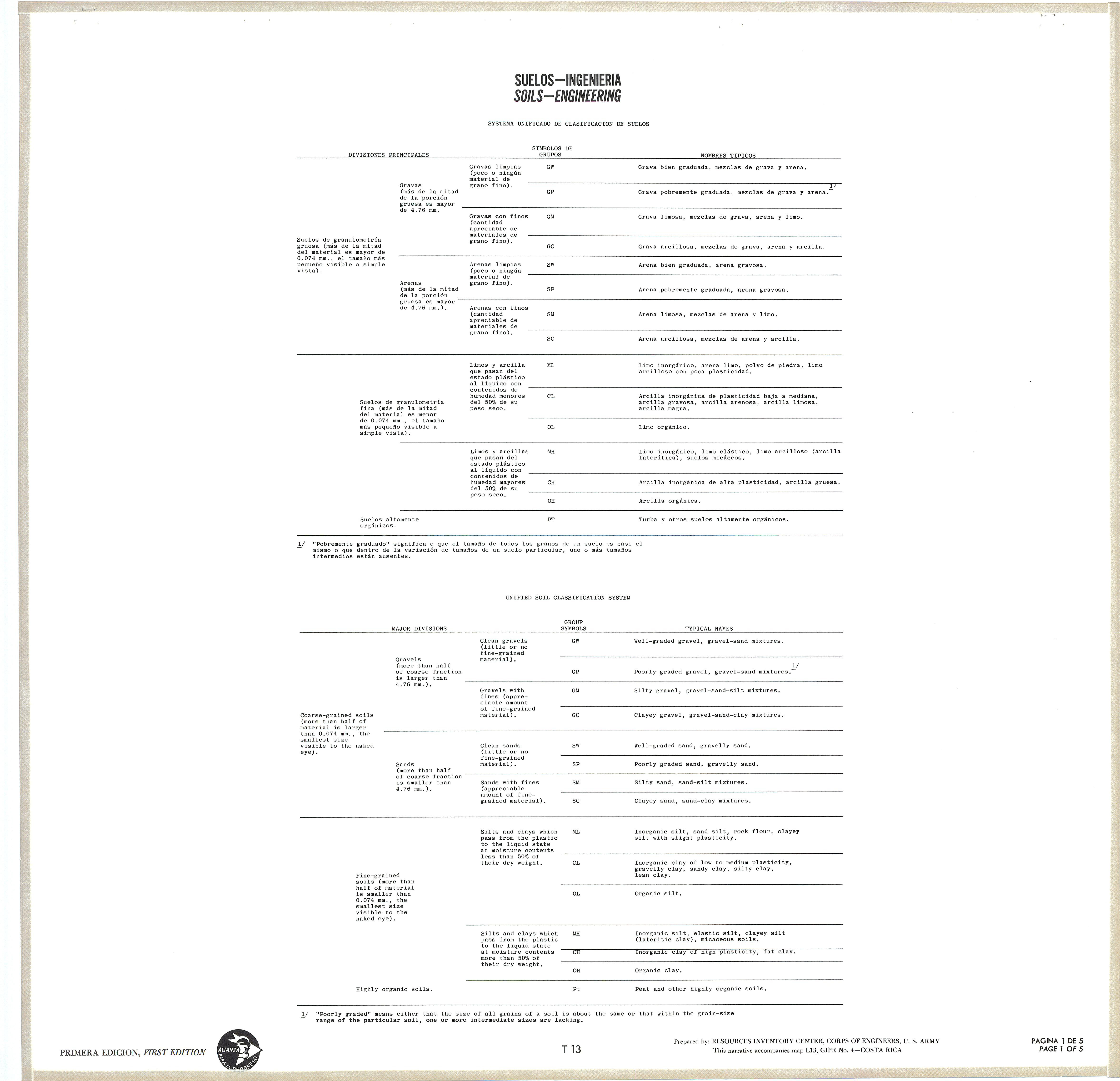
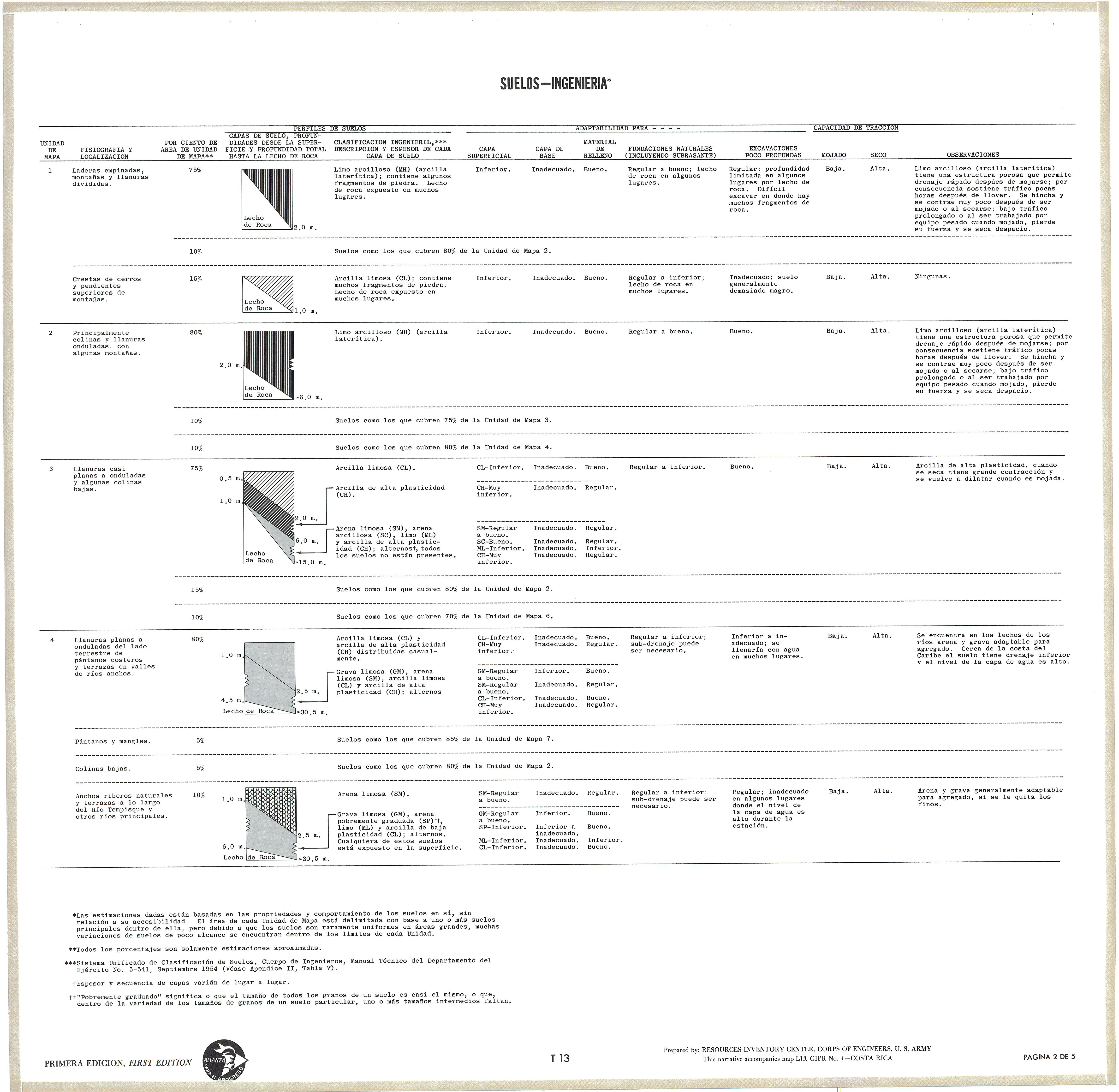
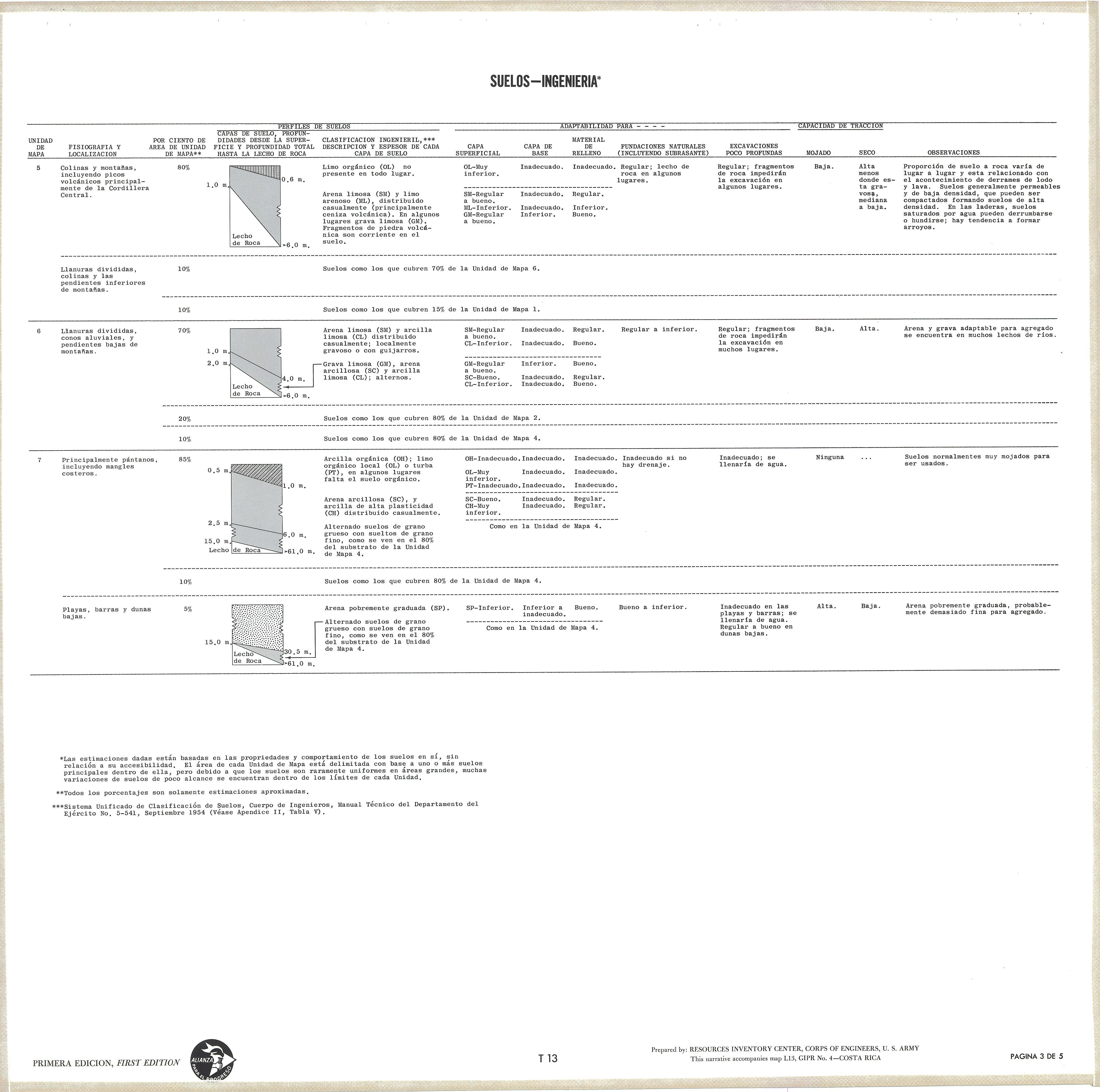
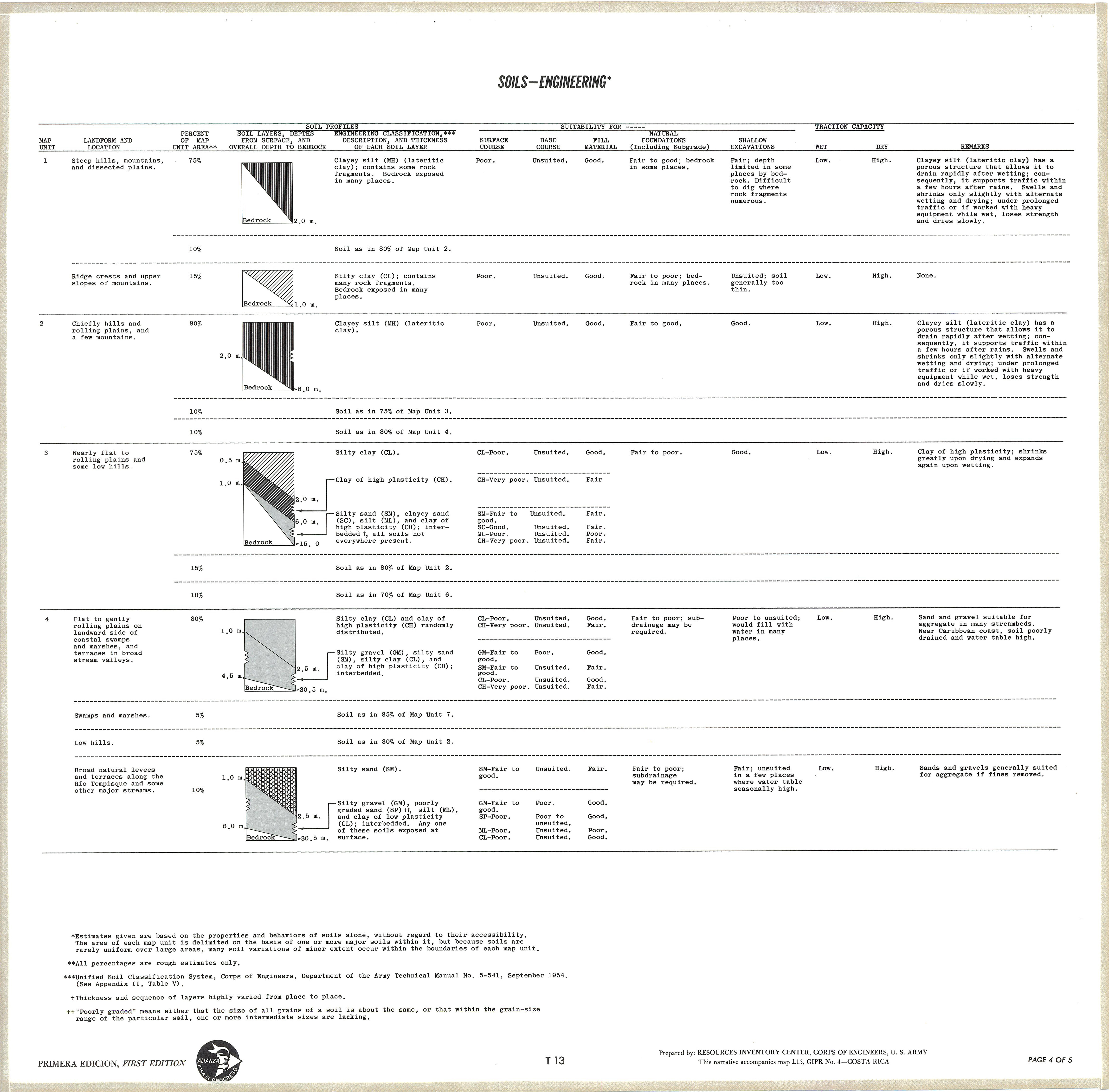
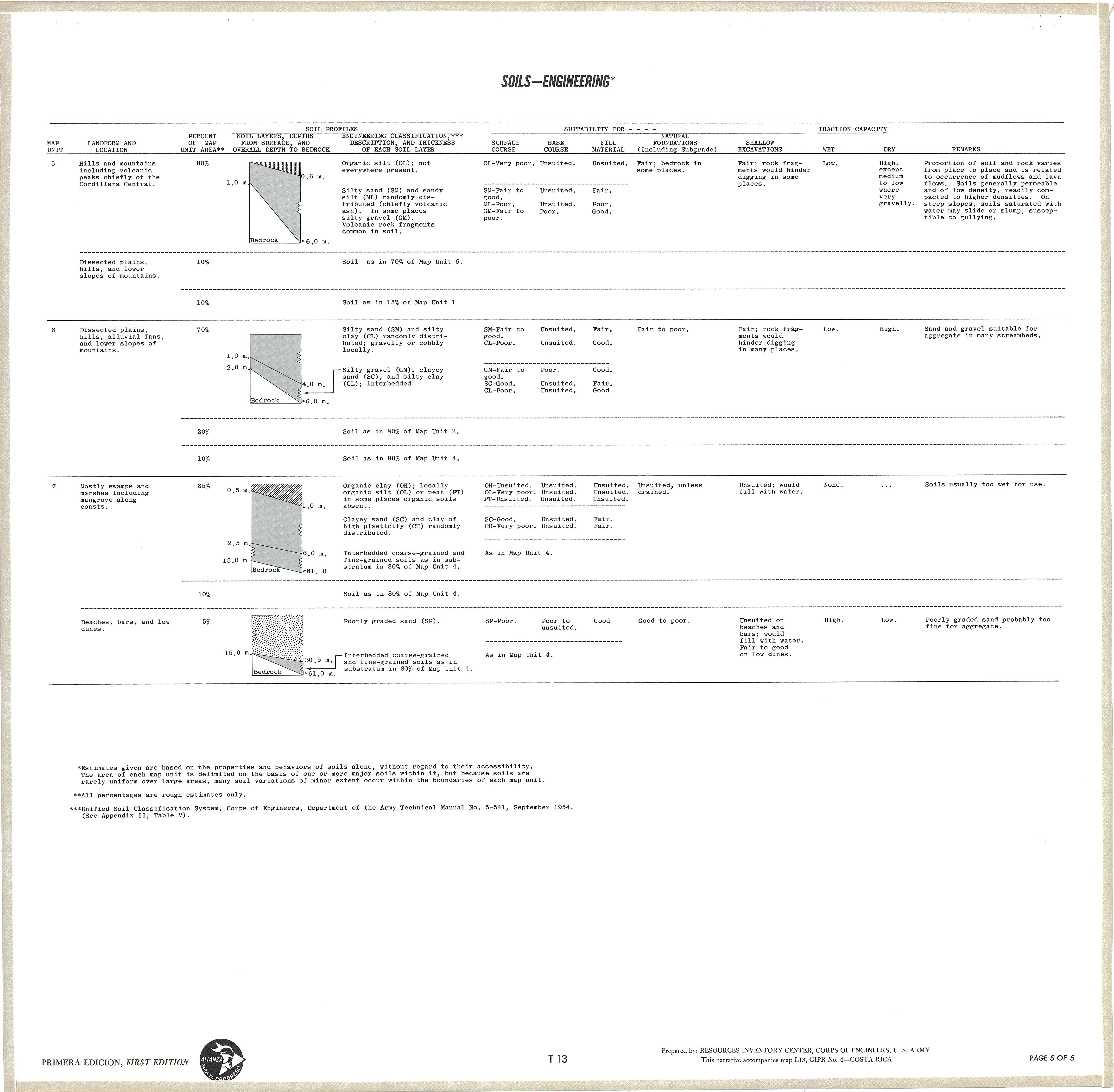
Soils-Engineering (L-13),(T-13); Description of the mapping units
Simple
- Date ( Publication )
- 1965-01-01
- Presentation form
- Hardcopy map
- Status
- Historical archive
Point of contact
FAO - UN AGL Documentation Center
Via delle Terme di Caracalla
,
Rome
,
00100
,
Italy
- Hours of service
- 8.30 - 17.00
- Keywords
-
- .All Subjects
- Keywords
-
- Soil Types
- Drainage
- Vegetation
- Climate
- Geology
- Groundwater
- Land Use
- Keywords ( Place )
-
- Costa Rica
- Denominator
- 750000
- Metadata language
- spa
- Metadata language
- eng
- Character set
- UTF8
- Topic category
-
- Geoscientific information
N
S
E
W
))
- Supplemental Information
- ISIS Identifier: 000880; Number of sheets: 26
Distributor
- Ordering instructions
- Location of the data: FAO - AGL COS-2
- Name
- No digital format
- Version
- n.a.
- OnLine resource
- costa_rica-880-suelos-ingenieria-soils-1-750,000.jpg ( WWW:DOWNLOAD-1.0-http--download )
- OnLine resource
- costa_rica-880-suelos-ingenieria_descripcion_1di5-soils-1-750,000.jpg ( WWW:DOWNLOAD-1.0-http--download )
- OnLine resource
- costa_rica-880-suelos-ingenieria_descripcion_2di5-soils-1-750,000.jpg ( WWW:DOWNLOAD-1.0-http--download )
- OnLine resource
- costa_rica-880-suelos-ingenieria_descripcion_3di5-soils-1-750,000.jpg ( WWW:DOWNLOAD-1.0-http--download )
- OnLine resource
- costa_rica-880-suelos-ingenieria_descripcion_4di5-soils-1-750,000.jpg ( WWW:DOWNLOAD-1.0-http--download )
- OnLine resource
- costa_rica-880-suelos-ingenieria_descripcion_5di5-soils-1-750,000.jpg ( WWW:DOWNLOAD-1.0-http--download )
- Hierarchy level
- Dataset
gmd:MD_Metadata
- File identifier
- fe976ac7-e5a7-4246-a7c0-6c93b673af18 XML
- Metadata language
- eng
- Character set
- UTF8
- Date stamp
- 2011-12-19T16:48:35
- Metadata standard name
- ISO 19115:2003/19139
- Metadata standard version
- 1.0
Overviews
large_thumbnail
thumbnail
Spatial extent
N
S
E
W
Provided by

Associated resources
Not available