 FAO Map Catalog
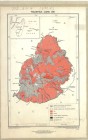
Mauritius - Land use
DOS Misc.-293
Simple
- Date ( Publication )
- 1960-01-01
- Presentation form
- Hardcopy map
- Status
- Historical archive
Point of contact
FAO - UN AGL Documentation Center
Via delle Terme di Caracalla
,
Rome
,
00100
,
Italy
- Hours of service
- 8.30 - 17.00
- Keywords
-
- Land
- Land Use
- Keywords
-
- Land Use
- Keywords ( Place )
-
- Mauritius
- Denominator
- 320000
- Metadata language
- eng
- Character set
- UTF8
- Topic category
-
- Farming
N
S
E
W
))
- Supplemental Information
- ISIS Identifier: 001634
Distributor
- Ordering instructions
- Location of the data: FAO - AGL MAURITIUS/LAND USE
- Name
- No digital format
- Version
- n.a.
- OnLine resource
- mauritius-1634-mauritius_land_use-land_use1-1-320,000.jpg ( WWW:DOWNLOAD-1.0-http--download )
- Hierarchy level
- Dataset
gmd:MD_Metadata
- File identifier
- f15a6eb0-88fd-11da-a88f-000d939bc5d8 XML
- Metadata language
- eng
- Character set
- UTF8
- Date stamp
- 2011-12-21T13:30:43
- Metadata standard name
- ISO 19115:2003/19139
- Metadata standard version
- 1.0
Overviews

large_thumbnail
thumbnail
Spatial extent
N
S
E
W
Provided by

Associated resources
Not available