 FAO Map Catalog
CropWatch Mapping and Reporting Units (MRUs)
Simple
- Date ( Publication )
- 2015-09-09T03:00:00
- Presentation form
- Digital map
- Purpose
- The MRUs are designed to be areas of uniform vulnerability to agroclimatic conditions. They provide a coherent picture of the variations of global agriculture, for instance the links between the distribution of crops, agricultural production potential and environmental variability (over space and time). They closely delineate the distribution of the major non-sugar food crops (barley, cassava, maize, potatoes, rice, soybean and wheat).
- Status
- Completed
- Maintenance and update frequency
- As needed
- Keywords ( Place )
-
- World
- Tag_forestry
- Keywords ( Theme )
-
- agroecologiccal zones
- vegetation zones
- impact assessment
- monitoring
- Access constraints
- Copyright
- Use constraints
- License
- Spatial representation type
- Vector
- Denominator
- 5000000
- Metadata language
- en
- Character set
- UTF8
- Topic category
-
- Climatology, meteorology, atmosphere
- Farming
- Begin date
- 1950-01-01
- End date
- 2014-12-31
))
- Supplemental Information
- The MRUs are part of the hierarchical approach to crop monitoring of CropWatch, which adopts increasingly detailed spatial scales and indicators from global to sub-national
- Reference system identifier
- WGS 1984
- Distribution format
-
-
ESRI Shapefile
(
1.0
)
-
ESRI Shapefile
(
1.0
)
- OnLine resource
-
CropWatch_MRU_polygons.zip
(
WWW:DOWNLOAD-1.0-http--download
)
Global CropWatch Mapping and Reporting Units (MRUs). ESRI Shapefiles.
- OnLine resource
-
CropWatch_MRU_characterization_1.pdf
(
WWW:DOWNLOAD-1.0-http--download
)
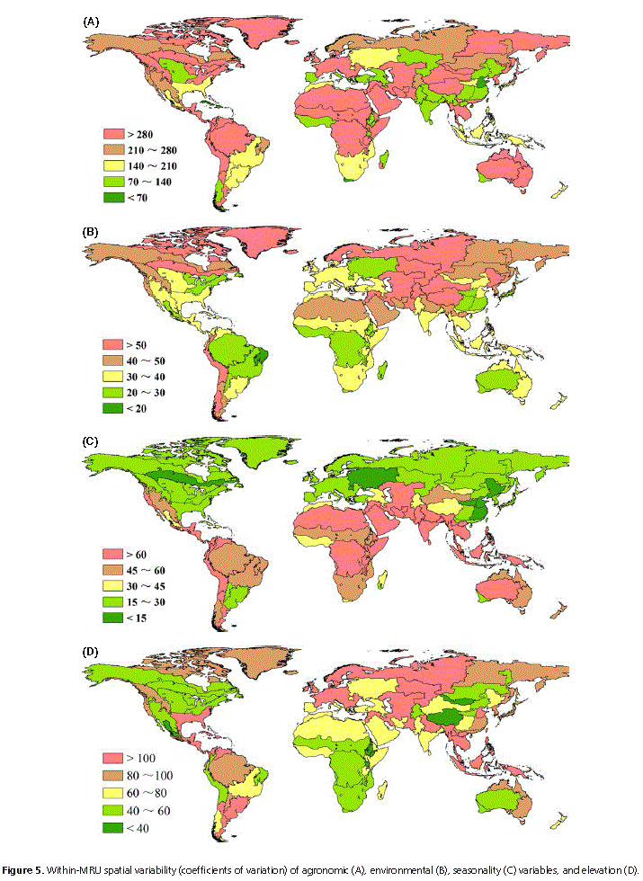
Table 1: Spatially averaged values of agronomic variables by MRU
- OnLine resource
-
CropWatch_MRU_characterization_2.pdf
(
WWW:DOWNLOAD-1.0-http--download
)
Table 2: Spatially averaged values for environmental and seasonality/time variability variables by MRU
- OnLine resource
-
Wiley Online Library
(
WWW:LINK-1.0-http--link
)
Design and characterization of spatial units for monitoring global impacts of environmental factors on major crops and food security
- Hierarchy level
- Dataset
- Statement
- The dataset was assembled by CropWatch based on the FAO GEZ and other sources. It is the first version of the set.
gmd:MD_Metadata
- File identifier
- e93e778f-d1b5-427f-a7e0-935458826f15 XML
- Metadata language
- en
- Character set
- UTF8
- Date stamp
- 2022-12-13T14:17:00
- Metadata standard name
- ISO 19115:2003/19139
- Metadata standard version
- 1.0
Overviews

Spatial extent
Provided by
