 FAO Map Catalog
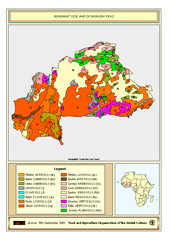
Dominant Soil map of Burkina Faso
Dominant soil map of Burkina Faso derived from the Digital Soil Map of the World.
Simple
- Date ( Creation )
- 09-2001
- Edition
- first
- Presentation form
- Digital map
- Status
- Completed
- Maintenance and update frequency
- As needed
- Keywords ( Theme )
-
- Soil
- Tag_soil
- Keywords ( Place )
-
- Burkina Faso
- Spatial representation type
- Vector
- Denominator
- 5000000
- Metadata language
- eng
- Character set
- UTF8
- Topic category
-
- Geoscientific information
N
S
E
W
))
- Reference system identifier
- WGS 1984
- OnLine resource
-
dom_soil.zip
(
WWW:DOWNLOAD-1.0-http--download
)
Dominant Soil map of Burkina Faso - Shapefile format
- Hierarchy level
- Dataset
gmd:MD_Metadata
- File identifier
- d6d13830-88fd-11da-a88f-000d939bc5d8 XML
- Metadata language
- eng
- Character set
- UTF8
- Date stamp
- 2019-11-22T10:40:04
- Metadata standard name
- ISO 19115:2003/19139
- Metadata standard version
- 1.0
Point of contact
FAO-UN - Land and Water Division (CBL)
-
(
)
Viale delle Terme di Caracalla
,
Rome
,
00153
,
Italy
Overviews
thumbnail
large_thumbnail
Spatial extent
N
S
E
W
Provided by

Associated resources
Not available