 FAO Map Catalog
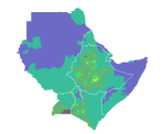
Average annual Potential Evapotranspiration (PET) in Northeast Africa.
Average annual Potential Evapotranspiration (PET) in Djibouti, Eritrea, Ethiopia, Kenya, Somalia, Sudan and Uganda.
Simple
- Date ( Creation )
- 1994-05-
- Edition
- First edition.
- Presentation form
- Digital document
- Purpose
- To enhance crop monitoring and forecasting procedures of regional and national early warning units.
- Status
- On going
Point of contact
FAO-UN - Climate and Environment Division (CBC)
-
Hideki Kanamaru
(
Natural Resources Officer
)
- Keywords
-
- evapotranspiration
- Tag_climate
- Keywords
-
- climate
- Keywords
-
- Horn of Africa
- Northeast Africa
- Keywords ( Place )
-
- Africa
- Spatial representation type
- Vector
- Denominator
- 5000000
- Metadata language
- eng
- Character set
- UTF8
- Topic category
-
- Climatology, meteorology, atmosphere
N
S
E
W
))
- Supplemental Information
- Map derived through interpolation and were subsequently area-averaged. For planning purposes, and to ensure the compatibility with other background data (such as demographic and agricultural statistics), the information is presented according to geographic units largely following administrative boundaries. The region was therefore subdivided into 1220 homogeneous map units which correspond to administrative units, or subdivisions thereof whenever steep ecological gradients occur. These map units constitute the basic elements shown in this map.
- Hierarchy level
- Dataset
- Description
- Last Updated
- Date / Time
- 2002-05-31 19:58:00
gmd:MD_Metadata
- File identifier
- c5893d20-88fd-11da-a88f-000d939bc5d8 XML
- Metadata language
- eng
- Character set
- UTF8
- Date stamp
- 2019-11-22T10:24:52
- Metadata standard name
- ISO 19115:2003/19139
- Metadata standard version
- 1.0
Overviews
thumbnail

large_thumbnail
Spatial extent
N
S
E
W
Provided by

Associated resources
Not available