 FAO Map Catalog
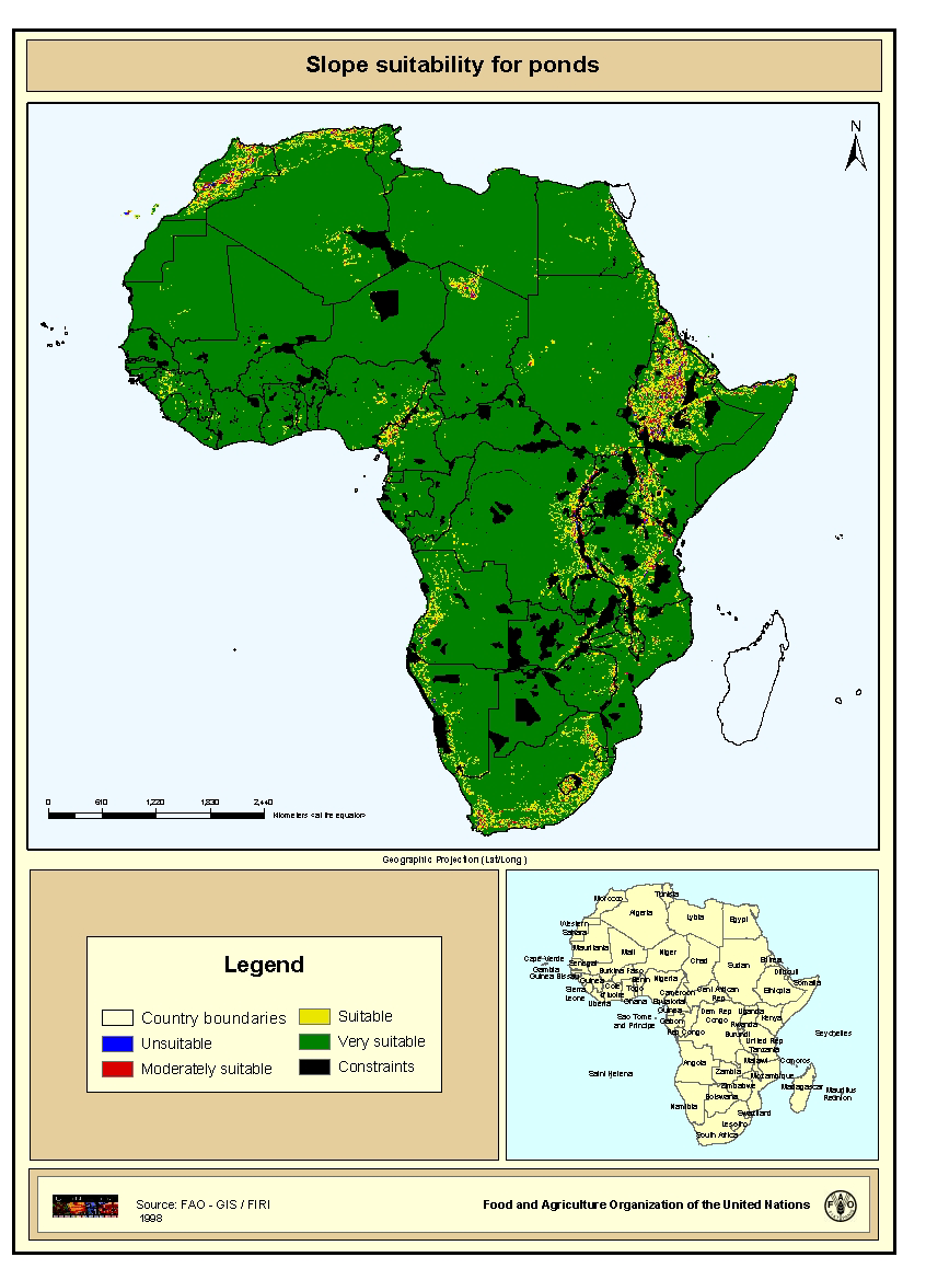
Slope suitability for ponds
Suitable areas for the construction of fish ponds based on a slope evaluation. Slope was derived from a global digital elevation model (GTOPOP30) in the form of percentages.
Simple
- Date ( Publication )
- 1998-01-01
- Edition
- First
- Presentation form
- Digital map
- Purpose
- The main objective was to map and estimate the areal expanses having suitable to optimum potential for subsistence and commercial warm water fish farming in ponds. A secondary objective was to encourage countries with relatively large potentials for warm water fish farming development to undertake more detailed, national-level studies as a step towards formulating or refining an aquaculture policy and to improve planning for aquaculture development.
- Status
- Completed
- Keywords
-
- Africa
- Slope
- Pond
- Fishery
- Fish farming
- Aquaculture
- CIFA Technical Paper 32
- Keywords ( Place )
-
- Africa
- Spatial representation type
- Grid
- Metadata language
- eng
- Character set
- UTF8
- Topic category
-
- Geoscientific information
- Begin date
- 1997-01-01
- End date
- 1998-01-01
N
S
E
W
))
- Supplemental Information
- This map derives from a wider study that evaluates inland fish farming potential at a continental-level, published by J.Aguilar-Manjarrez and S. S. Nath with the title "A strategic reassessment of fish farming potential in Africa" . CIFA Technical Paper. No. 32. Rome, FAO. 1998. 170p. This study is a follow-up of an earlier assessment of warm-water fish farming potential in Africa by Kapetsky (1994) with the objective to assess locations and areal expanses that have potential for warm-water and temperate-water fish farming in continental Africa. Resolution 5 km x 5 km.
- OnLine resource
- http://www.fao.org/docrep/W8522e/W8522E00.htm#TOC ( WWW:LINK-1.0-http--link )
- OnLine resource
- http://cres.anu.edu.au/software/africatxt.htm ( WWW:LINK-1.0-http--link )
- OnLine resource
- http://www.iiasa.ac.at/ ( WWW:LINK-1.0-http--link )
- OnLine resource
-
geonetwork:slope_3821
(
OGC:WMS-1.1.1-http-get-map
)
Slope suitability for ponds
- OnLine resource
-
slope.zip
(
WWW:DOWNLOAD-1.0-http--download
)
Slope suitability for ponds (GRID format)
- Hierarchy level
- Dataset
- Statement
- Conversion from ASCII files to Arc/Info GRID
gmd:MD_Metadata
- File identifier
- c462be80-88fd-11da-a88f-000d939bc5d8 XML
- Metadata language
- eng
- Character set
- UTF8
- Date stamp
- 2009-04-14T15:30:59
- Metadata standard name
- ISO 19115:2003/19139
- Metadata standard version
- 1.0
Overviews
thumbnail
large_thumbnail
Spatial extent
N
S
E
W
Provided by

Associated resources
Not available