 FAO Map Catalog
ORNL Land cover of Sub-Saharan Africa
As part of the the World Bank's review of its rural development strategy, the Bank sought the assistance of the Food and Agriculture Organization of the United Nations (FAO) in evaluating how farming systems might change and adapt over the next thirty years. Amongst other objectives, the World Bank asked FAO to provide guidance on priorities for investment in food security, poverty reduction, and economic growth, and in particular to identify promising approaches and technologies that will contribute to these goals. The results of the study are summarized in a set of seven documents, comprising six regional reports and the global overview contained in this volume. This document, which synthesises the results of the six regional analyses as well as discussing global trends, cross-cutting issues and possible implementation modalities, presents an overview of the complete study. This document is supplemented by two case study reports of development issues of importance to farming systems globally.
Simple
- Date ( Creation )
- 2001-05-01
- Edition
- First edition.
- Presentation form
- Digital map
- Purpose
- The farming systems presented in this study are considered to provide an effective broad framework for the prioritisation of development actions and investments for accelerating agricultural development, particularly in ways which can reduce rural poverty and hunger.
- Status
- On going
- Keywords
-
- LAND USE
- Tag_LUS
- Tag_land
- Keywords
-
- Global Farming Systems Study
- Sub-Saharan Africa
- Keywords ( Place )
-
- Africa
- Spatial representation type
- Grid
- Metadata language
- eng
- Character set
- UTF8
- Topic category
-
- Imagery base maps earth cover
- Begin date
- 2001-05-01
N
S
E
W
))
- Supplemental Information
- Data from the Oak Ridge National Laboratory, LandScan Global Population 1998 Database. The LandScan Land Cover Database is derived from the U.S. Geological Survey's (USGS) Global Land Cover Characteristics (GLCC) database with the following substantial modifications: 1. The LandScan Land Cover Database has been georegistered at 30 arc second resolution in a common grid for the entire globe. The original GLCC database was in Goode's Homolosine projection. 2. Considerable effort has been devoted to reconciling the positional accuracy of diverse global databases. Mismatches among databases were most conspicuous on coastlines. On the southern coast of France, for example, positional errors amounted to several kilometers, and these have been corrected. Globally, the LandScan Land Cover database coastlines are based on NIMA's World Vector Shoreline (WVS) at 1:250,000 scale. Typically, this coastline differs somewhat from the related line representing the seaward boundary of administrative units, and both of these differ from the land/water boundary indicated on the GLCC gridded database. In the final LandScan Land Cover Database, Version 1.1, the WVS takes precedence, and water is assigned to all cells extending more than one-half cell beyond the WVS coastline. Wherever the land surface had to be expanded to reach the WVS shoreline, we inserted an ?unclassified land?-. 3. The LandScan Land Cover Database contains a much improved ?urban? class. We replaced the USGS ?urban? class with two new classes--developed and partly developed. The developed class is composed of GLCC's urban cells plus all cells included in the Census Bureau's P-95 circles. The partly developed class is derived from Nighttime Lights of the World and contains all cells with a frequency value of 90% or greater. The the ?partly developed? class typically includes suburban areas, small towns, and scattered industries, airports, etc.
- OnLine resource
-
Online link to a website
(
WWW:LINK-1.0-http- -link
)
Online link to a website
- OnLine resource
- ssa_lcov_ornl.axl ( ESRI:AIMS-4.0-http--configuration )
- OnLine resource
- 1045.zip ( WWW:DOWNLOAD-1.0-http--download )
- Hierarchy level
- Dataset
- Description
- Last Updated
- Date / Time
- 2002-05-31 19:58:00
gmd:MD_Metadata
- File identifier
- bcbf2d80-88fd-11da-a88f-000d939bc5d8 XML
- Metadata language
- eng
- Character set
- UTF8
- Date stamp
- 2004-04-16T16:17:19
- Metadata standard name
- ISO 19115:2003/19139
- Metadata standard version
- 1.0
Overviews
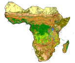
thumbnail
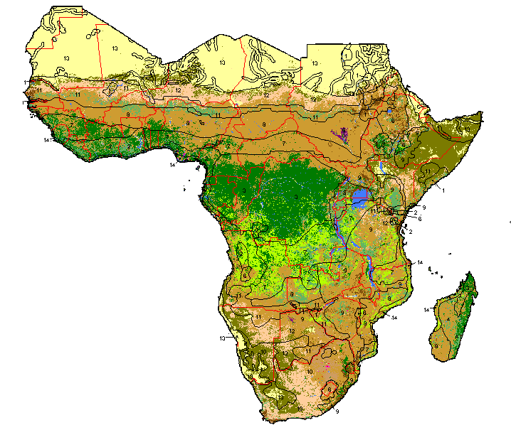
large_thumbnail
Spatial extent
N
S
E
W
Provided by

Associated resources
Not available