 FAO Map Catalog
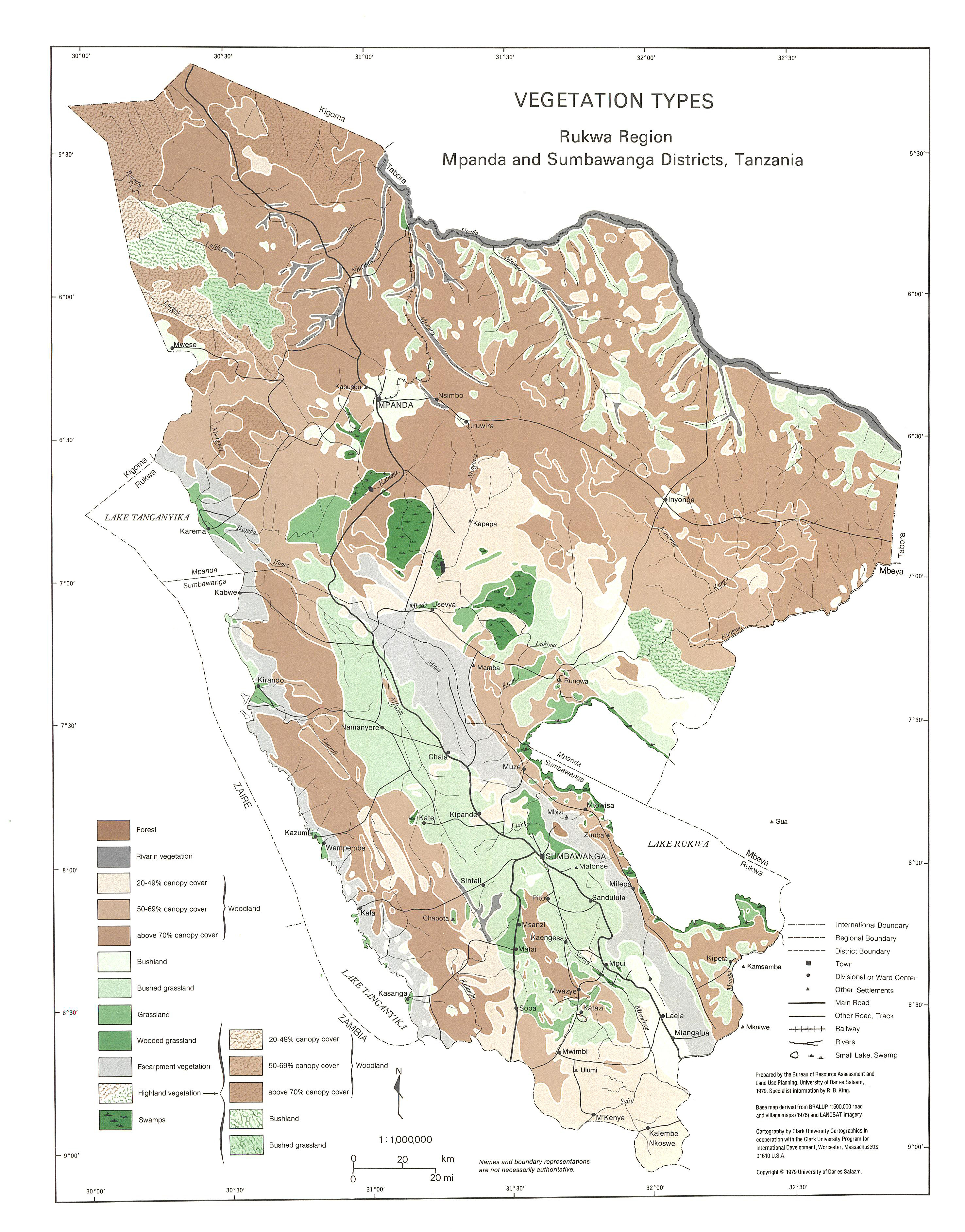
Rukwa region: Mpanda & Sumbawanga districts (Vegetation types - Tanzania)
Include:
Vegetation types, Mpanda
Simple
- Date ( Publication )
- 1979-01-01
- Presentation form
- Hardcopy map
- Status
- Historical archive
Point of contact
FAO - UN AGL Documentation Center
Via delle Terme di Caracalla
,
Rome
,
00100
,
Italy
- Hours of service
- 8.30 - 17.00
- Keywords
-
- .All Subjects
- Keywords
-
- Geology
- Landscape
- Land Suitability
- Crops
- Irrigation
- Vegetation
- Forestry
- Keywords ( Place )
-
- Tanzania
- Denominator
- 1000000
- Metadata language
- eng
- Character set
- UTF8
- Topic category
-
- Geoscientific information
N
S
E
W
))
- Supplemental Information
- ISIS Identifier: 001255; Number of sheets: 11; Related document location: AGL URT/S-
Distributor
- Ordering instructions
- Location of the data: FAO - AGL URT/S-
- Name
- No digital format
- Version
- n.a.
- OnLine resource
- tanzania-1255-vegetation_types,rukwa_region-vegetation-1-1,000,000.jpg ( WWW:DOWNLOAD-1.0-http--download )
- Hierarchy level
- Dataset
gmd:MD_Metadata
- File identifier
- 2482d3af-698f-499a-97cd-5fe61370ce09 XML
- Metadata language
- eng
- Character set
- UTF8
- Date stamp
- 2011-12-26T10:26:27
- Metadata standard name
- ISO 19115:2003/19139
- Metadata standard version
- 1.0
Custodian
FAO - UN AGL Documentation Center
-
Viale delle Terme di Caracalla
,
Rome
,
RM
,
00100
,
Italy
Overviews

thumbnail

large_thumbnail
Spatial extent
N
S
E
W
Provided by

Associated resources
Not available