 FAO Map Catalog
utilitiesCommunication
Type of resources
Available actions
Topics
Keywords
Contact for the resource
Provided by
Years
Formats
Representation types
Update frequencies
status
Scale
-

Published by Collins Bartholomew in partnership with Global System for Mobile Communications (GSMA), the Mobile Coverage Explorer is a raster data representation of the area covered by mobile cellular networks around the world. The dataset series is supplied as raster Data_MCE (operators) and Data_OCI (OpenCellID database). OCI dataset series has been created using OpenCellID tower locations. These derived locations have been used as the centre points of a radius of coverage: 12 kilometres for GSM networks, and 4km for 3G and 4G networks. No 5G data yet exists in the OpenCellID database. These circles of coverage from each tower have then been merged to create an overall representation of network coverage. The OCI dataset series is available at Global and National level. Global dataset series - sub hierarchy levels - contain three datasets representing cellular mobile radio technologies ‘2G’, ‘3G’ and ‘4G’ The file naming convention is as follows: OCI_Global<Technology>_<DataRelease> , where technology is either ‘2G’, ‘3G’, or ‘4G’ and G stands for 'generation'. At country level the rasters depict the network coverage in each country for each technology. Therefore a country is not defined by its border extent but rather by the coverage supplied by network operators with licences in that country. In the file naming convention, countries are identified using their ISO 3166-1 code as follows: OCI<ISO2Code><Technology>_<DataRelease>. The cell values in the OCI raster is equal to 1 – approximate coverage.
-
Published by Collins Bartholomew in partnership with Global System for Mobile Communications (GSMA), the Mobile Coverage Explorer is a raster data representation of the area covered by mobile cellular networks around the world. OCI dataset series has been created using OpenCellID tower locations. These derived locations have been used as the centre points of a radius of coverage: 12 kilometres for GSM 2G networks. These circles of coverage from each tower have then been merged to create an overall representation of network coverage. The OCI 2G dataset at Global and National scale. The file naming convention is as follows: OCI_Global<Technology>_<DataRelease> , where technology is ‘2G’, and G stands for 'generation'. At country level the rasters depict the network coverage in each country for each technology. Therefore a country is not defined by its border extent but rather by the coverage supplied by network operators with licenses in that country. In the file naming convention, countries are identified using their ISO 3166-1 code as follows: OCI<ISO2Code><Technology>_<DataRelease>. The cell values in the OCI raster is equal to 1 – approximate coverage.
-

The World Mobile Broadband coverage is a 1km resolution raster grid (1/0) representation of cellular mobile wireless Internet access. The grid is derived from Collins Bartholomew’s GSMA Mobile Coverage Explorer database and was computed using both operators’ submission to Global System for Mobile Communication (GSMA) and OpenCell ID cell tower database. The dataset includes operator’s submission coverage for 3G with strong signal, 4G strong signal and 5G, sourced from the network operators from submissions made directly to Collins Bartholomew or to GSMA, from operators who provide roaming detail for inclusion in the GSMA’s Network Coverage Maps web application. This data is supplemented with coverage created from OpenCellID tower locations. These derived locations have been used as the centre points of a radius of coverage: 12 kilometres for GSM networks, and 4km for 3G and 4G networks. No 5G data yet exists in the OpenCellID database. These circles of coverage from each tower have then been merged to create an overall representation of network coverage. The dataset uses 3G, 4G and 5G.
-

Published by Collins Bartholomew in partnership with Global System for Mobile Communications (GSMA), the Mobile Coverage Explorer is a raster data representation of the area covered by mobile cellular networks around the world. Data_MCE global coverage has been sourced from the network operators and created from submissions made directly to Collins Bartholomew or to GSMA, from operators who provide roaming detail for inclusion in the GSMA’s Network Coverage Maps web application (https://www.gsma.com/coverage). The dataset is provided at Global and National level. Global datasets contain the merged global coverages with the following file naming convention. MCE_Global<Technology>_<DataRelease>, where technology is ‘3G’. At country level the rasters depict the network coverage in each country for each technology. Therefore a country is not defined by its border extent but rather by the coverage supplied by network operators with licences in that country. In the file naming convention, countries are identified using their ISO 3166-1 code as follows: MCE_<ISO2Code><Technology>_<DataRelease>. The cell value in the MCE rasters are as follows: 1 - strong signal 2 - variable signal strength This data is supplemented with coverage created from OpenCellID (please see link in the associated resources of this metadata).
-
Published by Collins Bartholomew in partnership with Global System for Mobile Communications (GSMA), the Mobile Coverage Explorer is a raster data representation of the area covered by mobile cellular networks around the world. OCI dataset series has been created using OpenCellID tower locations. These derived locations have been used as the centre points of a radius of coverage: 4km for 4G networks. These circles of coverage from each tower have then been merged to create an overall representation of network coverage. The OCI 4G dataset is available at Global and National scale. The file naming convention is as follows: OCI_Global<Technology>_<DataRelease> , where technology is either ‘2G’, ‘3G’, or ‘4G’ and G stands for 'generation'. At country level the rasters depict the network coverage in each country for each technology. Therefore a country is not defined by its border extent but rather by the coverage supplied by network operators with licenses in that country. In the file naming convention, countries are identified using their ISO 3166-1 code as follows: OCI<ISO2Code><Technology>_<DataRelease>. The cell values in the OCI raster is equal to 1 – approximate coverage.
-
Published by Collins Bartholomew in partnership with Global System for Mobile Communications (GSMA), the Mobile Coverage Explorer is a raster data representation of the area covered by mobile cellular networks around the world. Data_MCE global coverage has been sourced from the network operators and created from submissions made directly to Collins Bartholomew or to GSMA, from operators who provide roaming detail for inclusion in the GSMA’s Network Coverage Maps web application (https://www.gsma.com/coverage). The dataset is provided at Global and National level. Global datasets contain the merged global coverages with the following file naming convention. MCE_Global<Technology>_<DataRelease>, where technology is ‘4G’. At country level the rasters depict the network coverage in each country for each technology. Therefore a country is not defined by its border extent but rather by the coverage supplied by network operators with licences in that country. In the file naming convention, countries are identified using their ISO 3166-1 code as follows: MCE_<ISO2Code><Technology>_<DataRelease>. The cell value in the MCE rasters are as follows: 1 - strong signal 2 - variable signal strength This data is supplemented with coverage created from OpenCellID (please see link in the associated resources of this metadata).
-
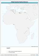
Seamless and topologically robust derivative of VMap0 - Ed5 data layers. The PIPE_LN shapefile data layer is comprised of 186 derivative vector framework library features derived based on 1:1 000 000 data originally from VMap0, 5th Edition. The layer provides nominal analytical/mapping at 1:1 000 000. Data processing complete globally, this is an African subset. Acronyms and Abbreviations: VMap0 - Vector Map for Level 0.
-
Published by Collins Bartholomew in partnership with Global System for Mobile Communications (GSMA), the Mobile Coverage Explorer is a raster data representation of the area covered by mobile cellular networks around the world. Data_MCE global coverage has been sourced from the network operators and created from submissions made directly to Collins Bartholomew or to GSMA, from operators who provide roaming detail for inclusion in the GSMA’s Network Coverage Maps web application (https://www.gsma.com/coverage). The dataset is provided at Global and National level. Global datasets contain the merged global coverages with the following file naming convention. MCE_Global<Technology>_<DataRelease>, where technology is ‘3G’. At country level the rasters depict the network coverage in each country for each technology. Therefore a country is not defined by its border extent but rather by the coverage supplied by network operators with licences in that country. In the file naming convention, countries are identified using their ISO 3166-1 code as follows: MCE_<ISO2Code><Technology>_<DataRelease>. The cell value in the MCE rasters are as follows: 1 - strong signal 2 - variable signal strength This data is supplemented with coverage created from OpenCellID (please see link in the associated resources of this metadata).
-
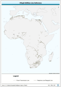
Seamless and topologically robust derivative of linearVMap0 - Ed5 Utility and related data layers. The UTIL_LN shapefile data layer is comprised of 2476 derivative vector framework library features derived based on 1:1 000 000 data originally from VMap0, 5th Edition. The layer provides nominal analytical/mapping at 1:1 000 000. Data processing complete globally, this is an African subset. Acronyms and Abbreviations: VMap0 - Vector Map for Level 0.
-
Published by Collins Bartholomew in partnership with Global System for Mobile Communications (GSMA), the Mobile Coverage Explorer is a raster data representation of the area covered by mobile cellular networks around the world. OCI dataset series has been created using OpenCellID tower locations. These derived locations have been used as the centre points of a radius of coverage: 4km for 3G networks. These circles of coverage from each tower have then been merged to create an overall representation of network coverage. The OCI 3G dataset is available at Global and National scale. The file naming convention is as follows: OCI_Global<Technology>_<DataRelease> , where technology is either ‘2G’, ‘3G’, or ‘4G’ and G stands for 'generation'. At country level the rasters depict the network coverage in each country for each technology. Therefore a country is not defined by its border extent but rather by the coverage supplied by network operators with licenses in that country. In the file naming convention, countries are identified using their ISO 3166-1 code as follows: OCI<ISO2Code><Technology>_<DataRelease>. The cell values in the OCI raster is equal to 1 – approximate coverage.