 FAO Map Catalog
Contact for the resource
Yafesi Okia
Type of resources
Available actions
Topics
Keywords
Contact for the resource
Provided by
Formats
Representation types
Update frequencies
status
Scale
From
1
-
2
/
2
-
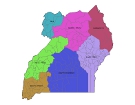
The national and administrative boundaries have been provided by the NFPI. Coastlines have been adapted to match the landcover dataset.
-
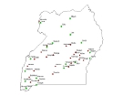
The full resolution dataset of towns was developed from data from the National Imagery and Mapping Agency (NIMA).