 FAO Map Catalog
USAID
Type of resources
Topics
Keywords
Contact for the resource
Provided by
Representation types
Update frequencies
status
Scale
-
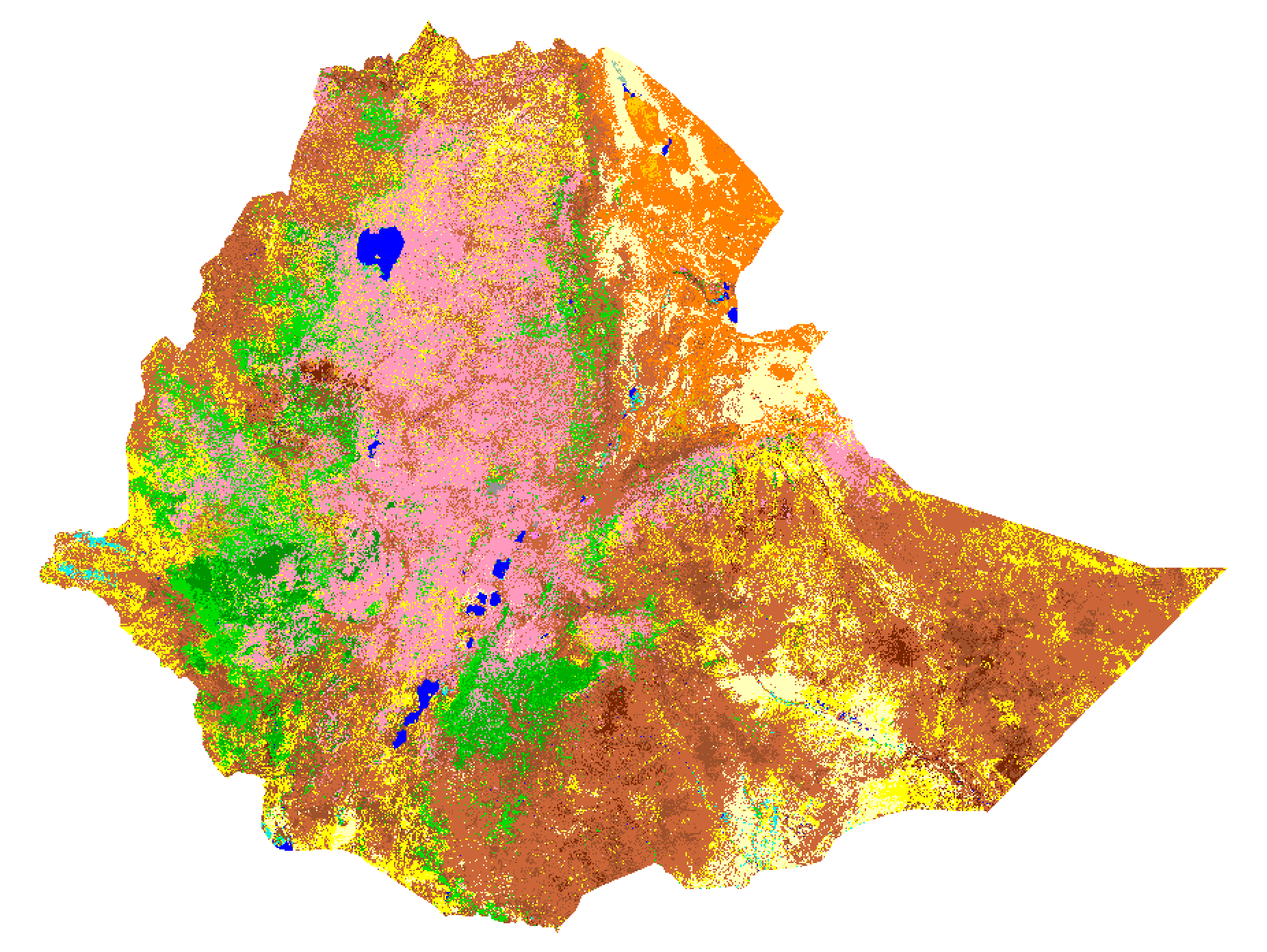
This map represents the Ethiopia Land Cover map for the development of Green House Gas Inventory. These products were derived from LandSat Imagery Data through a supervised classification method. The Ancillary data was provided by Ethiopia Mapping Agency.
-
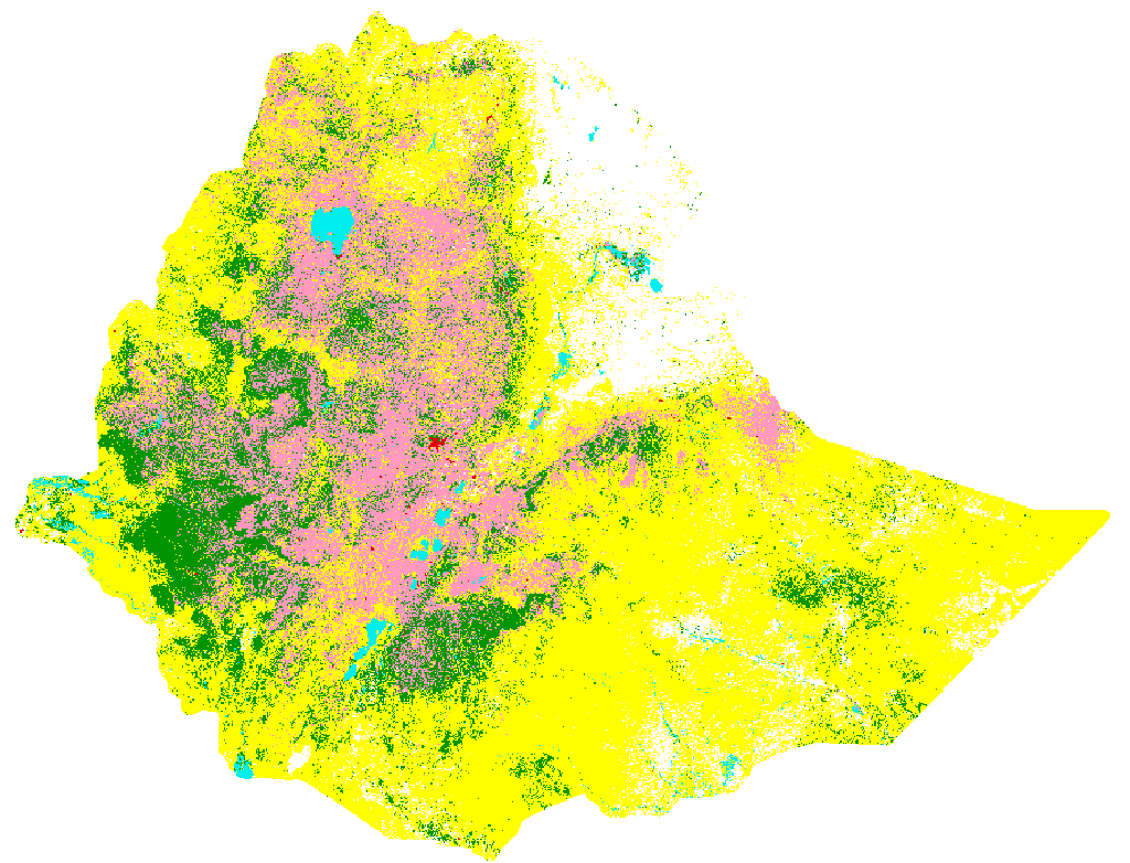
This map represents the Ethiopia Land Cover map for the development of Green House Gas Inventory. These products were derived from LandSat Imagery Data through a supervised classification method. The Ancillary data was provided by Ethiopia Mapping Agency.
-
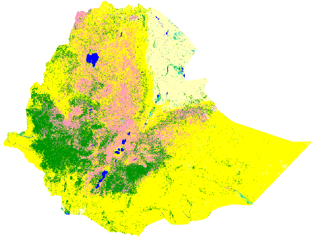
This map represents the Ethiopia Land Cover map for the development of Green House Gas Inventory. These products were derived from LandSat Imagery Data through a supervised classification method. The Ancillary data was provided by Ethiopia Mapping Agency.
-
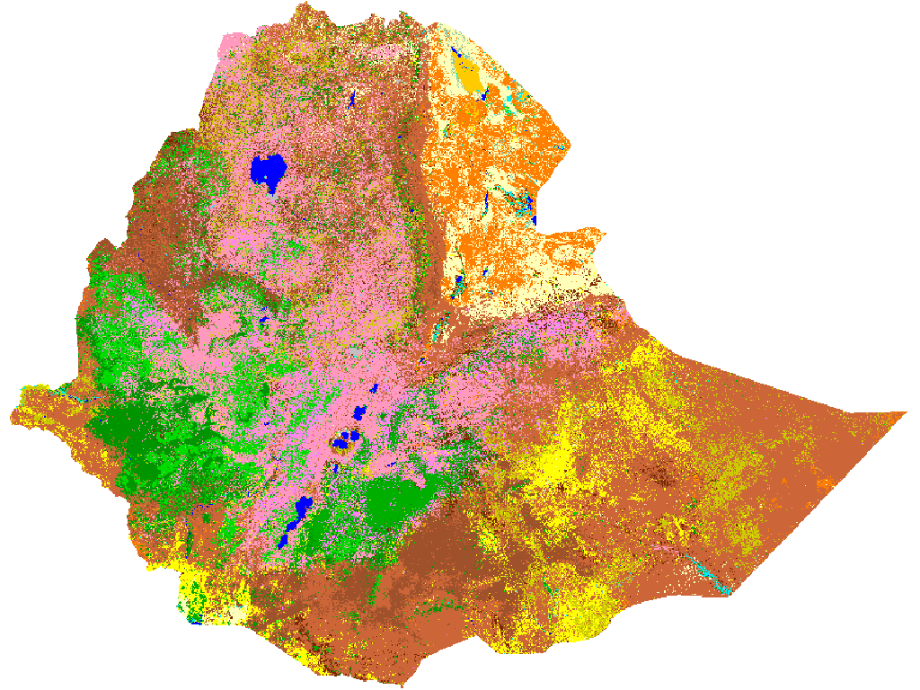
This map represents the Ethiopia Land Cover map for the development of Green House Gas Inventory. These products were derived from LandSat Imagery Data through a supervised classification method. The Ancillary data was provided by Ethiopia Mapping Agency.