 FAO Map Catalog
Contact for the resource
Senior Officer Land Resources (Retired)
Type of resources
Available actions
Topics
Keywords
Contact for the resource
Provided by
Years
Representation types
Update frequencies
status
Scale
From
1
-
1
/
1
-
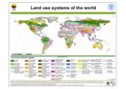
Version 1.1 of a thematic grid of Land Use Systems (LUS) and its attributes with a spatial resolution of 5 arc minutes or 0.083333 decimal degrees. This dataset is developed in the framework of the LADA project (Land degradation Assessment in Drylands) by the Land Tenure and Management Unit of the Food and Agriculture Organization of the United Nations and is copyright of FAO/UNEP GEF. The LUS map implementation is based on a innovative methodology combining more than 10 global datasets. Due to the map generation method, the quality of the map can never be uniform. The overall quality of the map depends heavily on the individual quality of the data for the different countries.