 FAO Map Catalog
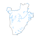
rivers
Type of resources
Available actions
Topics
Keywords
Contact for the resource
Provided by
Years
Formats
Representation types
Update frequencies
status
Scale
-
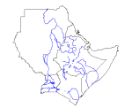
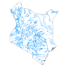
Major rivers in Djibouti, Eritrea, Ethiopia, Kenya, Somalia, Sudan and Uganda.
-

The FGGD inland water bodies map is a global raster datalayer with a resolution of 5 arc-minutes. It contains the value -997 where inland water bodies is present, the value 1 for the land. The information of inland water bodies is from the 1991 version of Digital Soil Map of the World.
-
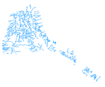
The rivers have been produced from visual interpretation of digitally enhanced LANDSAT TM images (Bands 4,3,2) acquired mainly in the year 1999.
-
GNS_RIV: GNS/GeoNet named river confluence & outflow locations Value-added derivative of source w/non-diacritical names of river confluence's. The GNS_RIV shapefile data layer is comprised of 138700 derivative point gazetteer features derived based on 1:250 000 data originally from GEOnet. The layer provides nominal analytical/mapping at 1:250 000. Data processing is complete globally, this is an African subset. Acronyms and Abbreviations: GNS/GeoNet - NIMA?s Geographic Names Server Gazetteer of Named Locations; NIMA - U.S. National Imagery & Mapping Agency, formerly the U.S. Defense Mapping Agency (DMA).
-
The full resolution dataset of rivers have been produced from visual interpretation of digitally enhanced LANDSAT TM images (Bands 4,3,2) acquired mainly in the year 1999.
-

The full resolution dataset of rivers have been taken from the DCW dataset.
-

The full resolution dataset of rivers have been produced from visual interpretation of digitally enhanced LANDSAT TM images (Bands 4,3,2) acquired mainly in the period 1994-1999.
-

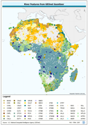
The rivers of Central America dataset is derived from the World Wildlife Fund's (WWF) HydroSHEDS drainage direction layer and a stream network layer. The source of the drainage direction layer was the 15-second Digital Elevation Model (DEM) from NASA's Shuttle Radar Topographic Mission (SRTM). The raster stream network was determined by using the HydroSHEDS flow accumulation grid, with a threshold of about 1000 km² upstream area. The stream network dataset consists of the following information: the origin node of each arc in the network (FROM_NODE), the destination of each arc in the network (TO_NODE), the Strahler stream order of each arc in the network (STRAHLER), numerical code and name of the major basin that the arc falls within (MAJ_BAS and MAJ_NAME); - area of the major basin in square km that the arc falls within (MAJ_AREA); - numerical code and name of the sub-basin that the arc falls within (SUB_BAS and SUB_NAME); - area of the sub-basin in square km that the arc falls within (SUB_AREA); - numerical code of the sub-basin towards which the sub-basin flows that the arc falls within (TO_SUBBAS) (the codes -888 and -999 have been assigned respectively to internal sub-basins and to sub-basins draining into the sea). The attributes table now includes a field named "Regime" with tentative classification of perennial ("P") and intermittent ("I") streams.
-
The full resolution dataset of rivers was produced from visual interpretation of digitally enhanced LANDSAT TM images (Bands 4,3,2) acquired mainly in the year 1995.
-
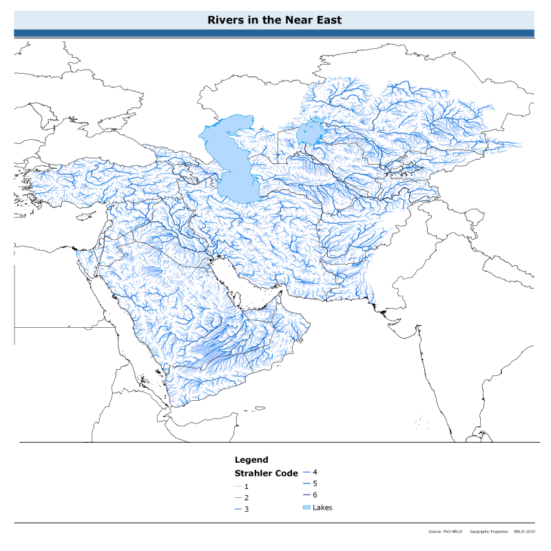
The rivers of the Near East dataset is derived from the World Wildlife Fund's (WWF) HydroSHEDS drainage direction layer and a stream network layer. The source of the drainage direction layer was the 15-second Digital Elevation Model (DEM) from NASA's Shuttle Radar Topographic Mission (SRTM). The raster stream network was determined by using the HydroSHEDS flow accumulation grid, with a threshold of about 1000 km² upstream area. The stream network dataset consists of the following information: the origin node of each arc in the network (FROM_NODE), the destination of each arc in the network (TO_NODE), the Strahler stream order of each arc in the network (STRAHLER), numerical code and name of the major basin that the arc falls within (MAJ_BAS and MAJ_NAME); - area of the major basin in square km that the arc falls within (MAJ_AREA); - numerical code and name of the sub-basin that the arc falls within (SUB_BAS and SUB_NAME); - area of the sub-basin in square km that the arc falls within (SUB_AREA); - numerical code of the sub-basin towards which the sub-basin flows that the arc falls within (TO_SUBBAS) (the codes -888 and -999 have been assigned respectively to internal sub-basins and to sub-basins draining into the sea). The attributes table now includes a field named "Regime" with tentative classification of perennial ("P") and intermittent ("I") streams.