 FAO Map Catalog
rice
Type of resources
Available actions
Topics
Keywords
Contact for the resource
Provided by
Years
Formats
Representation types
Update frequencies
status
Resolution
-
The Food and Agriculture Organization of the United Nations (FAO) with the collaboration of the International Institute for Applied Systems Analysis (IIASA), has developed a system that enables rational land-use planning on the basis of an inventory of land resources and evaluation of biophysical limitations and potentials. This is referred to as the Agro-ecological Zones (AEZ) methodology.
-

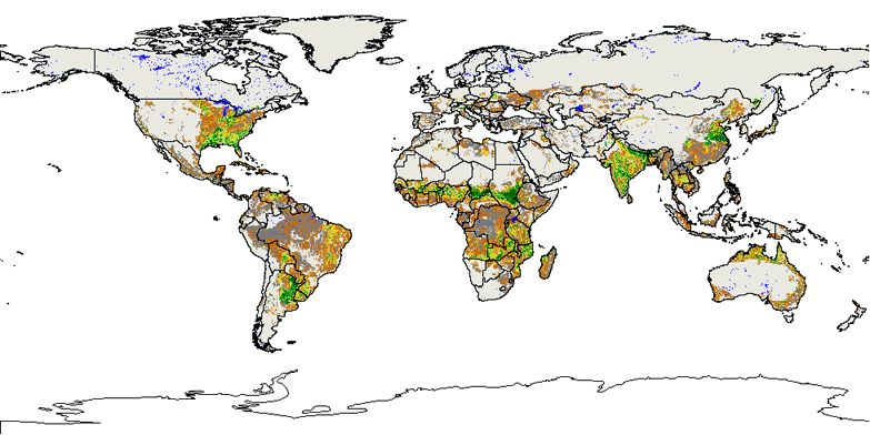
This raster dataset provides information on crop types and their spatial extent in Afghanistan. 6 classes are considered: wheat single crop, rice single crop, cotton single crop, wheat/rice double crops, other double crops, other single crops
-
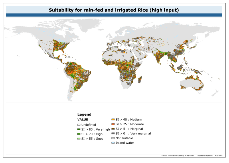
The raster dataset of suitability for rainfed and irrigated rice with high input has a spatial resolution of 5 * 5 arc minutes and is in geographic projection. Information with regard to rice suitability was obtained from the "Derived Soil Properties" of the FAO-UNESCO Soil Map of the World which contains raster information on soil properties.
-
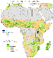
The suitability analysis allowed identifying a suitability weight to each crop, based on the climate conditions (ClimAfrica) outputs as well as on the soil quality. Both climate and soil classes have been combined in order to produce one suitability map for each crop and each 30-year period (historical, current, and the 3 future periods). This dataset has been produced in the framework of the “Climate change predictions in Sub-Saharan Africa: impacts and adaptations (ClimAfrica)” project, Work Package 4 (WP4). More information on ClimAfrica project is provided in the Supplemental Information section of this metadata.