 FAO Map Catalog
conservation
Type of resources
Available actions
Topics
Keywords
Contact for the resource
Provided by
Representation types
Update frequencies
status
Scale
-

DAD-IS is the key communication and information tool for implementing the Global Strategy for the Management of Farm Animal Genetic Resources (AnGR). DAD-IS provides: - guidelines to assist countries manage their AnGR; - searchable database on origin, population, risk status, performance and morphology of more than 14,000 breed populations of 35 species in 189 countries and updating functionality for National Coordinators; - a Global Early Warning System for AnGR; - searchable library of full texts and links to other websites related to AnGR management and the Global Strategy; - a forum for exchange of ideas and techniques in the area of AnGR management; and - country, regional and global contacts.
-

The African Water Resource Database (AWRD) is a set of data and custom-designed tools, combined in a GIS analytical framework aimed at facilitating responsible inland aquatic resource management with a specific focus on inland fisheries and aquaculture. It provides a valuable instrument to promote food security. The AWRD data archive includes an extensive collection of datasets covering the African continent, including: surface waterbodies, watersheds, aquatic species, rivers, political boundaries, population density, soils, satellite imagery and many other physiographic and climatological data. To display and analyse the archival data, it also contains a large assortment of new custom applications and tools programmed to run under version 3 of the ArcView GIS software environment (ArcView 3.x).
-

GISFish is a "one stop" site from which to obtain the global experience on Geographic Information Systems (GIS), Remote Sensing and Mapping as applied to Aquaculture and Inland fisheries. Development of GISFish is a work in progress being carried out under the guidance of the Aquaculture Management and Conservation Service (FIMA) of the Food and Agriculture Organization of the United Nations (FAO). GISFish sets out the issues in aquaculture and inland fisheries, and demonstrates the benefits of using GIS, remote sensing and mapping to resolve them. The global experience provided by GISFish is captured in Issues, Publications, Activities, Training, Data and Tools, Contacts, Discussions, News and events.
-
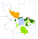
A set of 4 vector data, derived from the World Database on Protected Areas WDPA/IUCN (2009), representing le following layers: -Protected Areas; -Conservation managed units; -Hunting Management Areas; -Forest Reserves. Source: WDPA/IUCN (2009). The WDPA Annual Release includes all nationally designated (e.g. National Parks, Nature Reserves) and internationally recognized protected areas (e.g. UNESCO World Heritage Sites, Wetlands of International Importance) currently held in the WDPA, up to end of February 2009. This static version contains all data improvements made to the WDPA since the previous annual release in December 2007. This dataset is part of the GIS Database for the Environment Protection and Sustainable Management of the Okavango River Basin project (EPSMO). Detailed information on the database can be found in the “GIS Database for the EPSMO Project†document produced by Luis Veríssimo (FAO consultant) in July 2009, and here available for download.