 FAO Map Catalog
boundaries
Type of resources
Available actions
Topics
Keywords
Contact for the resource
Provided by
Years
Formats
Representation types
Update frequencies
status
Scale
-
The Food and Agriculture Organization of the United Nations (FAO) with the collaboration of the International Institute for Applied Systems Analysis (IIASA), has developed a system that enables rational land-use planning on the basis of an inventory of land resources and evaluation of biophysical limitations and potentials. This is referred to as the Agro-ecological Zones (AEZ) methodology.
-

The HDI was created to emphasize that people and their capabilities should be the ultimate criteria for assessing the development of a country, not economic growth alone. The HDI can also be used to question national policy choices, asking how two countries with the same level of GNI per capita can end up with different human development outcomes. These contrasts can stimulate debate about government policy priorities. The Human Development Index (HDI) is a summary measure of average achievement in key dimensions of human development: a long and healthy life, being knowledgeable and have a decent standard of living. The HDI is the geometric mean of normalized indices for each of the three dimensions. The health dimension is assessed by life expectancy at birth, the education dimension is measured by mean of years of schooling for adults aged 25 years and more and expected years of schooling for children of school entering age. The standard of living dimension is measured by gross national income per capita. The HDI uses the logarithm of income, to reflect the diminishing importance of income with increasing GNI. The scores for the three HDI dimension indices are then aggregated into a composite index using geometric mean. Refer to Technical notes for more details. The HDI simplifies and captures only part of what human development entails. It does not reflect on inequalities, poverty, human security, empowerment, etc. The HDRO offers the other composite indices as broader proxy on some of the key issues of human development, inequality, gender disparity and poverty. A fuller picture of a country's level of human development requires analysis of other indicators and information presented in the statistical annex of the report.
-

Employment is defined as persons of working age who were engaged in any activity to produce goods or provide services for pay or profit, whether at work during the reference period or not at work due to temporary absence from a job, or to working-time arrangement. The agriculture sector consists of activities in agriculture, hunting, forestry and fishing, in accordance with division 1 (ISIC 2) or categories A-B (ISIC 3) or category A (ISIC 4). Source: International Labour Organization, ILOSTAT database. Data retrieved on January 29, 2021.
-

The 2020 Global Multidimensional Poverty Index (MPI) data and publication "Charting pathways out of multidimensional poverty: Achieving the SDGs" released on 16 July 2020 by the Oxford Poverty and Human Development Initiative (OPHI) at the University of Oxford and the Human Development Report Office of the United Nations Development Programme (UNDP). The global Multidimensional Poverty Index (MPI) measures the complexities of poor people’s lives, individually and collectively, each year. This report focuses on how multidimensional poverty has declined. It provides a comprehensive picture of global trends in multidimensional poverty, covering 5 billion people. It probes patterns between and within countries and by indicator, showcasing different ways of making progress. Together with data on the $1.90 a day poverty rate, the trends monitor global poverty in different forms. The COVID-19 pandemic unfolded in the midst of this analysis. While data are not yet available to measure the rise of global poverty after the pandemic, simulations based on different scenarios suggest that, if unaddressed, progress across 70 developing countries could be set back 3–10 years. It is 10 years before 2030, the due date of the Sustainable Development Goals (SDGs), whose first goal is to end poverty in all its forms everywhere. The MPI provides a comprehensive and in-depth picture of global poverty – in all its dimensions – and monitors progress towards Sustainable Development Goal (SDG) 1 – to end poverty in all its forms. It also provides policymakers with the data to respond to the call of Target 1.2, which is to ‘reduce at least by half the proportion of men, women, and children of all ages living in poverty in all its dimensions according to national definition'. By detailing the connections between the MPI and other poverty-related SDGs, the report highlights how the lives of multidimensionally poor people are precarious in ways that extend beyond the MPI’s 10 component indicators.
-

This dataset assesses the vulnerability of a system or a community to the adverse effects of climate change and associated hazards, considering the available information on the following indicators:
-

The database aims to provide comprehensive information on internal displacement worldwide. It covers all countries and territories for which IDMC has obtained data on situations of internal displacement, and provides data on situations of Displacement associated with sudden-onset natural hazard-related disasters (2008-2020).
-

The percentage of people in the population who live in households classified as moderately or severely food insecure. A household is classified as moderately or severely food insecure when at least one adult in the household has reported to have been exposed, at times during the year, to low quality diets and might have been forced to also reduce the quantity of food they would normally eat because of a lack of money or other resources.
-
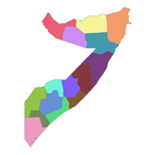
The national and administrative boundaries have been taken from the DCW dataset. Coastlines have been adapted to match the land cover dataset.
-
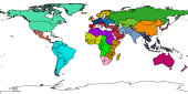
Ad1-Polygonal representation of countries based on VMap0 and perhaps DCW. The AD1_PY shapefile data layer is comprised of 58 derivative polygon african national-subnational areas features derived based on 1:1 000 000 data originally from FAO. The layer provides nominal analytical/mapping at 1:1 000 000. Acronyms and Abbreviations: VMap0 - Vector Map for Level 0; DCW - Digital Chart of the World FAO - Food and Agriculture Organization in the United Nations.
-

The INFORM Epidemic Risk Index is a prototype version of hazard dependent INFORM Risk Index created in 2018. It was developed under the technical lead of the JRC and in close collaboration with WHO for the epidemic components. Through extensive consultation, the WHO identified the underlying risk drivers of epidemic, which enabled the development of a conceptual framework for epidemic risk assessment in countries. JRC developed the INFORM Epidemic Risk Index as an adaptation of the INFORM Risk index, preserving the integrity of the original model. The risk score ranges from 0-10, where 10 is the highest risk. In its original version it is covering four groups of Infectious diseases on the base of the mode of transmission and the epidemiological triad addressing agent, host and environment: Zoonoses, Vector borne, Person-to-person (P2P), Foodborne and Waterborne