 FAO Map Catalog
Uganda
Type of resources
Available actions
Topics
Keywords
Contact for the resource
Provided by
Years
Formats
Representation types
Update frequencies
status
Scale
Resolution
-
Deforestation and forest degradation for Bugoma Central Forest Reserve
-
The dataset provides information on the distribution of population by disagregatd down to Sub-County level as per the National Census conducted by the Uganda Bureau of Statistics (UBOS) in August 2014. By then Uganda had a total population of 34,856,813 people and was growing at a rate of 3.3% per annum.
-
Outer boundary of the country
-
These are forest change maps produced by the analysis of pairs of consecutive epoc datasets with the aim of revealing the location and quantity of chain within the forest classes
-
These are forest change maps produced by the analysis of pairs of consecutive epoc datasets with the aim of revealing the location and quantity of chain within the forest classes
-
These are circular National Biomass Survey (NBS) of radius 12.62 meters measured in 2016
-
Exploratory Inventory (EI) undertaken when a reserve is first being brought under management or when management is being reintroduced after a lapse of many years to get a feel of what exists therein.It is a low intensity inventory (about 1%) designed for preliminary management information that uses fixed-size strata (typically 1 km2) called blocks. Two randomly placed transects are established within each block. Circular sample plots are evenly placed along lines typically 100 meters. Each sample plots has an area of 500 m2 and a radius of 12.6 meters with a nested ¼ plot sub-sample. On the main sample plot, trees down of diameter at breast height (dbh) equal or greater than 20 cm measured while on the sub-plot trees with dbh equal or greater 10 cm but less than 20 cm measured. - These datasets were produced using a timeseries anlysis to obtain forest change including degradation for the respective years.
-
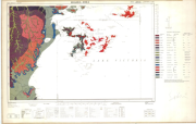
Include: Masaka (Sheet SA-36-2)
-
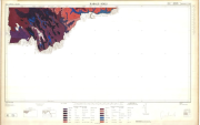
Include: Kabale (Sheet SA-36-5)
-

This raster data provides a dataset containing points harvested and classified by on field enumerators. Points are classified as cropland, non cropland. Each datum can contain further information as comments and weather the point contains mixed crop. 2602 features points.