 FAO Map Catalog
Inland waters
Type of resources
Available actions
Topics
Keywords
Contact for the resource
Provided by
Years
Formats
Representation types
Update frequencies
status
Scale
Resolution
-
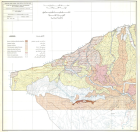
Carte hydrologique de la haute-jezireh, carte n° 2, (200 000)
-
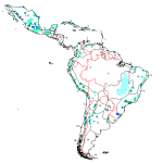
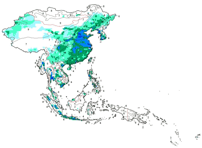
Data from FAO and University of Kassel, Germany. Doll, P and Siebert, Stefan (1999) A Digital Global Map of Irrigated Areas, Report No A9901, Centre for Environmental Systems Research, University of Kassel, Kassel, Germany
-
Seamless and robust derivative of SWB, Double-Lined River, and Inshore Island Features from SRTM-SWBD data tiles. Data source: NASA Surface Water Body Database. Highest resolution water body and coastal mask of Africa
-
As part of the the World Bank's review of its rural development strategy, the Bank sought the assistance of the Food and Agriculture Organization of the United Nations (FAO) in evaluating how farming systems might change and adapt over the next thirty years. Amongst other objectives, the World Bank asked FAO to provide guidance on priorities for investment in food security, poverty reduction, and economic growth, and in particular to identify promising approaches and technologies that will contribute to these goals. The results of the study are summarized in a set of seven documents, comprising six regional reports and the global overview contained in this volume. This document, which synthesises the results of the six regional analyses as well as discussing global trends, cross-cutting issues and possible implementation modalities, presents an overview of the complete study. This document is supplemented by two case study reports of development issues of importance to farming systems globally.
-
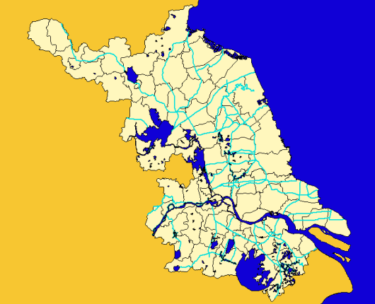
Major streams of Jiangsu Province, China at County level
-
As part of the the World Bank's review of its rural development strategy, the Bank sought the assistance of the Food and Agriculture Organization of the United Nations (FAO) in evaluating how farming systems might change and adapt over the next thirty years. Amongst other objectives, the World Bank asked FAO to provide guidance on priorities for investment in food security, poverty reduction, and economic growth, and in particular to identify promising approaches and technologies that will contribute to these goals. The results of the study are summarized in a set of seven documents, comprising six regional reports and the global overview contained in this volume. This document, which synthesises the results of the six regional analyses as well as discussing global trends, cross-cutting issues and possible implementation modalities, presents an overview of the complete study. This document is supplemented by two case study reports of development issues of importance to farming systems globally.
-
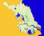
Minor streams of Jiangsu Province, China at County level
-
As part of the the World Bank's review of its rural development strategy, the Bank sought the assistance of the Food and Agriculture Organization of the United Nations (FAO) in evaluating how farming systems might change and adapt over the next thirty years. Amongst other objectives, the World Bank asked FAO to provide guidance on priorities for investment in food security, poverty reduction, and economic growth, and in particular to identify promising approaches and technologies that will contribute to these goals. The results of the study are summarized in a set of seven documents, comprising six regional reports and the global overview contained in this volume. This document, which synthesises the results of the six regional analyses as well as discussing global trends, cross-cutting issues and possible implementation modalities, presents an overview of the complete study. This document is supplemented by two case study reports of development issues of importance to farming systems globally.
-
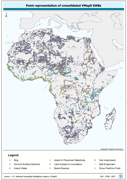
Robust centre-point derivative of SWB - Hydro polygonal features. The VMAP_PT shapefile data layer is comprised of 25128 derivative polygon framework library features derived based on 1:1 000 000 data originally from VMap0/DCW. The layer provides nominal analytical/mapping at 1:1 000 000. Seamlessly complete globally, with consolidation-harmonization @ ~70%, this Africa subset at final. Acronyms and Abbreviations: VMap0 - Vector Map for Level 0; SWB - Surface Water Body; DCW - Digital Chart of the World.
-
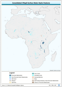
Seamless and topologically robust derivative of source VMap0 SWB and related hydrological features, i.e. swamps, etc. data layers. The VMAP_PY shapefile data layer is comprised of 25128 derivative vector framework library features derived based on 1:1 000 000 data originally from VMap0/DCW. The layer provides nominal analytical/mapping at 1:1 000 000. Seamlessly complete globally, with consolidation-harmonization @ ~70%, this Africa subset at final. Acronyms and Abbreviations: VMap0 - Vector Map for Level 0; SWB - Surface Water Body DCW - Digital Chart of the World.