 FAO Map Catalog
Global Farming Systems Study
Type of resources
Available actions
Topics
Keywords
Contact for the resource
Provided by
Years
Representation types
Update frequencies
status
-

As part of the the World Bank's review of its rural development strategy, the Bank sought the assistance of the Food and Agriculture Organization of the United Nations (FAO) in evaluating how farming systems might change and adapt over the next thirty years. Amongst other objectives, the World Bank asked FAO to provide guidance on priorities for investment in food security, poverty reduction, and economic growth, and in particular to identify promising approaches and technologies that will contribute to these goals. The results of the study are summarized in a set of seven documents, comprising six regional reports and the global overview contained in this volume. This document, which synthesises the results of the six regional analyses as well as discussing global trends, cross-cutting issues and possible implementation modalities, presents an overview of the complete study. This document is supplemented by two case study reports of development issues of importance to farming systems globally.
-
Data from the Oak Ridge National Laboratory, LandScan Global Population 1998 Database. Estimates for rural population were obtained by excluding the Urban Population Areas. This was achieved by removing settled and partly settled grid cells from the Landcover Dataset and removing(limiting) propulation density figures to produce a net result which approximates the known rural population. Data-set has been exported as Binary format.
-
As part of the the World Bank's review of its rural development strategy, the Bank sought the assistance of the Food and Agriculture Organization of the United Nations (FAO) in evaluating how farming systems might change and adapt over the next thirty years. Amongst other objectives, the World Bank asked FAO to provide guidance on priorities for investment in food security, poverty reduction, and economic growth, and in particular to identify promising approaches and technologies that will contribute to these goals. The results of the study are summarized in a set of seven documents, comprising six regional reports and the global overview contained in this volume. This document, which synthesises the results of the six regional analyses as well as discussing global trends, cross-cutting issues and possible implementation modalities, presents an overview of the complete study. This document is supplemented by two case study reports of development issues of importance to farming systems globally.
-
Data from the Oak Ridge National Laboratory, LandScan Global Population 1998 Database. The LandScan Land Cover Database is derived from the U.S. Geological Survey's (USGS) Global Land Cover Characteristics (GLCC) database with the following substantial modifications: 1. The LandScan Land Cover Database has been georegistered at 30 arc second resolution in a common grid for the entire globe. The original GLCC database was in Goode's Homolosine projection. 2. Considerable effort has been devoted to reconciling the positional accuracy of diverse global databases. Mismatches among databases were most conspicuous on coastlines. On the southern coast of France, for example, positional errors amounted to several kilometers, and these have been corrected. Globally, the LandScan Land Cover database coastlines are based on NIMA's World Vector Shoreline (WVS) at 1:250,000 scale. Typically, this coastline differs somewhat from the related line representing the seaward boundary of administrative units, and both of these differ from the land/water boundary indicated on the GLCC gridded database. In the final LandScan Land Cover Database, Version 1.1, the WVS takes precedence, and water is assigned to all cells extending more than one-half cell beyond the WVS coastline. Wherever the land surface had to be expanded to reach the WVS shoreline, we inserted an unclassified land-. 3. The LandScan Land Cover Database contains a much improved urban class. We replaced the USGS urban class with two new classes--developed and partly developed. The developed class is composed of GLCC's urban cells plus all cells included in the Census Bureau's P-95 circles. The partly developed class is derived from Nighttime Lights of the World and contains all cells with a frequency value of 90% or greater. The the partly developed class typically includes suburban areas, small towns, and scattered industries, airports, etc. Data-set has been exported as Binary format.
-

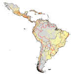
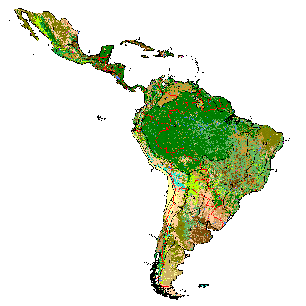
As part of the the World Bank's review of its rural development strategy, the Bank sought the assistance of the Food and Agriculture Organization of the United Nations (FAO) in evaluating how farming systems might change and adapt over the next thirty years. Amongst other objectives, the World Bank asked FAO to provide guidance on priorities for investment in food security, poverty reduction, and economic growth, and in particular to identify promising approaches and technologies that will contribute to these goals. The results of the study are summarized in a set of seven documents, comprising six regional reports and the global overview contained in this volume. This document, which synthesises the results of the six regional analyses as well as discussing global trends, cross-cutting issues and possible implementation modalities, presents an overview of the complete study. This document is supplemented by two case study reports of development issues of importance to farming systems globally. Farming systems are defined as populations of farms that have broadly similar resource bases, enterprise patterns, household livelihoods and constraints, and for which similar development strategies and interventions would be appropriate. The biophysical, economic and human elements of a farm are interdependent, and thus farms can be analysed as systems from various points of view. In this study, farm activities and household livelihoods embrace fishing, pastoralism, farm forestry, hunting and gathering, as well as cropping and intensive animal husbandry. The analysis of farming systems constitutes the core of the Farming Systems Approach, which diagnoses constraints and identifies opportunities and strategic priorities for rural development. The power of the approach lies in its ability to integrate multi-disciplinary analyses of production and its relationship to resources, technologies, markets, services, policies and institutions in their local cultural context.
-
Data from FAO and University of Kassel, Germany. Doll, P and Siebert, Stefan (1999) A Digital Global Map of Irrigated Areas, Report No A9901, Centre for Environmental Systems Research, University of Kassel, Kassel, Germany
-

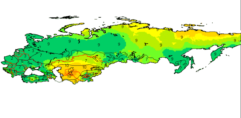
Derived from the Global Agro-Ecological Zones Study, Food and Agriculture Organization of the United Nations (FAO), Land and Water Development Division (AGL) with the collaboration of the International Institute for Applied Systems Analysis (IIASA), 2000. Data averaged over a period of 37 years. Raster data-set has been exported as ASCII raster file type.
-
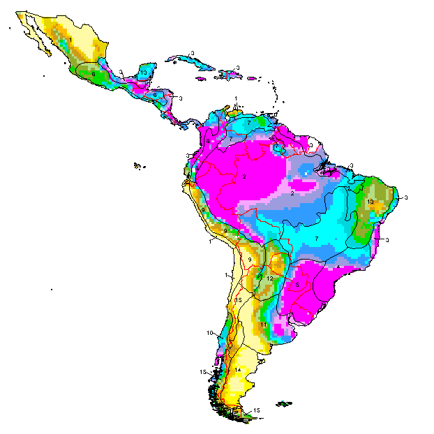
As part of the the World Bank's review of its rural development strategy, the Bank sought the assistance of the Food and Agriculture Organization of the United Nations (FAO) in evaluating how farming systems might change and adapt over the next thirty years. Amongst other objectives, the World Bank asked FAO to provide guidance on priorities for investment in food security, poverty reduction, and economic growth, and in particular to identify promising approaches and technologies that will contribute to these goals. The results of the study are summarized in a set of seven documents, comprising six regional reports and the global overview contained in this volume. This document, which synthesises the results of the six regional analyses as well as discussing global trends, cross-cutting issues and possible implementation modalities, presents an overview of the complete study. This document is supplemented by two case study reports of development issues of importance to farming systems globally.