 FAO Map Catalog
Drainage
Type of resources
Available actions
Topics
Keywords
Contact for the resource
Provided by
status
Scale
-

Includes: Land suitability for broadcast Irri Aus (Map 2)
-
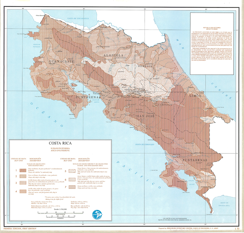
Include: Soils-Engineering (L-13),(T-13); Description of the mapping units
-

Include: Rock Types (L-10), (T-10); Rock Types Map; Description of the mapping units
-
Include: Vegetation (L-6), (T-6); Soils (L-5), (T-5); (L-13), (T-13); State of the ground (L-8), (T-8); Rock Types (L-10), (T-10); Geology (L-9), (T-9); Drainage (L-3), (L-3); Land use (L-17), (T-17); Land potential (L-18), (T-18); Vegetation (L-6), (T-6); Surface configuration (L-2), (T-2);
-

Include: Geology (L-9)
-

Include: Soils-Agricultural (b/w and colour), (L-5),(T-5); Description of the mapping units
-

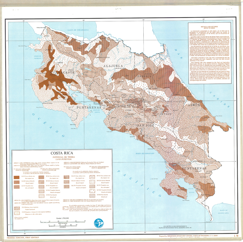
Include: Land potential (L-18), (T-18); Land potential Map; Description of the mapping units
-
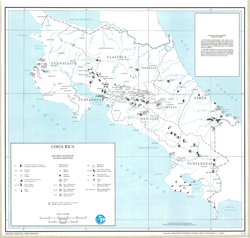
Include: Mineral resources (L-11), (T-11); Description of the mapping units
-
Include: Land potential (L-8), (T-18); Description of the mapping units
-
Include: State of the ground (L-8), (T-8); State of the ground Map; Description of the mapping units