 FAO Map Catalog
Digital Soil Map of the World
Type of resources
Available actions
Topics
Keywords
Contact for the resource
Provided by
Representation types
Update frequencies
status
-
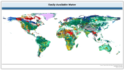
The raster dataset of easily available water has a spatial resolution of 5 * 5 arc minutes and is in geographic projection. Information with regard to available water was obtained from the "Derived Soil Properties" of the FAO-UNESCO Soil Map of the World which contains raster information on soil properties.
-

The raster dataset of the FAO/UNESCO Digital Soil Map of the World (DSMW) has a spatial resolution of 5 * 5 arc minutes and is in geographic projection.
-
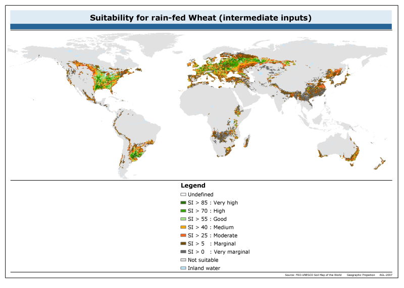
The raster dataset of suitability for rainfed wheat with intermediate inputs has a spatial resolution of 5 * 5 arc minutes and is in geographic projection. Information with regard to wheat suitability was obtained from the "Derived Soil Properties" of the FAO-UNESCO Soil Map of the World which contains raster information on soil properties.
-
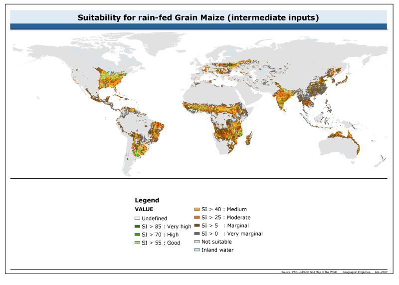
The raster dataset of suitability for maize has a spatial resolution of 5 * 5 arc minutes and is in geographic projection. Information with regard to maize suitability was obtained from the "Derived Soil Properties" of the FAO-UNESCO Soil Map of the World which contains raster information on soil properties.
-
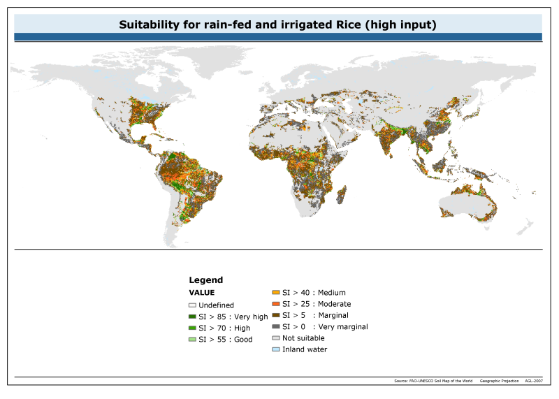
The raster dataset of suitability for rainfed and irrigated rice with high input has a spatial resolution of 5 * 5 arc minutes and is in geographic projection. Information with regard to rice suitability was obtained from the "Derived Soil Properties" of the FAO-UNESCO Soil Map of the World which contains raster information on soil properties.