 FAO Map Catalog
DEM
Type of resources
Available actions
Topics
Keywords
Contact for the resource
Provided by
Years
Formats
Representation types
Update frequencies
status
Scale
-
CoastalDEM90® is a 3 arcsecond (~90 meter) horizontal resolution digital elevation model based on SRTM 3.0, a near-global dataset derived from satellite radar during a NASA mission in 2000. SRTM is known to contain significant error caused by factors such as topology, vegetation, buildings, and random noise. We have used machine learning techniques to estimate SRTM elevation error in coastal areas between (and including) 120m in nominal SRTM elevation. Each pixel in a CoastalDEM raster within the relevant elevation and spatial domains represents the corrected elevation at that point - the result of subtracting estimated error from SRTM 3.0. Pixels outside these domains are set to their original SRTM value. The Coastal DEM dataset was supplied to Worldpop under license for non-commercial use. It was modified to replace the value -32767 with those values from a SRTM-based elevation model that WorldPop have (https://hub.worldpop.org/geodata/listing?id=58) Bias (m) RMSE (m) LE90 (m) LE95 (m) USA (Original SRTM) 3.67 5.36 9.12 11.23 USA (Corrected) < 0.11 2.39 3.90 4.99 Australia (Original) 2.49 4.15 6.76 8.98 Australia (Corrected) - 0.11 2.46 3.94 5.16
-
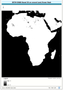
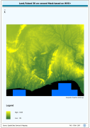
A 30 arc-second land/ocean mask derived from the SRTM -SWBD nominal 30 metre coastline data. SRTM is Shuttle Radar Topography Mission; SWBD is Surface Waterbody . The SRC_MASK grid data layer is comprised of 10800x11400 derivative raster digital elevation model features derived based on 0.00833_ data originally from SRTM 30as v.2.
-
RGB Image with Ortho-Flattened effect for terrestrial and bathymetric elevation data. RGB is 3 band spatial imagery forced into the Red:Green:Blue spectrum. The SRTM30_FLAT image data layer is comprised of 9600x9600 derivative raster digital elevation model features derived based on 0.00833_ data originally from SRTM 30as v.2.
-
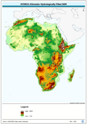
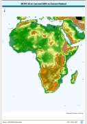
"Seamless" set of 3304 Arc-grid based DEM tiles derived from the Version 2 of the SRTM 3 arc second data library covering Africa; nominal 90 metre. Source: NASA/SRTM
-
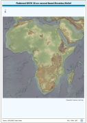
An hydrologically filled version of the GTopo30 DEM employing a Afro-centric Lambert Azimuthal Equal Area Projection. The H1K_LAEA grid data layer is comprised of 9194x8736 derivative raster hydrologically filled dem features derived based on 1 kilometer data originally from HYDRO1k. Acronyms and Abbreviations: GT30/GTopo30 - Global Topographic 30 arc second DEM database, nominal 1km postings; DEM - Digital Elevation Model.
-
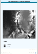
Lake Tanganyika SRTM 3 as DEM Mosaic. The DEM_MOS grid data layer is comprised of 14401x16801 derivative raster digital elevation model features derived based on 0.000833_ data originally from SRTM. The layer provides nominal analytical/mapping at 1:250 000. Acronyms and Abbreviations: SRTM - Shuttle Radar Topography Mission DEM - Digital Elevation Model
-
Enhanced SRTM-GTopo30 DEM with ocean values masked and set to null. SRTM is Shuttle Radar Topography Mission; GT30/GTopo30 is Global Topographic 30 arc second DEM database, nominal 1km postings; DEM is Digital Elevation Model. The SRTMGT30 grid data layer is comprised of 10800x11400 derivative raster digital elevation model features derived based on 0.00833_ data originally from SRTM 30as v.2.
-
Volta Basin SRTM 3 as Based DEM Mosaic. SRTM is Shuttle Radar Topography Mission; DEM is Digital Elevation Model. The DEM_MOS grid data layer is comprised of 13201x14401 derivative raster digital elevation model features derived based on 0.000833_ data originally from SRTM 3as v.2.
-
Derivative of the above "Null" SRTM 3-arc second dataset with terrestrial void areas backfilled with SRTM-GTopo30 DEM, 3204 Arc-Grid tiles. Source: FAO