 FAO Map Catalog
Cities
Type of resources
Available actions
Topics
Keywords
Contact for the resource
Provided by
Years
Formats
Representation types
Update frequencies
status
Resolution
-
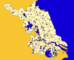
Major cities of Jiangsu Province, China at County level
-
The "Major Cities" layer is derived from the "World Cities" dataset provided by ArcGIS Data and Maps group as part of the global data layers made available for public use. "Major cities" layer specifically contains National and Provincial capitals that have the highest population within their respective country. Cities were filtered based on the STATUS (“National capital”, “National and provincial capital”, “Provincial capital”, “National capital and provincial capital enclave”, and “Other”). Majority of these cities within larger countries have been filtered at the highest levels of POP_CLASS (“5,000,000 and greater” and “1,000,000 to 4,999,999”). However, China for example, was filtered with cities over 11 million people due to many highly populated cities. Population approximations are sourced from US Census and UN Data. Credits: ESRI, CIA World Factbook, GMI, NIMA, UN Data, UN Habitat, US Census Bureau Disclaimer: The designations employed and the presentation of material at this site do not imply the expression of any opinion whatsoever on the part of the Secretariat of the United Nations concerning the legal status of any country, territory, city or area or of its authorities, or concerning the delimitation of its frontiers or boundaries.
-

Accessibility to major cities dataset is modelled as raster-based travel time/cost analysis, computed for the 26 largest cities (>250k habitants) in the country. The following cities are included: City - Population Chiniot 278,528 Nawabshah 279,338 Mingora 331,377 Okara 358,146 Kasur 358,296 Mardan 359,024 Wah Cantonment 379,534 Sahiwal 388,795 Gujrat 390,758 Dera Ghazi Khan 397,362 Rahimyar Khan 420,963 Sheikhūpura 473,269 Larkana 488,006 Sukkur 500,401 Sialkot 656,730 Sargodha 658,208 Bahawalpur 762,774 Quetta 999,385 Hyderabad 1,733,622 Multan 1,872,641 Peshawar 1,969,823 Gujranwala 2,028,421 Rawalpindi Islamabad 3,106,827 Faisalabad 3,210,158 Lahore 11,119,985 Karachi 14,884,402 This 500m resolution raster dataset is part of FAO’s Hand-in-Hand Initiative, Geographical Information Systems - Multicriteria Decision Analysis (GIS-MCDA) aimed at the identification of value chain infrastructure sites (or optimal location).
-

Accessibility to major cities dataset is modelled as raster-based travel time/cost analysis, computed for the 20 largest cities (>110k habitants) in the country. The following cities are included: City - Population Luanda - 6,759,313 Lubango - 600,751 Huambo - 595,304 Benguela - 555,124 Cabinda - 550,000 Malanje - 455,000 Saurimo - 393,000 Lobito - 357,950 Kuito - 355,423 Uíge - 322,531 Luena - 273,675 Moçâmedes - 255,000 Menongue - 251,178 Sumbe - 205,832 Soyo - 200,920 Dundo - 177,604 N'dalatando - 161,584 M'banza-Kongo - 148,000 Ondjiva - 121,537 Gabela - 116,903 This 500m resolution raster dataset is part of FAO’s Hand-in-Hand Initiative, Geographical Information Systems - Multicriteria Decision Analysis (GIS-MCDA) aimed at the identification of value chain infrastructure sites (or optimal location).