 FAO Map Catalog
Boundaries
Type of resources
Available actions
Topics
Keywords
Contact for the resource
Provided by
Years
Formats
Representation types
Update frequencies
status
Scale
Resolution
-
The ISO19115 metadata standard is the preferred metadata standard to use. If unsure what templates to start with, use this one.
-
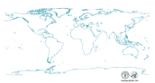
Coastline of the world extracted from Vector Map Level 0 and converted to Arc/Info format by FAO/GIS. Vector Map (VMap) Level 0 is an updated and improved version Digital Chart of the World (DCW).
-

The Climate Change ATLAS (CSIC, https://github.com/SantanderMetGroup/ATLAS) provides climate change information for essential climate variables generated from CMIP and CORDEX international initiatives. There are different data cubes for experiment and variable providing climate projections for 1) three reference future periods (2021-2040, 2041-2060, 2080-2100) for RCP 2.6 an 8.5 scenarios with respect to the baseline reference period 1981-2010, and 2) three Global Warming Levels (1.5, 2 and 3 degC, obtained from the RCP8.5 scenario), with respect to preindustrial values (as characterized by the 1850-1900 period). The list of experiments and models used is available at https://github.com/SantanderMetGroup/ATLAS/tree/master/AtlasHub-inventory
-

International boundaries provided by United Nations Clear Map. The United Nations Clear Map (hereinafter “Clear Map”) is a background reference web mapping service produced to facilitate “the issuance of any map at any duty station, including dissemination via public electronic networks such as Internet” and “to ensure that maps meet publication standards and that they are not in contravention of existing United Nations policies” in accordance with the in the Administrative Instruction on “Regulations for the Control and Limitation of Documentation – Guidelines for the Publication of Maps” of 20 January 1997 (http://undocs.org/ST/AI/189/Add.25/Rev.1) Clear Map is created for the use of the United Nations Secretariat and community. All departments, offices and regional commissions of the United Nations Secretariat including offices away from Headquarters using Clear Map remain bound to the instructions as contained in the Administrative Instruction and should therefore seek clearance from the UN Geospatial Information Section (formerly Cartographic Section) prior to the issuance of their thematic maps using Clear Map as background reference. Disclaimers: The designations employed and the presentation of material on this map do not imply the expression of any opinion whatsoever on the part of the Secretariat of the United Nations concerning the legal status of any country, territory, city or area or of its authorities, or concerning the delimitation of its frontiers or boundaries. Credits (Attribution) Produced by: United Nations Geospatial Contributor: UNGIS, UNGSC, Field Missions CONTACT US: Your feedback is appreciated and should be sent directly to: Email:[email protected] / [email protected] (UNCLASSIFIED) © UNITED NATIONS 2018 More information on the United Nations Clear Map website at https://geoportal.dfs.un.org/arcgis/sharing/rest/content/items/541557fd0d4d42efb24449be614e6887/data
-
This dataset represents the administrative units 'Gewogs' which are the second-level subdivisions of Bhutan. The dataset was originally produced by the Department of Survey and Land Records under National Land Ministry, Bhutan. The data was sourced from FAO-Bhutan in March 2022, feature topology/geometry was corrected, and international borders validated against the United Nations official borders (United Nations Geospatial Information Section - UN-Map 2018). The dataset is part of FAO's Hand-in-Hand (HiH) second administrative level boundaries 2022 dataset series, published on the HiH Geospatial Platform for thematic mapping, integration of geospatially enabled statistics, zonal statistics extraction, and used for HiH initiative geospatial analysis (GIS-MCDA, suitability/location analysis, agricultural typologies).
-
This dataset represents the second-level administrative unit 'States' of Nigeria. The dataset was prepared by the Office of the Surveyor General of the Federation, Federal Surveys of Nigeria in February 2022 to Second Administrative Level Boundaries (SALB) Program of United Nations. The reference scale for this Geospatial data is equivalent to 1:1,000,000 scale, or larger scale. Data was downloaded from UN-SALB site in June 2022, feature topology/geometry was corrected, international borders validated against the United Nations official borders (United Nations Geospatial Information Section - UN-Map 2018). The dataset is part of FAO's Hand-in-Hand (HiH) second administrative level boundaries 2022 dataset series, published on the HiH Geospatial Platform for thematic mapping, integration of geospatially enabled statistics, zonal statistics extraction, and used for HiH initiative geospatial analysis (GIS-MCDA, suitability/location analysis, agricultural typologies).
-
This dataset represents the third-level administrative unit 'freguesias' of Cape Verde. The dataset was originally produced by the Instituto Nacional de Gestão do Território (INGT), Cape Verde from 2010 administrative division. The reference scale for this Geospatial data is equivalent to 1:5,000 scale. The data was sourced from FAOCV in February 2022, feature topology/geometry was corrected, and international borders validated against the United Nations official borders (United Nations Geospatial Information Section - UN-Map 2018). The dataset is part of FAO's Hand-in-Hand (HiH) second administrative level boundaries 2022 dataset series, published on the HiH Geospatial Platform for thematic mapping, integration of geospatially enabled statistics, zonal statistics extraction, and used for HiH initiative geospatial analysis (GIS-MCDA, suitability/location analysis, agricultural typologies).
-
This dataset represents the second-level administrative unit 'Districts' of Zimbabwe. The dataset was uploaded by the Department of the Surveyor General, Zimbabwe in March, 2020 to Second Administrative Level Boundaries (SALB) Program of United Nations. The reference scale for this Geospatial data is equivalent to 1:1,000,000 scale, or larger scale. Data was downloaded from UN-SALB site in March 2022, feature topology/geometry was corrected, international borders validated against the United Nations official borders (United Nations Geospatial Information Section - UN-Map 2018). The dataset is part of FAO's Hand-in-Hand (HiH) second administrative level boundaries 2022 dataset series, published on the HiH Geospatial Platform for thematic mapping, integration of geospatially enabled statistics, zonal statistics extraction, and used for HiH initiative geospatial analysis (GIS-MCDA, suitability/location analysis, agricultural typologies).
-
This dataset represents the second-level administrative unit 'Prefectures' of Central African Republic. The dataset was uploaded by the Service de la Cartographie et de la Télédétection of Central African Republic in January 2021 to Second Administrative Level Boundaries (SALB) Program of United Nations. The reference scale for this Geospatial data is equivalent to 1:1,000,000 scale, or larger scale. Data was downloaded from UN-SALB site in December 2022, feature topology/geometry was corrected, international borders validated against the United Nations official borders (United Nations Geospatial Information Section - UN-Map 2018). The dataset is part of FAO's Hand-in-Hand (HiH) second administrative level boundaries 2022 dataset series, published on the HiH Geospatial Platform for thematic mapping, integration of geospatially enabled statistics, zonal statistics extraction, and used for HiH initiative geospatial analysis (GIS-MCDA, suitability/location analysis, agricultural typologies).
-
This dataset represents the second-level administrative unit 'Arrondissements' of Haiti. As of 2015, the 10 departments of Haiti were divided into 41 arrondissements. The dataset was uploaded by the Centre National de l'information Geo-Spatiale, Haiti in October 2019 for Second Administrative Level Boundaries (SALB) Program of United Nations. The reference scale for this Geospatial data is equivalent to 1:1,000,000 scale, or larger scale. Data was downloaded from UN-SALB site in May 2022, feature topology/geometry was corrected, international borders validated against the United Nations official borders (United Nations Geospatial Information Section - UN-Map 2018). The dataset is part of FAO's Hand-in-Hand (HiH) second administrative level boundaries 2022 dataset series, published on the HiH Geospatial Platform for thematic mapping, integration of geospatially enabled statistics, zonal statistics extraction, and used for HiH initiative geospatial analysis (GIS-MCDA, suitability/location analysis, agricultural typologies).