 FAO Map Catalog
65000000
Type of resources
Available actions
Topics
Keywords
Contact for the resource
Provided by
Years
Representation types
Update frequencies
status
Scale
-
WRIBASIN: Watersheds of the World published by the World Resources Institute, A cleaned version of this watershed delineation enhanced to include WRI's original publication attributes. The WRIBASIN shapefile data layer is comprised of 254 derivative vector major river basins features derived based on ~250 000 cell data originally from WRI-Rutgers. Data processing is complete globally, this is an African subset.
-
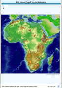
A Shaded relief image based on the first globally available elevation model. The AFRICA_BACKGROUND image data layer is comprised of 973x985 derivative raster bathymetry and elevation features derived based on 0.08333_ data originally from ETOPO5.
-
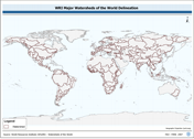
WRIBASIN: Watersheds of the World published by the World Resources Institute, a cleaned version of this watershed delineation enhanced to include WRI's original publication attributes. The WRIBASIN shapefile data layer is comprised of 254 derivative vector major river basins features derived based on ~250 000 cell data originally from WRI-Rutgers. Data processing is complete globally, this is an African subset. Acronyms and Abbreviations: WRI - World Resources Institute.