 FAO Map Catalog
20000000
Type of resources
Available actions
Topics
Keywords
Contact for the resource
Provided by
Years
Representation types
Update frequencies
status
Scale
-
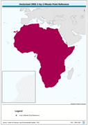
Vectorized CRES 3-by-3 Minute Point Reference. The CRES_PT shapefile data layer is comprised of 1004351 derivative calculated water temperature features derived based on 0.5 degrees resolution data originally from CRES/FAO. The layer provides nominal analytical/mapping at 1:220 000 000. Acronyms and Abbreviations: CRES - Centre for Resource and Environmental Studies, The Australian National University (ANU).
-
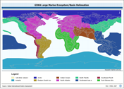
GIWA_LME: Global International Waters Assessment's Terrestrial WSs and Large Marine Ecosystems, a medium resolution WS delineation based on terrestrial modifications to the NOAA-URI Large Marine Ecosystems. The GIWA_LME shapefile data layer is comprised of 2936 derivative vector large marine ecosystems and terrestrial basins features derived based on ~100 000 cell data originally from GIWA - URI. The layer provides nominal analytical/mapping at 1:20 000 00. Data processing is complete and under revision globally. NOAA - U.S. National Oceanographic & Atmospheric Administration; URI - University of Rhode Islands, USA; GIWA - Global International Water Assessment watershed delineation; LME - Large Marine Ecosystems.
-
Consolidated table of air temperature. The AT_MNTHY tabular data layer is comprised of 1004351 derivative raster air temperature features derived based on 0.5_ data originally from CRES/FAO. The layer provides nominal analytical/mapping at 1:220 000 000. Acronyms and Abbreviations: CRES - Centre for Resource and Environmental Studies, The Australian National University (ANU); FAO - Food and Agriculture Organization in the United Nations.
-
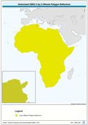
Vectorized CRES 3-by-3 Minute Polygon Reference. The CRES_PY shapefile data layer is comprised of 1004351 derivative calculated climate features derived based on 0.5 data originally from CRES/FAO. The layer provides nominal analytical/mapping at 1:220 000 000. Acronyms and Abbreviations: CRES - Centre for Resource and Environmental Studies, The Australian National University (ANU).
-
Consolidated table of water temperature. The WT_MNTHY tabular data layer is comprised of 1004351 derivative raster water temperature features derived based on 0.5 degrees resolution data originally from CRES/FAO. The layer provides nominal analytical/mapping at 1:220 000 000. Acronyms and Abbreviations: CRES - Centre for Resource and Environmental Studies, The Australian National University (ANU); FAO - Food and Agriculture Organization in the United Nations.