 FAO Map Catalog
100000
Type of resources
Available actions
Topics
Keywords
Contact for the resource
Provided by
Years
Formats
Representation types
Update frequencies
status
Scale
-
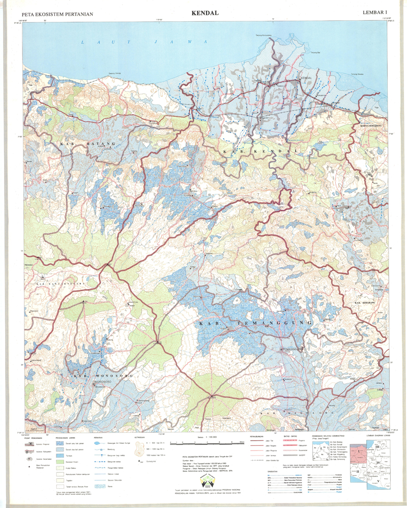
Include: Kendal (1991) (Lembar I)
-
Include: Carte des aptitudes des sols aux cultures irriguées
-
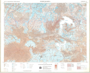
Include: Purwakarta (1990) (Lembar II)
-
Include: Central Tunisia; Kasserine
-
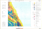
Basement rocks of Al Qusayr quadrangle (NG 36 K3)
-
This dataset is a thematic reaggregated version of the original national Africover landcover multipurpose database. It contains all cultivated land. The original full resolution land cover has been produced from visual interpretation of digitally enhanced LANDSAT TM images (Bands 4,3,2) acquired mainly in the year 1999 (see the "Multipurpose Landcover Database" metadata for more details). This dataset is intended for free public access. Thematic aggregation is the way that the end user customizes the Africover database to fulfil his/her specific requirements. The Africover database gives equal level of detail to Agriculture as well as Natural vegetation or Bare Areas etc. Generally a single user does not need this level of detail for each class type; therefore he/she will enhance the information of one land cover type and will generalize or erase the information related to other land cover aspects. The most powerful way to conduct an aggregation exercise is to use the classifiers as basic elements of the exercise. This gives the user the maximum flexibility on the use of data. The shape main attributes correspond to the following fields: -ID -HECTARES -CULT_ID -CULT_DESC You can download a zip archive containing: -the rw-cult-agg (.shp) -the Rwanda Classifiers Used (.pdf) -the Rwanda legend (.pdf and .xls) -the Rwanda Legend - LCCS Import file (.xls) -the LCCS glossary_rwanda(.pdf) -the thematic-aggregation-procedure (.pdf) -the thematic-aggregation-annex1 (.pdf) -the thematic-aggregation-annex2 (.pdf) -the Userlabel Definitions (.pdf)
-
The full resolution dataset of towns was developed from data from the National Imagery and Mapping Agency (NIMA).
-
Include: Malang (1992) (36)
-

Include: General land form of Che Ju Do (500 000) - Temperature and precipitation changes in the vicinity of Che Ju Do (500000)- General geologic map of Che Ju Do (500000)
-
This vector layer represents the geologic units in the CORB-Contributing area of Angola. Source: Data provided by SINFIC, based on the Topographic Map of Angola (Laboratorio Nacional de Investigação Científica Tropica, 1982). This dataset is part of the GIS Database for the Environment Protection and Sustainable Management of the Okavango River Basin project (EPSMO). Detailed information on the database can be found in the “GIS Database for the EPSMO Project†document produced by Luis Veríssimo (FAO consultant) in July 2009, and here available for download.