 FAO Map Catalog
28-1
Type of resources
Available actions
Topics
Keywords
Contact for the resource
Provided by
Years
Representation types
Update frequencies
status
Scale
-
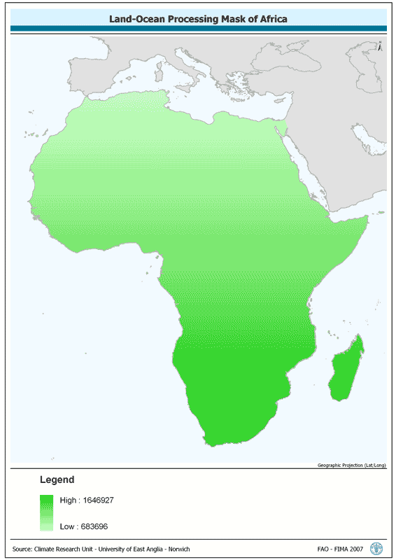
Land-Ocean Processing Mask. The AF-CRU_MASK grid data layer is comprised of 447x533 derivative raster climate features derived based on 0.167 degrees resolution data originally from CRU. The layer provides nominal analytical/mapping at 1:70 000 000. Acronyms and Abbreviations: CRU - Climatic Research Unit - School of Environmental Sciences, University of East Anglia - Norwich.
-
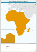
Vectorized 10-by-10 minute Grid (Polygon). The CRU_PY shapefile data layer is comprised of 92718 derivative calculated climate features derived based on 0.167 degrees resolution data originally from CRU. The layer provides nominal analytical/mapping at 1:70 000 000. Acronyms and Abbreviations: CRU - Climatic Research Unit - School of Environmental Sciences, University of East Anglia - Norwich.
-
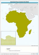
Vectorized 10-by-10 minute Grid (Point). The CRU_PT shapefile data layer is comprised of 92718 derivative calculated climate features derived based on 0.167 degrees resolution data originally from CRU. The layer provides nominal analytical/mapping at 1:70 000 000. Acronyms and Abbreviations: CRU - Climatic Research Unit - School of Environmental Sciences, University of East Anglia - Norwich.
-

AF_LCHYD: Wetlands and other SWB features dropped during the DCW standard change to VMAP0Wet/Inundated land & other hydrological features from the DCW DNNET & LCPOLY (DCW Network and Land Cover layers sources), updated w/VMAP0 IW layer. The AF_LCHYD shapefile data layer is comprised of 7067 derivative vector physiography - hypsography features derived based on 1:1 000 000 data originally from DCW. The layer provides nominal analytical/mapping at 1:1 000 000. Acronyms and Abbreviations: SWB - Surface Water Body DCW - Digital Chart of the World VMap0 - Vector Map for Level 0; IW - Inland Water.