 FAO Map Catalog
FAO- GeoNetwork
Type of resources
Available actions
Topics
Keywords
Contact for the resource
Provided by
Years
Representation types
Update frequencies
status
Scale
-
Derivative of the "Baseline" SRTM 3 arc second dataset with ocean and terrestrial void areas set to null using a SRTM-SWBD 1 arc second mask, 3204 Arc-grid based tiles. Source: FAO
-
"Seamless" set of 3304 Arc-grid based DEM tiles derived from the Version 2 of the SRTM 3 arc second data library covering Africa; nominal 90 metre. Source: NASA/SRTM
-

Arc-grid "2.5d Hillshade" based derivative of SRTM 3-arc second "Null"set covering Africa, 3204 tiles. Source: FAO
-
Derivative of the above "Null" SRTM 3-arc second dataset with terrestrial void areas backfilled with SRTM-GTopo30 DEM, 3204 Arc-Grid tiles. Source: FAO
-
Consolidated Table of CRU Evapotranspiration. The ET_MNTHY tabular data layer is comprised of 92717 derivative raster evapotranspiration features derived based on 0.16667_ data originally from CRU. The layer provides nominal analytical/mapping at 1:70 000 000. Acronyms and Abbreviations: CRU - Climatic Research Unit - School of Environmental Sciences, University of East Anglia - Norwich.
-
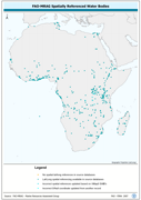
Spatially World Lake features which could be cross-referenced to VMap0 - SWB features. The AF_WL_PT shapefile data layer is comprised of 499 derivative tabular | point limnological, world lakes and rivers features derived based on 1:5 000 000 data originally from FAO. The layer provides nominal analytical/mapping at 1:5 000 000. Data processing 60% complete globally, with African and Arabian subsets 100% complete. Acronyms and Abbreviations: VMap0 - Vector Map for Level 0; SWB - Surface Water Body.
-
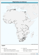
Seamless and topologically robust derivative of all linear Transport/Rail VMap0 - Ed5 data layers. The RR_LN shapefile data layer is comprised of 2492 derivative vector framework library features derived based on 1:1 000 000 data originally from VMap0, 5th Edition. The layer provides nominal analytical/mapping at 1:1 000 000. Data processing complete globally, this is an African subset. Acronyms and Abbreviations: VMap0 - Vector Map for Level 0.
-
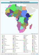
Ad1-Seamless and topologically robust derivative of all polygonal VMap0 - Ed5 coastline and national/sovereign boundary data layers cross-checked against related linear vectors. The AD1_PY shapefile data layer is comprised of 1122 derivative vector framework library features derived based on 1:1 000 000 data originally from VMap0, 5th Edition. The layer provides nominal analytical/mapping at 1:1 000 000. Data processing complete globally, this is an African subset. Acronyms and Abbreviations: VMap0 - Vector Map for Level 0.
-
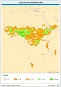
April 1st-Decadal Rainfall 1996. The APR1_95 grid data layer is comprised of 1152x1152 derivative raster precipitation features derived based on 8 kilometers data originally from EDC. 2nd and 3rd Decadal Rainfall from January to December is also available for download. Acronyms and Abbreviations: EDC - USGS EROS (Earth Resources Observation Systems) Data Center
-
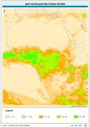
April 1st-Decadal Short Mean Rainfall. The APR1_SM grid data layer is comprised of 1152x1152 derivative raster precipitation features derived based on 8 kilometers data originally from EDC. 2nd and 3rd Decadal Rainfall from January to December is also available for download. Acronyms and Abbreviations: EDC - USGS EROS (Earth Resources Observation Systems) Data Center