 FAO Map Catalog
FAO SDRN - GIEWS
Type of resources
Available actions
Topics
Keywords
Contact for the resource
Provided by
Years
Representation types
Update frequencies
status
Scale
-
Ad1-Polygonal representation of countries based on VMap0 and perhaps DCW. The AD1_PY shapefile data layer is comprised of 58 derivative polygon african national-subnational areas features derived based on 1:1 000 000 data originally from FAO. The layer provides nominal analytical/mapping at 1:1 000 000. Acronyms and Abbreviations: VMap0 - Vector Map for Level 0; DCW - Digital Chart of the World FAO - Food and Agriculture Organization in the United Nations.
-
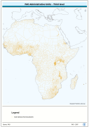
Ad3-Polygonal representation of 2nd-order subnational boundaries from country sources integrated with Ad1 boundaries from VMap0 and DCW. The AD3_PY shapefile data layer is comprised of 5690 derivative polygon african national-subnational areas features derived based on 1:1 000 000 data originally from FAO. The layer provides nominal analytical/mapping at 1:1 000 000. Acronyms and Abbreviations: VMap0 - Vector Map for Level 0; DCW - Digital Chart of the World FAO - Food and Agriculture Organization in the United Nations.