 FAO Map Catalog
water bodies
Type of resources
Available actions
Topics
Keywords
Contact for the resource
Provided by
Years
Representation types
Update frequencies
status
Scale
-
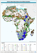
GNS_SWB: Surface Water Bodies based on named locations GNS/GeoNet Gazetteer. The GNS_SWB shapefile data layer is comprised of 46591 derivative point gazetteer features derived based on 1:250 000 data originally from GEOnet. The layer provides nominal analytical/mapping at 1:250 000. Data processing is complete globally, this is an African subset. Acronyms and Abbreviations: GNS/GeoNet Gazetteer - NIMA's Geographic Names Server Gazetteer of Named Locations; SWB - Surface Water Body.
-

Enhanced Rivers linear derivative based on 4 separate RWDB2 Library layers. The RWDB_RIV shapefile data layer is comprised of 4376 derivative line framework library features derived based on 1:3 000 000 data originally from . The layer provides nominal analytical/mapping at 1:3 000 000. Data processing is complete globally, this is an African subset. Acronyms and Abbreviations: RWDB2 or RWDB II- Relational World Database II.
-

SWB and related hydrological features subset of the AfriCover country separates. The Africover shapefile data layer is comprised of 11296 derivative vector land cover - africover features derived based on ~1:250 000 data originally from FAO. The layer provides nominal analytical/mapping at 1:125 000. Acronyms and Abbreviations: SWB - Surface Water Body.
-

Topologically corrected polygonal derivative of 7 RWDB2 library layers to create continental baselines. The RWDB_BND-PY shapefile data layer is comprised of 20874 derivative vector framework library features derived based on 1:3 000 000 data originally from RWDBII. The layer provides nominal analytical/mapping at 1:3 000 000. Data processing complete globally. Acronyms and Abbreviations: RWDB2 or RWDB II- Relational World Database II.
-
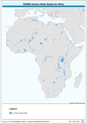
This dataset derives from the RWDB_SWB-PY shapefile data layer which covers the entire globe and is comprised of 8750 derivative vector framework library features derived based on 1:3,000,000 data originally from RWDBII. The original dataset is an enhanced SWB polygonal derivative based on 4 separate RWDB2 Library layers. The layer provides nominal analytical/mapping at 1:3,000,000. Acronyms and Abbreviations: RWDB2 or RWDB II- Relational World Database II SWB - Surface Water Body
-

Linear outlines of SWB (Surface Waterbody) features integrated with Rivers and other linear surface hydrological features. The RWDB_HYD-LN shapefile data layer is comprised of 29177 derivative vector framework library features derived based on 1:3 000 000 data originally from RWDBII. The layer provides nominal analytical/mapping at 1:3 000 000. Data processing complete globally. Acronyms and Abbreviations: RWDB2 or RWDB II - Relational World Database II; SWB - Surface Waterbody.
-
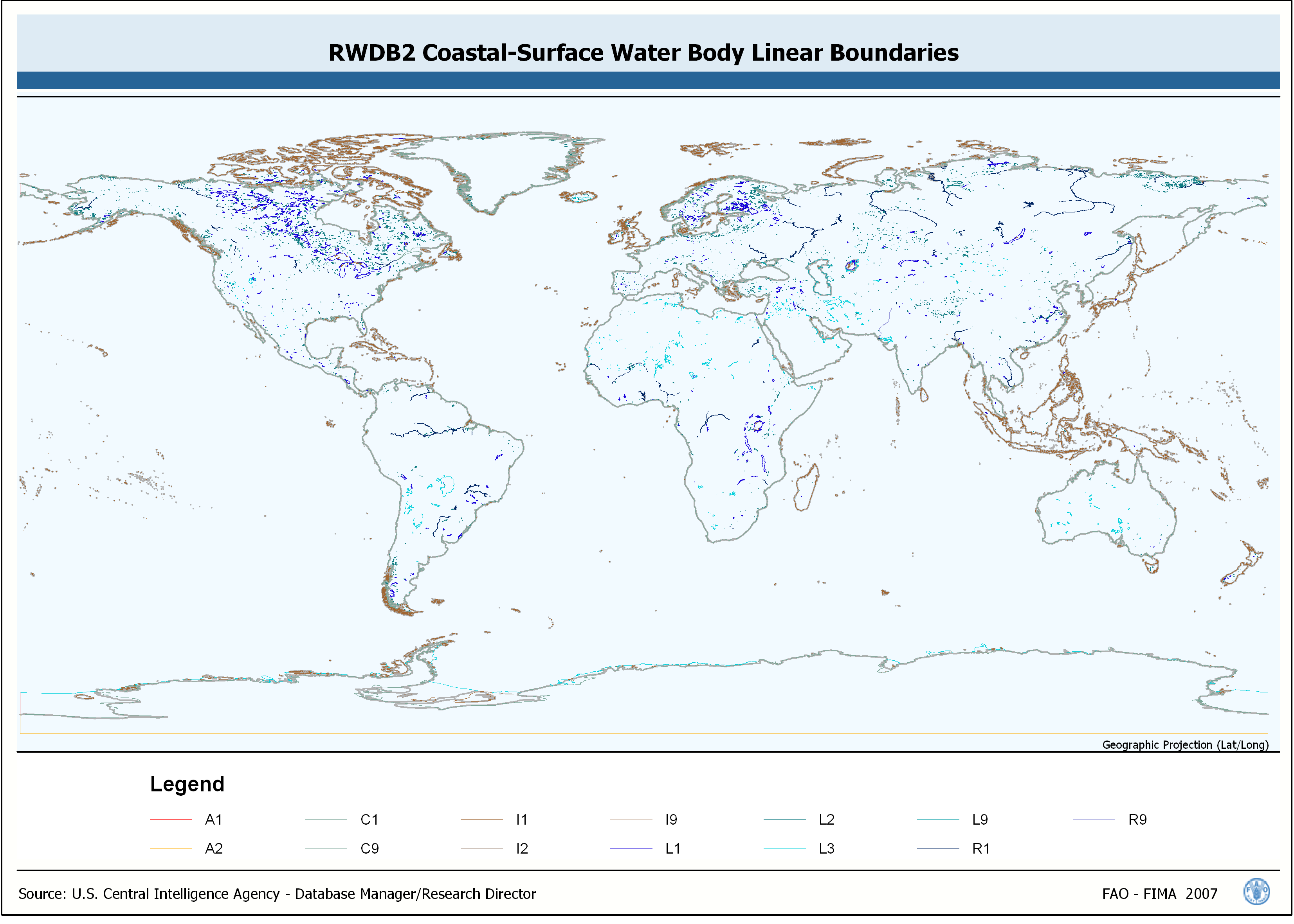
Linear output of coastlines and SWB features, derived from integration of 7 RWDB2 library layers. The RWDB_BND-LN shapefile data layer is comprised of 25319 derivative vector framework library features derived based on 1:3 000 000 data originally from RWDBII. The layer provides nominal analytical/mapping at 1:3 000 000. Data processing complete globally. Acronyms and Abbreviations: RWDB2 or RWDB II- Relational World Database II SWB - Surface Water Body.
-
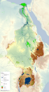
This map shows the Geographic Information System (GIS) ancillary information used to prepare thematic posters for the FAO-Nile Basin project. They are: -administrative units; -basin boundary; -boundary above water bodies; -country boundaries; canals&tunnels; -cities; -irrigated areas; -protected areas; -rivers; urban areas; -water bodies; -SRTM. Sources and information for each layer can be found in the "FAO Nile Information Products Synthesis Report" here available in the Distribution section of this metadata form.