 FAO Map Catalog
Vegetation
Type of resources
Available actions
Topics
Keywords
Contact for the resource
Provided by
Years
Formats
Representation types
Update frequencies
status
Scale
Resolution
-
This map was produced within the Conservation International/KFW project “Avoided deforestation through consolidation and creation of protected areas and forest carbon financing mechanisms in the Guiana region". The map was created by SarVision based on ALOS PALSAR Images.
-
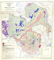
Vegetation map of the Federation of Rhodesia and Nyasaland
-

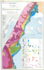
Vegetation map of Malaysia
-
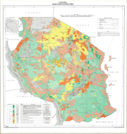
Landscape ecological vegetation map of Lake Manyara, National Park, Tanzania
-
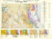
Include: Guadalajara, Tampico : Ethnic Groups, Bioclimate, Geology, Lithology, Soils, Forestry (Cartons) (5000000).
-
Vegetation cover types
-
The VNP22Q2 dataset provides yearly land surface phenology data for the period from 2013 to present. The VNP22Q2 product generates phenological metrics of individual vegetation growing cycles on the vegetated land surface with a spatial resolution of 500m at global level between 60°S to 80°N. The 500m VIIRS GLSP product is a level 3 product and follows the structure and file format of the high level global VIIRS data. For more detail, please visit the website of the data provider: https://lpdaac.usgs.gov/products/vnp22q2v001/
-
Proyek Kali KontoTentative vegetation sketchmap
-

Carte de la végétation de la région de Bereby
-

Coverage: Beni Abbes; Vegetation Map