 FAO Map Catalog
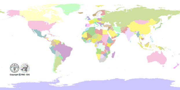
Administrative boundaries
Type of resources
Available actions
Topics
Keywords
Contact for the resource
Provided by
Years
Formats
Representation types
Update frequencies
status
Scale
-
DCW Coastline and International Boundaries (includes tile boundaries).
-
This dataset represents the second-level administrative unit 'cantons' of Costa Rica. There are 82 cantons under 7 provinces. The dataset was uploaded by the Instituto Geográfico Nacional of Costa Rica in December, 2021 to Second Administrative Level Boundaries (SALB) Program of United Nations. The reference scale for this Geospatial data is equivalent to 1:1,000,000 scale, or larger scale. Data was downloaded from UN-SALB site in July 2023, feature topology/geometry was corrected, international borders validated against the United Nations official borders (United Nations Geospatial Information Section - UN-Map 2018). The dataset is part of FAO's Hand-in-Hand (HiH) second administrative level boundaries 2022 dataset series, published on the HiH Geospatial Platform for thematic mapping, integration of geospatially enabled statistics, zonal statistics extraction, and used for HiH initiative geospatial analysis (GIS-MCDA, suitability/location analysis, agricultural typologies).
-
This dataset represents the second-level administrative unit 'Delegations' of Tunisia. There are 24governorates which were divided into 279 delegations. The dataset was uploaded by the Office de la Topographie et de la Cartographie, Tunisia in October, 2022 to Second Administrative Level Boundaries (SALB) Program of United Nations. The reference scale for this Geospatial data is equivalent to 1:1,000,000 scale, or larger scale. Data was downloaded from UN-SALB site in May 2023, feature topology/geometry was corrected, international borders validated against the United Nations official borders (United Nations Geospatial Information Section - UN-Map 2018). The dataset is part of FAO's Hand-in-Hand (HiH) second administrative level boundaries 2022 dataset series, published on the HiH Geospatial Platform for thematic mapping, integration of geospatially enabled statistics, zonal statistics extraction, and used for HiH initiative geospatial analysis (GIS-MCDA, suitability/location analysis, agricultural typologies).
-
This dataset represents the second-level administrative unit 'Districts' of Lesotho. There are 10 Districts. The dataset was uploaded by the Department of Lands, Surveys & Physical Planning in June, 2022 to Second Administrative Level Boundaries (SALB) Program of United Nations. The reference scale for this Geospatial data is equivalent to 1:1,000,000 scale, or larger scale. Data was downloaded from UN-SALB site in June 2023, feature topology/geometry was corrected, international borders validated against the United Nations official borders (United Nations Geospatial Information Section - UN-Map 2018). The dataset is part of FAO's Hand-in-Hand (HiH) second administrative level boundaries 2022 dataset series, published on the HiH Geospatial Platform for thematic mapping, integration of geospatially enabled statistics, zonal statistics extraction, and used for HiH initiative geospatial analysis (GIS-MCDA, suitability/location analysis, agricultural typologies).
-
This dataset represents the second-level administrative unit 'Departments' of Mauritania. There are 15 regions which are subdivided into departments. The dataset was uploaded by the Direction de la Cartographie et de l'Information Géographique, Mauritania in July, 2023 to Second Administrative Level Boundaries (SALB) Program of United Nations. The reference scale for this Geospatial data is equivalent to 1:1,000,000 scale, or larger scale. Data was downloaded from UN-SALB site in August 2023, feature topology/geometry was corrected, international borders validated against the United Nations official borders (United Nations Geospatial Information Section - UN-Map 2018). The dataset is part of FAO's Hand-in-Hand (HiH) second administrative level boundaries 2022 dataset series, published on the HiH Geospatial Platform for thematic mapping, integration of geospatially enabled statistics, zonal statistics extraction, and used for HiH initiative geospatial analysis (GIS-MCDA, suitability/location analysis, agricultural typologies).
-
This dataset represents the second-level administrative unit 'communes' of Benin. There are 77 communes under 12 departments. The dataset was uploaded by the Institut Géographique National du Bénin in September, 2021 to Second Administrative Level Boundaries (SALB) Program of United Nations. The reference scale for this Geospatial data is equivalent to 1:1,000,000 scale, or larger scale. Data was downloaded from UN-SALB site in June 2023, feature topology/geometry was corrected, international borders validated against the United Nations official borders (United Nations Geospatial Information Section - UN-Map 2018). The dataset is part of FAO's Hand-in-Hand (HiH) second administrative level boundaries 2022 dataset series, published on the HiH Geospatial Platform for thematic mapping, integration of geospatially enabled statistics, zonal statistics extraction, and used for HiH initiative geospatial analysis (GIS-MCDA, suitability/location analysis, agricultural typologies).
-
This dataset represents the second-level administrative unit 'arrondissements' of Senegal. There are 45 arrondissements under 14 regions. The dataset was uploaded by the Agence Nationale de l'Aménagement du Territoire, Senegal in August, 2021 to Second Administrative Level Boundaries (SALB) Program of United Nations. The reference scale for this Geospatial data is equivalent to 1:1,000,000 scale, or larger scale. Data was downloaded from UN-SALB site in January 2022, feature topology/geometry was corrected, international borders validated against the United Nations official borders (United Nations Geospatial Information Section - UN-Map 2018). The dataset is part of FAO's Hand-in-Hand (HiH) second administrative level boundaries 2022 dataset series, published on the HiH Geospatial Platform for thematic mapping, integration of geospatially enabled statistics, zonal statistics extraction, and used for HiH initiative geospatial analysis (GIS-MCDA, suitability/location analysis, agricultural typologies).
-
This dataset represents the second-level administrative unit 'territories' and 'cities' of Democratic Republic of the Congo. There are 26 provinces which are subdivided into . 219 territories, villes or cities. The dataset was uploaded by the Institut Géographique du Congo in December, 2022 to Second Administrative Level Boundaries (SALB) Program of United Nations. The reference scale for this Geospatial data is equivalent to 1:1,000,000 scale, or larger scale. Data was downloaded from UN-SALB site in March 2023, feature topology/geometry was corrected, international borders validated against the United Nations official borders (United Nations Geospatial Information Section - UN-Map 2018). The dataset is part of FAO's Hand-in-Hand (HiH) second administrative level boundaries 2022 dataset series, published on the HiH Geospatial Platform for thematic mapping, integration of geospatially enabled statistics, zonal statistics extraction, and used for HiH initiative geospatial analysis (GIS-MCDA, suitability/location analysis, agricultural typologies).
-
This dataset represents the administrative districts of Mozambique which is the second-level administrative unit.The dataset was uploaded by National Remote Sensing & Cartography Centre - Centro Nacional de Cartografia e Teledeteção, Mozambique in July 2021 to Second Administrative Level Boundaries (SALB) Program of United Nations. The reference scale for this Geospatial data is equivalent to 1:1,000,000 scale, or larger scale. Data was downloaded from UN-SALB site in May 2022, feature topology/geometry was corrected, international borders validated against the United Nations official borders (United Nations Geospatial Information Section - UN-Map 2018). The dataset is part of FAO's Hand-in-Hand (HiH) second administrative level boundaries 2022 dataset series, published on the HiH Geospatial Platform for thematic mapping, integration of geospatially enabled statistics, zonal statistics extraction, and used for HiH initiative geospatial analysis (GIS-MCDA, suitability/location analysis, agricultural typologies).
-
This dataset represents the second-level administrative unit 'districts' of Sri Lanka. There are 25 districts under 9 provinces. The dataset was uploaded by the Survey Department of Sri Lanka under Ministry of Home Affairs in November, 2021 to Second Administrative Level Boundaries (SALB) Program of United Nations. The reference scale for this Geospatial data is equivalent to 1:1,000,000 scale, or larger scale. Data was downloaded from UN-SALB site in July 2023, feature topology/geometry was corrected, international borders validated against the United Nations official borders (United Nations Geospatial Information Section - UN-Map 2018). The dataset is part of FAO's Hand-in-Hand (HiH) second administrative level boundaries 2022 dataset series, published on the HiH Geospatial Platform for thematic mapping, integration of geospatially enabled statistics, zonal statistics extraction, and used for HiH initiative geospatial analysis (GIS-MCDA, suitability/location analysis, agricultural typologies).