 FAO Map Catalog
750000
Type of resources
Available actions
Topics
Keywords
Contact for the resource
Provided by
Years
Representation types
Update frequencies
status
Scale
-
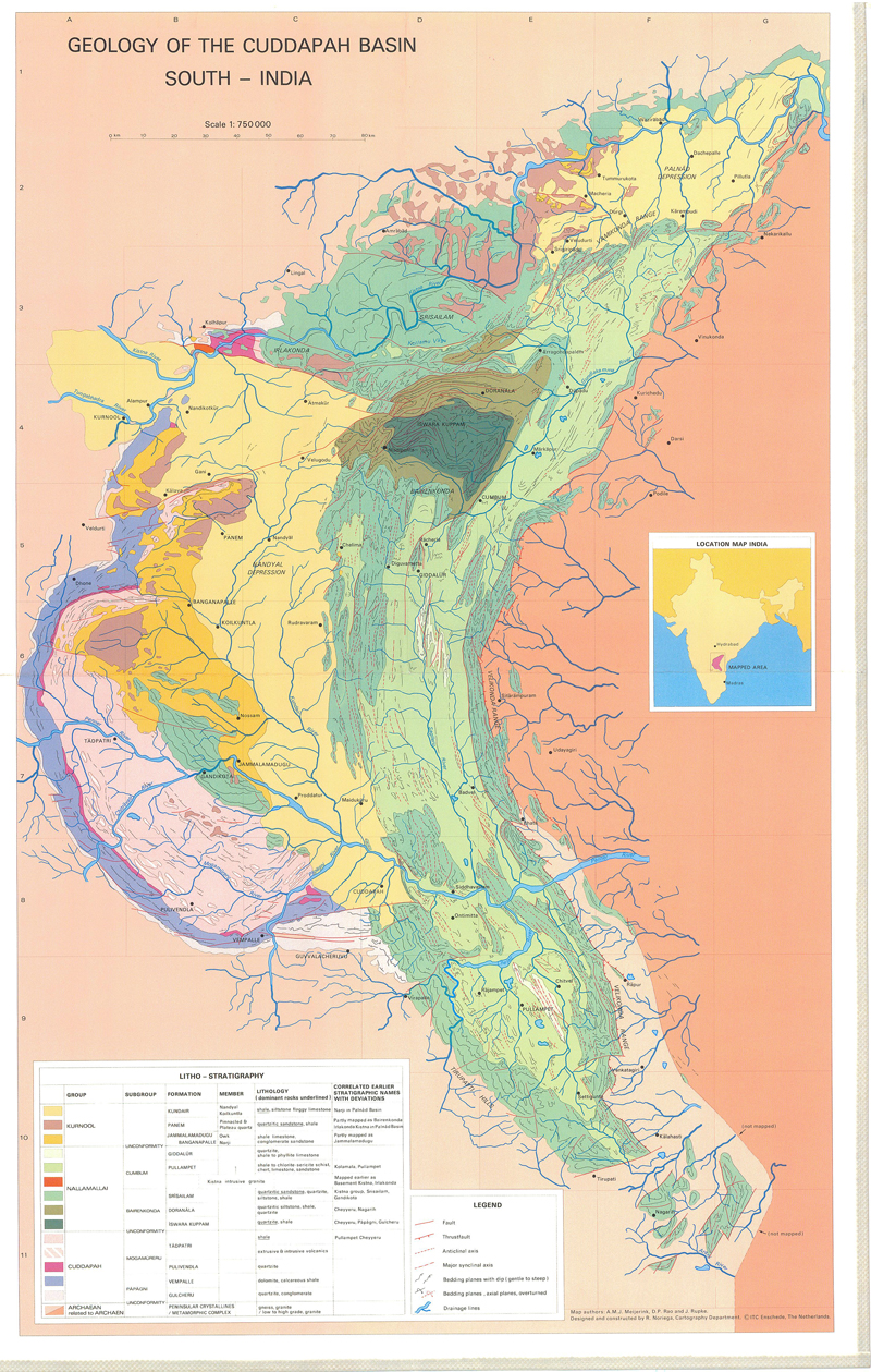
Geology of the Cuddapah Basin, South India
-
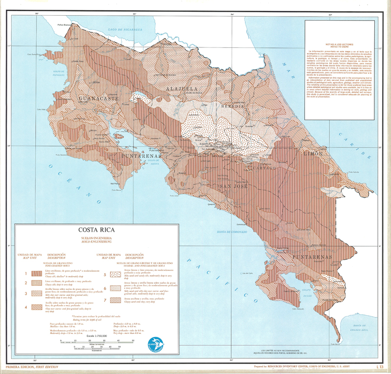
Include: Soils-Engineering (L-13),(T-13); Description of the mapping units
-

Include: Geology (L-9)
-

Include: Soils-Agricultural (b/w and colour), (L-5),(T-5); Description of the mapping units
-
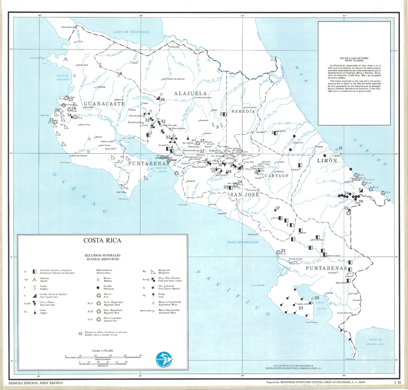
Include: Mineral resources (L-11), (T-11); Description of the mapping units
-
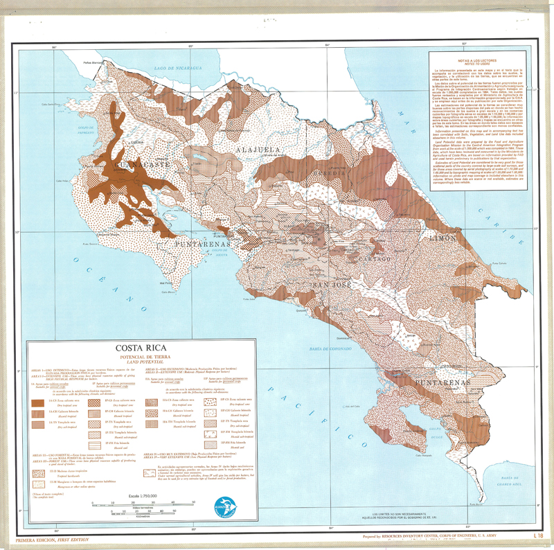
Include: Land potential (L-8), (T-18); Description of the mapping units
-
ETM+ based natural-color image mosaic base contrast-lightened for better visual integration with 1:1m scale cartographic vector data. The AF_ETM_BASE image data layer is comprised of 18910x23158 derivative image satellite based imagery features derived based on 465 metre data originally from ETM+ Browse.
-
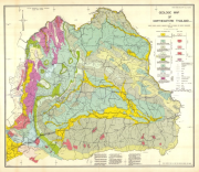
Geologic map of Northeastern Thailand
-
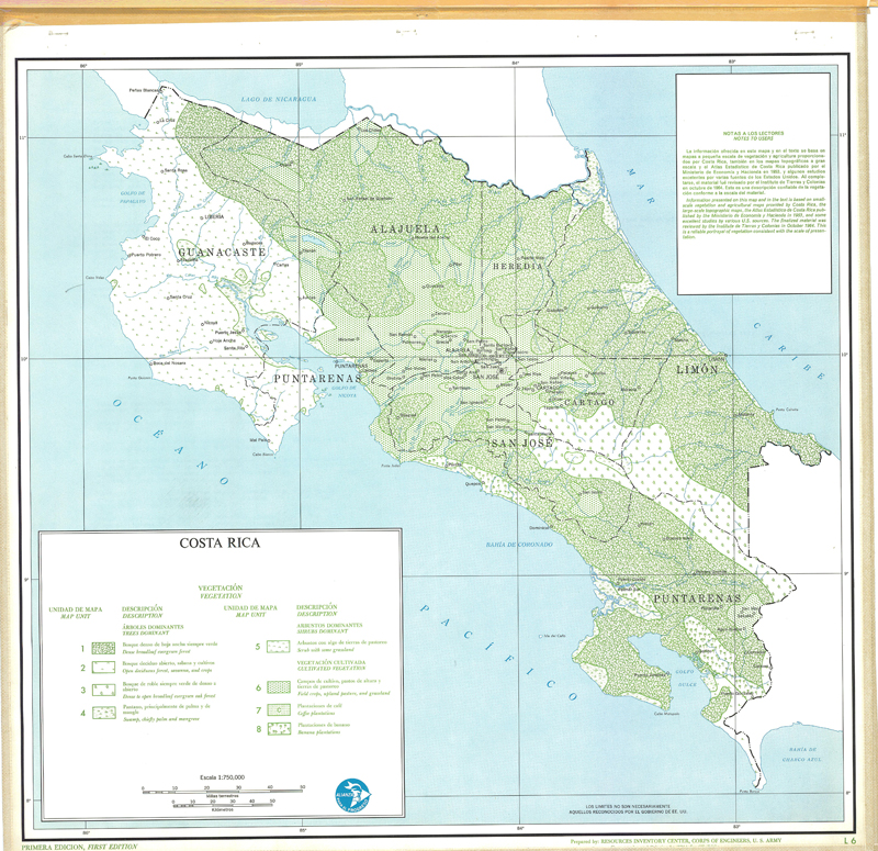
Include: Vegetation (L6),(t-6); Description of the mapping units
-
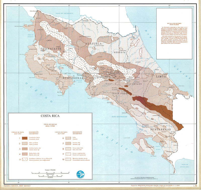
Include: Rock types (L-10),(T-10); Description of the mapping units